Space Scientists to Give Earth a Physical Checkup : Environment: Current, new satellites will help NASA examine planet’s health. Many call effort long overdue.
- Share via
It is a scene right out of the ER: Good old Earth, every square foot of her scrutinized continuously by a constellation of spies in the sky, hooked up like an intensive-care patient to high-tech instruments keeping track of every bulge and burp, cough and sputter, heave and sigh; her vital gases measured; her vital fluids tracked; her plumbing checked for leaks and overflows; her intimate history uncovered.
Will she make it through the night? That is the question about to be posed by an ambitious NASA effort to diagnose the health of our home planet.
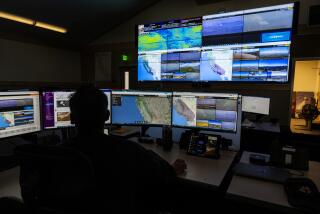
The folks who brought us the flashy planetary probes that phoned home dramatic images of Mars, Jupiter, Uranus and Venus are now turning their sights inward. Called Mission to Planet Earth (MTPE), the effort is a combination of current shuttle- and satellite-borne instrumentation, and a series of planned new satellites that will make up the Earth Observing System (EOS).
Collectively, they will scrutinize Earth more doggedly and in more detail than ever before.
In the process, the mission will try to answer some increasingly urgent questions:
* Is the Earth about to suffocate under its carbon dioxide sheet? Heat trapping gases such as carbon dioxide buildup in the atmosphere due to burning of fossil fuels and deforestation.
* Will it fry under its badly damaged ozone umbrella? Fluorocarbons manufactured on Earth break up the fragile ozone layer that screens out cancer-causing ultraviolet rays.
* Will it be poisoned by its own pollution? People and industries dirty the air and water with their non-recyclable wastes.
* Will it melt under the cumulative impact of ice sheets turning to water that floods coastal communities? Warming temperatures make sea levels rise.
* Or is continual wearing down by destructive agriculture practices a more clear and present danger? Clear-cutting and erosion destroy topsoils and eat away at fertile areas amenable to human habitation.
Even though no one knows for sure what ails the planet, the possible prognoses seem too dire not to check out.
Many scientists and environmentalists think this kind of introspective effort is long overdue. Researchers know surprisingly little about the health of their planet. They know more about the sun--93 million miles away. They know more about the landscape of Venus, even though that planet is shrouded in thick, acid clouds.
In fact, it was the grand success of space missions to Venus and Mars that turned geologists into virtual astronauts, studying the Earth from space instead of with hiking boots and hammers. “The Viking missions got us used to looking at planets with remote-sensing technology,” said geologist Diane Evans, project scientist with Mission to Planet Earth. “They made us think about new ways of looking at Earth.”
NASA and foreign space agencies have been road-testing increasingly sophisticated satellites and other instruments for monitoring Earth since the late 1970s. With satellites that can penetrate political and geographic boundaries with impunity, they have yielded some spectacular results.
Tantalizing recent finds have included lost cities buried in the dust, ancient riverbeds under the Sahara and secret habitats of gorillas in the African mist. Satellites have also tracked the birth and development of El Nino currents responsible for wacky weather patterns, seen bulges in the ground that might predict volcanic eruptions and followed the formation of eddies in the Gulf of Mexico dangerous enough to topple oil rigs. They have uncovered hidden mineral deposits, subtle motions of continental plates and patterns of snowmelt in glaciers.
But many of these efforts were one-shot projects, or limited in scope, rather than part of sustained efforts to monitor the vital signs of the entire globe. Scientists say there is a lot more to learn. “In many ways, we’re just beginning,” said Charles Kennil, head of Mission to Planet Earth.
The Earth is a much more complex organism than either the sun or Venus, which makes studying it all the more difficult. The sun is composed primarily of hydrogen and helium. The Earth contains at least 22 elements in significant amounts and in a bewildering variety of forms. Venus has no running water or oceans to muddy up features. On Earth, plants, insects, animals and microorganisms continuously metabolize elements in complex webs that are far from understood.
Because everything is interrelated on Earth, it can be difficult to disentangle causes and effects. Everything is changing: As the Earth turns from day to night, it breathes oxygen and carbon dioxide in global respiratory rhythms; when the continents shift, they can take ocean sediments and deposit them on snowcapped peaks; as a rain forest digests sunlight and minerals, it feeds them to birds that spread seeds far and wide; when a city metabolizes rubber and oil and hot dogs, it regurgitates pollutants that linger in the sky.
“There are connections between ecosystems that (are) entirely unrelated,” said Kennil. “When there’s a windstorm on the Sahara, minerals get into the upper atmosphere and may fertilize the rain forest in Brazil. Plus, we’ve got this complicating factor on the surface of the Earth called people.”
Much of the technology to track these interplays already exists. For nearly 20 years, Landsat satellites have been snapping pictures of Earth that have virtually replaced other data used for mapping topology and mineral resources. Weather satellites hovering over the oceans have made predicting storms and heat waves far more reliable. NASA’s newest star, the Topex/Poseiden satellite (a joint venture with France), has mapped what scientists call the height of the ocean to within a few inches. A radar system flown aboard a space shuttle penetrated the Cambodian forest to see outlines of the ancient city of Angkor.
Some of this is, or will be, brought under the umbrella of Mission to Planet Earth.
In addition, new satellites will be launched into permanent orbits, where they will be able to keep a sustained and detailed eye on Earth. In particular, they will be looking for signs that the Earth’s temperature is really on the rise. Because for all the talk about global warming, no one knows for certain whether the Earth is heating up, or whether a temperature increase in necessarily harmful.
There’s no question that emission of gases that trap heat, such as carbon dioxide, have risen dramatically since the Industrial Revolution began, and are likely to double within the next generation or so. These so-called greenhouse gases allow the sun’s heat to penetrate the atmosphere, but not escape; if they work the way some researchers think they do, the Earth could heat up like a greenhouse.
But because Earth’s climate has always been erratic, predicting a long-term phenomenon like global warming is extremely difficult. The planet has swung from periods of nearly global tropical heat to ice ages and back again. “We’re really not sure if we’re staving off an ice age or contributing to warming,” said Evans. “It’s a very tough call.”
Even if the temperature does rise, it is not clear how the Earth will respond. “It isn’t a matter of temperature,” said Kennil. “That’s just a number. The question is: How will the Earth respond to these changes? How will they affect human beings?”
It could be that compensating factors mitigate the influence of warming trends. Clouds, for example, might reflect more heat back into space, cooling the planet. Plants raised in rich carbon-dioxide environments might grow faster, soaking up more of the gas.
“People agree that when you put (greenhouse gases) into the atmosphere, they drive the system toward warming,” said Kennil. “But they don’t agree on what will happen as a result.”
In order to find out how the Earth will react to an atmosphere rich with greenhouse gases, researchers have to solve some fairly fundamental mysteries. For example, while calculations show a huge increase in the amount of carbon dioxide being breathed into the atmosphere by processes such as burning of fossil fuels, researchers are not sure where it is going. It is not all showing up in the air.
“The ocean takes up some,” said Jeff Dozier, a remote-sensing expert at UC Santa Barbara. “But we need to be able to measure the carbon intake of land and ocean. We need very specific measurements, not just taking pictures. We need a much better picture of how the whole Earth system works.”
To get such a picture, the dozen or so satellites planned for orbit insertion track clouds, wind, energy, atmospheric chemistry and gases over the next 15 years. They will be joined by the Upper Atmospheric Research Satellite--which recently nailed down the source of ozone-destroying CFCs as decidedly human--and the Topex/Poseiden satellite.
Ironically, one of the most spectacular remote-sensing technologies tested on recent shuttle flights was cut from the Mission to Planet Earth.
Known as SIR-C/X-SAR (Spaceborne Imaging Radar-C/X-Band Synthetic Aperture Radar), the system uses radar to penetrate clouds, forest canopies, rice paddies and even the layers of debris left by the ebbing and flowing of different civilizations. Unlike simpler radar systems, it can “see” in three different colors (or wavelengths) and three different polarizations.
Last April and October, the shuttle-borne SIR-C brought back startling images of burned areas where forests had been clear-cut for agricultural purposes; ash flows spreading down the slopes of volcanoes like tentacles, wiping out villages; patterns of flooding near the Amazon in Brazil and levee breaks caused by the Midwestern floods of 1993 in the United States.
But for all its successes, SIR-C is languishing in storage, while a National Academy of Sciences committee decides what to do with it. “We think it’s a shame,” said Evans, who would like to see the imaging system flown as a “free flier” on its own satellite.
Radar mapping, meanwhile, is left to less sophisticated European and Japanese satellites that provide data to researchers worldwide.
For example, Ingrid Zabel, a physicist who studies the Greenland ice sheet at the Byrd Polar Research Center, uses data from the European ERS1, but would love to have data from a more high-tech system such as SIR-C. “Ice sheets are so huge that even a little melting could raise the sea level enough to make a big impact on people in coastal communities,” she said. And only radar can reveal patterns of melting that scientists can use as benchmarks to keep track of possibly dangerous trends.
SIR-C has not been grounded because NASA was unhappy with it. Rather, NASA has not been able to find the funding for it in the midst of its general cutbacks. “There are lots of constituencies telling NASA how to spend its budget,” said Dozier.
Researchers who want to put SIR-C into permanent orbit argue that only radar can see through clouds, through leaves, through ice; only radar can provide a global topological map of Earth. Surprisingly, satellites have mapped the landscape of Venus more completely than they have Earth.
But others say that fancy radar systems are not really necessary to accurately gauge the well-being of the planet.
One of these scientists is Caltech geologist Bruce Murray, who thinks that the satellites are too big, too expensive and organized too much around NASA Central rather than local and regional users of the information. “The EOS money goes to big aerospace contractors to build great big things,” he said. “There’s too much emphasis on fancy science and too little on regional issues crucial for human habitation.”
He also worries that the emphasis is wrong. The Earth Observing System is focused on the atmosphere and ocean, he says, with too little attention being paid to issues of land use on Earth, such as grazing and poor agricultural practices.
Finally, Murray and other scientists complain that NASA has already obtained far more information about the Earth from remote-sensing systems than anyone has been able to use; instead of building more satellites, they say, the agency should get more out of the data that has already been obtained.
Despite these criticisms, most scientists, including Murray, are eager to get every bit of possible information about the Earth. Says Gary Ernst, a geologist and environmental scientist at Stanford: “I want to know how everything is changing. Cloud cover, vegetation, detailed geology in remote regions, ocean circulation patterns as a function of time. We’re modifying the Earth in ways that may not be comfortable for future generations. We need more information and we need it now.”
Such information will also become increasingly important to monitoring international agreements on environmental concerns such as pollution, ozone depletion, warming and deforestation. It also has political overtones-which is one reason that Kennil is trying to make Mission to Planet Earth an international effort.
Some of the planned EOS satellites will be able to pick up the chemical signatures unique to each country--a perfume created by a combination of environment and economy. As nations blame each other for littering the planet with pollutants, this information will have great power to pinpoint the perpetrators. “It will certainly reduce arguments about who’s doing what,” said Kennil.
Of all the images of Earth beamed back from space, Kennil--who is also a professor of physics at UCLA--thinks the one snapped by the first Apollo astronauts on their way to the moon is still the best.
“Suddenly, you saw it for the first time as a single integrated whole. And it was that human perception from which this whole conception came. Because it taught people that there was an environment bigger than their own back yard.”
(BEGIN TEXT OF INFOBOX / INFOGRAPHIC)
Life on Earth
This first-ever global map of the production of chlorophyll by living organisms shows where life thrives, and where it is absent. The image was created from data obtained from two satellites over eight years.
RED SPOTS IN THE OCEAN: Rich blooms of phytoplankton, microscopic plants that convert energy from the sun into food for all marine life.
DARK GREEN OR BLACK: Forrested areas such as South America and the lower part of Africa indicate a dense canopy of life.
YELLOW AREAS: Barren areas such as the Sahara.
BRIGHT RED AREAS ALONG THE COAST: Places where shallow water and rich nutrients from the land combine to produce an abundance of marine life.
MAMMOTH MOUNTAIN: An imaging system that uses three radar bands allows researchers to calculate how much water is available in the snowpack to get Los Angeles through the dry season. Each band is a different wavelength and penetrates the snow to different depths.
Source: NASA


