‘Phantom’ Tulare Lake Comes Back to Life
- Share via
CORCORAN, Calif. — On the salt flats of the San Joaquin Valley, in the middle of J.G. Boswell’s cotton empire, one of America’s great phantom lakes has returned from the dead.
Once the largest body of fresh water west of the Mississippi, Tulare Lake went dry in the 1930s when farmers choked off the four rivers that empty into its basin. But every 15 years or so, in the wake of a record winter storm or heavy spring snowmelt, the dams and ditches cannot contain the rivers.
When that happens, the great inland sea, at least a hint of it anyway, rouses from its slumber.
“I know people call it a ‘phantom,’ ” said Carlo Wilcox, one of Boswell’s water crew. “But we tend not to think of it that way.”
Last month, not even the elaborate devices of the Boswell company, the biggest farming operation in the world, could tame the rivers’ surge. Tulare Lake, once extending 60 miles tip-to-tip and home to three Native American tribes and a wealth of wildlife, has now reclaimed a 10-mile-long, 9-mile-wide sweep of cotton land.
Its spectacle offers no warning. After driving an hour across a flat expanse of vineyards, orchards and dairy farms, the road before you suddenly ends and the earthy air fills with the faint smell and sound of ocean. Climbing atop a muddy embankment, gazing across the lake’s unending midsection, you feel lost for a moment.
More than 57,000 acres of fields are flooded--nine feet deep in some spots--and whitecaps move swiftly past telephone poles. It is brown in parts and pure blue in others, and sun glints off flocks of mud hens, pintail and mallard ducks, blue and white herons and pelicans stabbing at catfish and carp.
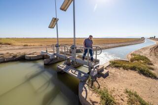
Earlier this month, with a green light from the Army Corps of Engineers, the Boswell crew cut a 100-yard gash in the north bank of the Tule River to relieve pressure from rising flood waters. It was a desperate move calculated to save the river’s banks from more extensive damage while flooding 42 additional square miles of Boswell cotton land.
“People say this is a ‘controlled flood,’ but not really,” said Wilcox. “The rivers are dictating to us, not us to them. We’re slaves to nature right now.”
*
Halfway between Los Angeles and San Francisco, this basin has a strange, slightly menacing feel, wet or dry. While it qualifies as desert, averaging less than 10 inches of rain a year, it also happens to sit at the foot of one of the nation’s most generous watersheds, the Sierra Nevada snowpack.
Before agriculture subdued the mountain rivers, much of the southern San Joaquin Valley was transformed each spring into marsh teeming with tule elk and antelope, honkers, and gray and Canada geese. No land sat lower than this basin, the terminus of the Tule, Kaweah, Kings and Kern rivers.
The shallow lake that sprang from their waters--dubbed La Laguna de los Tulares by Spanish explorers--covered more than 1,200 square miles, bigger than the Great Salt Lake. On rafts and canoes made from the thick tule reeds, Yokut hunters fished for salmon, perch and sturgeon while the women waded far into the waters to dig for clams and mussels.
So bountiful was the harvest that white settlers named the area Mussel Slough, and commercial fishermen in the 1870s plied the lake in schooners and steamers and caught terrapin turtles served as delicacies in San Francisco restaurants.
Visitors never forgot the roar of the big birds alighting.
“An immense body of wild geese whose wings and cries as they moved from place to place caused this kind of roaring noise,” wrote Charles Nordhoff, a New York journalist who penned one of the first travel books about California in 1873. “A noise like the rush of a distant railroad train.”
In 1880, in the name of reclamation, the state Legislature allowed newcomers to buy marshland for $2.50 an acre, $2 of which would be refunded if they helped construct a levee system. This touched off a decades-long stampede of “sandlappers,” the derisive name given farmers who cultivated swampland.
Tulare Lake may have continued to turn up blue on most maps but it was pretty much a mirage.
*
After the sandlappers came farmers with bigger vision and guile--such as Col. James G. Boswell, a military and cotton man driven out of Georgia by the boll weevil, and Clarence Salyer, a hard-drinking Virginia hillbilly who carried the cruel moniker “Cockeye” on account of a fake eye that wandered when he shot ducks.
The two men battled head-to-head for nearly half a century, blowing up each other’s levees in wet years to divert water and in dry years to steal it. They divided the town of Corcoran in half, truck dealers and tractor salesmen aligned with Boswell, their competitors aligned with Salyer, the Santa Fe railroad tracks carving out a thin truce line between the two.
Then a few years ago, the two patriarchs long dead, their kin ended one of the most protracted and colorful family feuds in California history. Boswell bought out Salyer, lock, stock and levee.
But even with one operator controlling the intricate system of canals, ditches, embankments and pumping machines, the rivers don’t always listen. Only in a winter like this one, witnessing the power of Tulare Lake’s ghost and seeing how miserably man’s devices have failed, can you appreciate the length agriculture has gone to turn back these rivers.
As soon as the dams begin releasing flood waters, Boswell crews rush to spots along the Tule and Kaweah rivers and install more than a dozen pumps that remove water otherwise headed for the cotton king’s lowlands. This water, about 1,800 acre-feet a day, is stored in a large irrigation canal.
At the same time, on the Kings River, 10,000 acre-feet a day is diverted away from the Tulare Lake basin into the San Joaquin River.
The federal government mandates these diversions even when farms and towns along the San Joaquin face their own flooding. It is all dictated by an agreement reached between Boswell and the Army Corps of Engineers a half century ago. By helping pay for the construction of Pine Flat Dam on the Kings River, the Boswell empire forever guaranteed flood control protection in all but the worst of winters.
Old-timers here recall one such winter in 1969. The waves from the lake carried such force that Boswell had to buttress the levees with pancaked cars from a wrecking yard.
“During the last big flood, in 1983, the lake grew to nearly twice this size and it took two years for us to drain all the water,” Wilcox said.
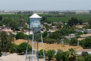
It is almost certain that the land won’t be dry for even a late planting of cotton seed, and that will pose economic hardship for Boswell and the town of Corcoran, which despite its troubled prison still bills itself as the “Farming Capital of the World.”
“I know the lake is something to see but you’re talking about one-fourth of our farm acreage under water for at least a year, if not longer,” said Ruben Quintanilla, a city councilman and local auto parts dealer.
“This will not only affect Boswell but the people who sell them chemicals and cars, tractors and harvesters. We’re in for some rough times.”
More to Read
Sign up for Essential California
The most important California stories and recommendations in your inbox every morning.
You may occasionally receive promotional content from the Los Angeles Times.


