Failing Satellite Expected to Burn Up in Atmosphere
- Share via
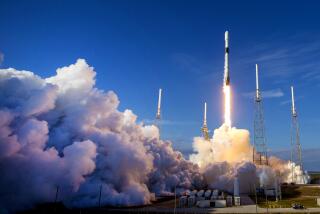
A $64.8-million NASA satellite--spinning slowly out of control since its launch from Vandenberg Air Force Base last month--is expected to fall out of orbit and burn up in the atmosphere this week, space agency officials said.
The 890-pound Lewis Earth observation satellite, built by TRW Space and Electronics Group in Redondo Beach, was designed to push the state of the art in scientific and commercial imaging from space. But unable to keep its solar panels aimed steadily at the sun, the satellite can’t generate enough power to stay in orbit, TRW spokeswoman Sally Koris said.
Unless radio contact with the satellite can be reestablished, it may reenter the atmosphere as early as today, but no one knows exactly when or where along its polar orbit it will start its fiery descent.
The best NASA officials could say Monday was that increasing atmospheric drag on the spacecraft may pull it from orbit sometime between today and early next week. The most likely reentry date is Saturday, they said. The U.S. Space Command is tracking the satellite as its orbit fails; the craft is expected to burn up at high altitude.
“Based on our previous experience with this type of spacecraft, we expect Lewis to burn up in the atmosphere,” said Samuel Venneri, chief technologist at NASA headquarters in Washington. “The probability that any part of it will survive is very low and it presents no significant threat to people on the ground.
“[But] the potential loss of the mission is an obvious disappointment,” he said.
In the days immediately after its Aug. 22 launch from Vandenberg, the spacecraft seemed to be operating normally, a TRW spokesperson said Monday. Telemetry signals received Aug. 26, however, indicated that the satellite was spinning about twice every minute, caused perhaps by misfirings of its thruster rockets.
Unable to recharge from the solar panels, the spacecraft’s batteries were quickly drained. In the weeks since, space agency and TRW engineers have been unable to regain control of the craft.
The experimental satellite, named for 19th century explorer Meriwether Lewis, was the first in NASA’s Small Spacecraft Technology Initiative, a program to speed satellite development while trimming costs.
Making use of about 40 new technologies, the Lewis satellite carried advanced imaging instruments designed to split up the spectrum of light into as many as 384 distinct bands, all the better to monitor oil spills, keep track of farm yields, survey the habitats of endangered species and make other measurements of the planet’s environmental health.
Sensors able to detect invisible wavelengths of light, such as infrared and ultraviolet light, reflected by the surface of the Earth have revealed a wealth of detail about the planet ranging from the health and extent of its vegetation to the chemistry of its surface features.
A new generation of such hyperspectral imagers developed at UC Berkeley, NASA’s Goddard Space Flight Center and TRW, were installed aboard the Lewis satellite. They have the capacity to more finely discern distinctions between spectral bands and can thus read the planet’s surface in greater detail.
An independent review board, to be headed by someone unconnected with the space agency, is being set up and is expected to report its findings on the cause of the satellite failure in 60 days.
More to Read
Sign up for Essential California
The most important California stories and recommendations in your inbox every morning.
You may occasionally receive promotional content from the Los Angeles Times.


