Floridians Look Down on U.S. Satellite Study of Reef
- Share via
KEY WEST, Fla. — U.S. authorities said Friday they would use top-secret spy satellites to watch boat traffic on the fragile Florida Keys’ coral reef, a decision that outraged privacy-mad free spirits in the island chain.
Although officials said the satellite data would be used only to learn about human impact on the reef, feisty residents who have warred with the Feds on issues ranging from the booty of the Spanish Main to the collection of tropical fish complained they will be under the watchful eye of Big Brother.
“We’re talking 1984 here,” said local treasure hunter Pat Clyne, referring to the George Orwell novel.
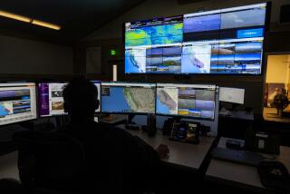
Starting in June, the spy satellites will begin counting boat traffic at various points along the 110-mile archipelago, said scientist Chris Elvidge of the National Geophysical Data Center in Boulder, Colo.
The National Reconnaissance Office operates constellations of spy satellites to eavesdrop on foreign communications and photograph clandestine military sites.
Some of the satellites are believed to produce black and white photos so detailed that they can literally read the writing on the wall.
But Elvidge, who runs the lab where the satellite photos will be read, denied scientists were trying to invade anyone’s privacy.
He said the spacecraft will be restricted to gathering statistics on the size and numbers of boats at three sites.
“We’re not identifying the individuals who are associated with the boats. We’re not identifying the boats or recording how frequently the same boat comes to an area,” Elvidge said. “Data’s not being gathered for any law enforcement or regulatory linkage.”
Bob Leeworthy, chief economist for the U.S. National Ocean Service in Silver Spring, Md., said he would use the data to count boat traffic in three protected sites along the reef: Molasses Reef, Key Largo Dry Rocks and the Elbow.
Leeworthy said that during a 72-day monitoring period when the satellites are taking pictures, National Oceanic and Atmospheric Administration crews will ride boats to the sites to count people in the water and on boats.
More to Read
Sign up for Essential California
The most important California stories and recommendations in your inbox every morning.
You may occasionally receive promotional content from the Los Angeles Times.


