Drained Reservoir Exposes Drowned Homesteads
- Share via
WATERBURY, Vt. — From the coarse grass in what used to be a lush farm valley, it’s easy to spot the remnants of a bridge that hasn’t carried traffic in more than half a century.
Last year the concrete abutments sat under about 40 feet of water in Waterbury Reservoir, not far from one of the most popular recreation spots in the state. Today a stream that long ago passed under the bridge meanders again in its old bed.
It took the threat of a dam failure to expose the remains under the 850-acre reservoir. An emergency decision to lower the water level created a natural museum of sorts that tells the story of an earlier period in Vermont history when the state was still a hardscrabble, rural backwater.
A half-dozen farms once were spread alongside the stream. Today most of the buildings under the reservoir or on Ricker Mountain just west of it are gone.
“Anything that was going to be underwater they burned down or dragged off,” said 74-year-old Nelson Dibble, who has farmed these parts for 50 years.
But the stone foundations remain, along with concrete steps, horseshoes and iron hardware scattered near the once active homesteads.
The farms on Ricker Mountain, named after the family that moved here from Maine in the 1830s, weren’t drowned by the reservoir. They were all but dead in the years after the Depression when the government bought the land and the Civilian Conservation Corps started piling the rocks in a gorge to create the Waterbury Reservoir.
“Before they put the dam in this was the best pasture. It was all white clover,” Dibble said.
Like the area now exposed by the drained reservoir, the skeletons of Ricker Mountain are here as well. The Ricker family graveyard. Old bedsprings. Cast iron pots that sit rusting in cellar holes. Cemeteries that stand in the middle of the forest that has reclaimed the fields as surely as the water drowned the pastures in the valley.
It might be too much to say this was once a thriving community. It was a place where a self-sufficient people subsisted.
They got by with a few pigs and the cows they raised for butter and cheese. They lived mostly on the potatoes, cabbage, pumpkins, turnips and squash they grew. At the end of the harsh Vermont winters, they tapped maple trees for syrup. Lumber from the mountain provided one of the few sources of outside income.
By the late 1800s, farmers began to realize that anything was better than eking out a subsistence living on tiny farms high up on a rocky mountainside. There had to be an easier way.
Many abandoned Ricker Mountain for the relatively flat prairies of the Midwest and the Plains, where rich and free farmland beckoned.
The conversion from farming community to state-owned land began in the 1920s when Green Mountain Power began eyeing the gorge as the site of a power station. The company bought out the first farm in 1921.
It wasn’t until after the big flood of 1927 devastated the state and brought in federal public works money to prevent future floods that the dam project gained momentum. The United States Engineering Department, the predecessor of the Army Corps of Engineers, surveyed the Winooski River Valley and suggested seven sites for flood control dams.
The Little River was one of those sites. The state bought about 10,000 acres of land in the area, much of it from Green Mountain Power.
Full-scale construction began in 1935 when 5,000 members of the Civilian Conservation Corps cleared the valley and built the dam. It was finished and the reservoir was filled in 1938.
The death of the communities apparently didn’t provoke protests from those in danger of losing their homes. Many welcomed the government buyouts at a time when money was scarce, said Brian Lindner, a historian whose grandfather’s farm was submerged under the reservoir near its northern end.
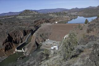
Last year, state engineers detected disturbing seepage from the dam and ordered the reservoir lowered to prevent a catastrophic collapse. The lowered water pressure makes the dam safe until repairs can be completed in late 2004.
More to Read
Sign up for Essential California
The most important California stories and recommendations in your inbox every morning.
You may occasionally receive promotional content from the Los Angeles Times.


