Vinland Map Authenticity Questioned
- Share via
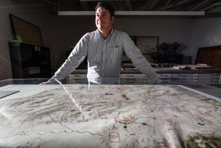
Two new studies released Monday provide contradictory evidence about the authenticity of the controversial Vinland map, considered by some to be the oldest map of North America.
One study, conducted by researchers at the Smithsonian Institution, shows that the parchment on which it is drawn is old enough to be genuine. But the second study by British researchers suggests that the ink is of modern origin.
The Vinland map purportedly dates from about 1440--50 years before Columbus discovered the New World--and accurately shows the North American coastline around Hudson Bay and the Gulf of St. Lawrence. It has long been claimed as proof that Scandinavian sailors Bjarni and Leif Eriksson were the first Europeans to visit the New World.
That claim has subsequently been upheld by the discovery of pre-Columbian Norse settlements in the region, but the validity of the map itself has been continually questioned--and many experts now believe it to be a sophisticated forgery.
The dating of the parchment provides the strongest evidence yet that the map might be genuine, said Jaqueline S. Olin, who recently retired from the Smithsonian Center for Materials Research and Education. “It’s nice now to know what the date of the parchment is, and it raises questions about how a forger would have gotten access to parchment” from the correct time period, she said.
“We’re pretty confident that the parchment is from the 15th century,” added retired physicist Douglas Donahue of the University of Arizona. “That’s the only conclusion we can really make from this.”
Little is known about the history of the map before its purchase by a New Haven antiquities dealer in the early 1950s. Financier Paul A. Mellon purchased the map in 1958 for $1 million and donated it to Yale University, where it now resides. Its value is currently estimated to be about $24 million.
Questions immediately arose about its authenticity, and Yale commissioned noted chemist Walter C. McCrone, who died just last week, to examine the document. Using a microscope, he concluded that the ink contained a titanium dioxide mineral called anatase, which was not used in ink before the 1920s. On the basis of this finding, he labeled the map a forgery.
In the mid-1990s, however, physicist Thomas Cahill of UC Davis used newer techniques to study the ink and concluded that McCrone had misidentified the mineral he saw under the microscope. Cahill and his colleagues reported only trace amounts of anatase on the map, adding they had found similar amounts on authentic documents from the same period.
In the first of the new studies, Olin received permission to cut off a small fragment of the map parchment and subject it to radiocarbon dating, which was performed by Donahue and chemist Garman Harbottle of Brookhaven National Laboratory. The team reports in the August edition of the journal Radiocarbon that the parchment was made in AD 1434, plus or minus 11 years.
That dating is considered particularly interesting because the map had previously been linked through a variety of indirect evidence to the Roman Catholic Church’s Council of Basel, which was convened from 1431 to 1449. Olin argues that a putative forger was unlikely both to have realized the significance of that date and to have obtained parchment of the correct age.
Critics, however, note that a Swiss mill is known to have produced significant quantities of parchment for the Council of Basel, and that a sample of that material could have been obtained.
In the second study, reported in the July 31 issue of the journal Analytical Chemistry, chemists Robin J. H. Clark and Katherine Brown of University College in London used a newer technique called Raman spectroscopy to examine the ink on the parchment. They conclude that a forger used two separate preparations to give the appearance of authenticity.
Medieval inks were generally made from an iron gallotannate compound. As this material ages and erodes from the parchment, it turns the parchment brittle and leaves behind a yellow after-image.
Clark and Brown concluded that the alleged forger simulated this process by first drawing the map in a yellowish ink containing anatase. A second ink containing carbon was then applied on top of the yellow lines. As the carbon ink slowly flakes off, it exposes the yellow lines, which give the appearance of aging. The carbon ink, in contrast, would not have produced a yellow stain as it aged.
More to Read
Sign up for Essential California
The most important California stories and recommendations in your inbox every morning.
You may occasionally receive promotional content from the Los Angeles Times.


