Is the Thanksgiving week storm approaching Southern California really a ‘bomb cyclone’?

- Share via
News organizations, commercial weather forecasters and numerous people on social media have been calling the storm approaching California this week a “bomb cyclone,” but Kathy Hoxsie, a meteorologist at the National Weather Service office in Oxnard, is uncomfortable with that name.
“That’s a little too sensational,” said Hoxsie, who prefers to simply call the system a deep low. “We’re not ready to call it a bomb cyclone. We prefer to shy away from sensational terminology because it doesn’t illuminate what’s really happening.”
What everyone can agree on is that a powerful, cold, low-pressure system packing strong winds will continue to deepen through Tuesday night as it moves down the West Coast. It will bring rain, mountain snow and cold temperatures to Southern California on Wednesday and Thursday.
The term “bombogenesis” refers to the process during which a midlatitude cyclone rapidly intensifies, dropping at least 24 millibars — a measure of barometric pressure — over 24 hours, creating what is known as a “bomb cyclone.” This can happen when a cold air mass collides with a warmer air mass, often over warmer ocean water. Low pressure is associated with clouds and precipitation, and the lower the pressure, the stronger the storm.
A cyclone is the meteorological term for a system of winds that rotate inward toward low atmospheric pressure. Such circulation is always counterclockwise in the Northern Hemisphere, and clockwise in the Southern Hemisphere. Cyclonic rotation is caused by the Coriolis effect resulting from the Earth’s rotation.
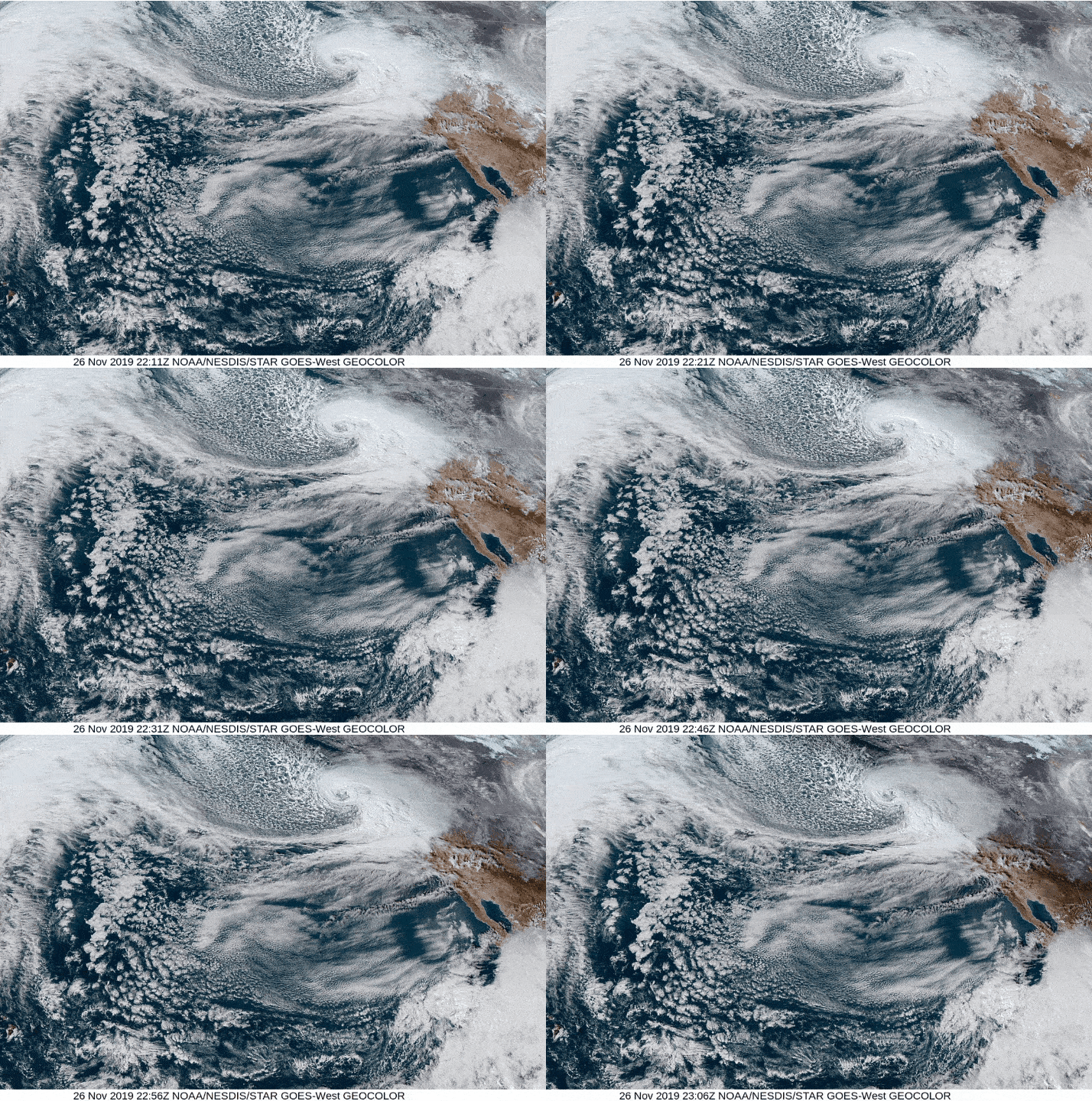
Satellite images of this week’s storm show it turning in a counterclockwise direction, trailing a long cold front and looking like an enormous white comma.
Fred Sanders, a professor at the Massachusetts Institute of Technology, defined such rapidly deepening low-pressure systems as “meteorological bombs,” and the term became more common after a 1980 article by Sanders in the Monthly Weather Review.
The pressure in this week’s storm was expected to drop 37 millibars during an 18-hour period, according to the National Weather Service, and would fit the definition of a bomb cyclone, Hoxsie conceded. Indeed, an earlier shift at the National Weather Service’s Oxnard office tweeted to that effect. But Hoxsie said she cringes at such terminology.
She said it’s a “fun term,” like a “polar vortex” and a “Frankenstorm” — a name that was given to Hurricane Sandy, which occurred on the East Coast of the U.S. close to Halloween in October 2012.
A “Pineapple Express” is another example of a popular name for an atmospheric river, but she cautions that it refers only to such wet storms that are warm and come from the southwest, in the direction of the Hawaiian Islands. She said the Pineapple Express name is sometimes used inaccurately to describe atmospheric rivers that arrive in California from due west and thus aren’t as warm.
Hoxsie allowed that once a designation such as “bomb cyclone” is out there in the public, the media “almost have to go with it.” And however sensational the term may be, it is beneficial to the extent that it makes people aware and gets them talking about the weather.
More to Read
Sign up for Essential California
The most important California stories and recommendations in your inbox every morning.
You may occasionally receive promotional content from the Los Angeles Times.


