Damaging Santa Ana winds are on tap for Monday in the Los Angeles region, forecasters say

- Share via
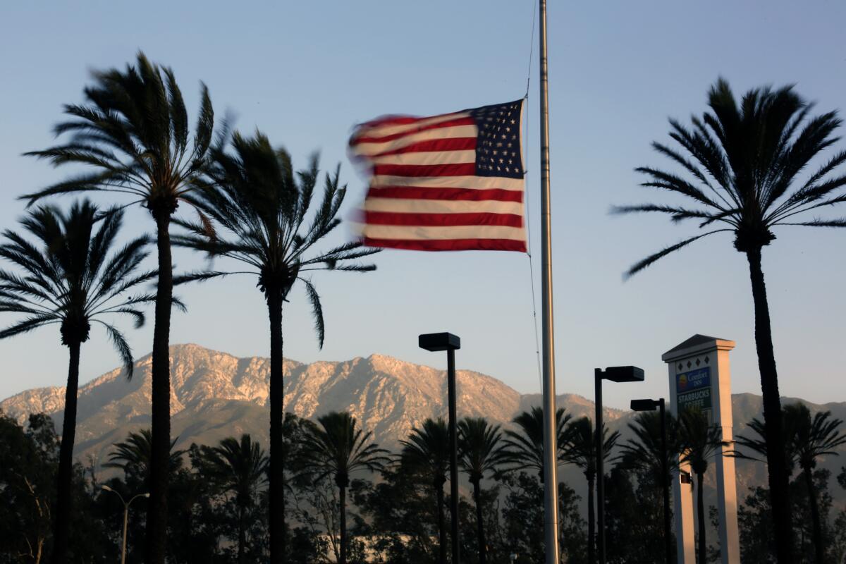
Damaging Santa Ana winds could cause power outages, downed power lines and felled tree limbs on Monday, the National Weather Service said. Widespread critical fire weather conditions are likely from late Sunday night through Tuesday.
The strongest winds are expected late Sunday night through Monday, especially early Monday morning into the evening hours. Gusts of 60 to 75 mph are possible in the mountains. Winds could exceed 55 mph in the valleys and 45 mph at the coast, the weather service said.
Relative humidity will range from 4% to 10% in the mountains and foothills and from 8% to 18% in the valleys. Humidity levels will recover poorly overnight.
A fire weather watch is in effect for much of Los Angeles and Ventura counties from late Sunday night through Tuesday. Vegetation is already extremely dry, and single-digit humidity will create the potential for extreme fire danger and fire behavior. Any fire that is ignited will spread rapidly. Peak fire danger will persist from Monday morning through Monday night.
California is experiencing its worst fire season on record.
Climate scientist Daniel Swain writes that this wind event is poised to be the strongest of the season so far and “will likely approach the magnitude of the extreme autumn wind events in 2019 and 2017. Given that vegetation is now at or near record dryness levels — much as it was prior to the North Bay firestorm in October 2017 — this is a very concerning forecast.”

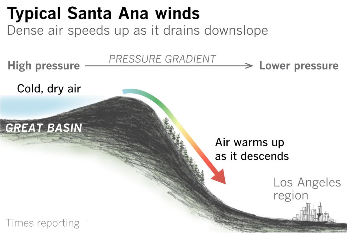
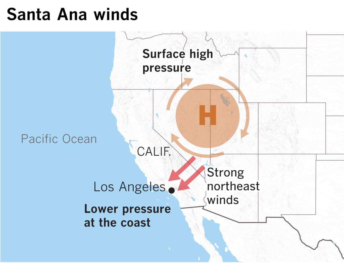
A deep, cold, upper-level low — which may drop a little light rain on areas south of Point Conception Saturday night and Sunday — will move through, then to the southeast of the region by late Monday. As the cold front departs, high pressure will build into the Great Basin of Nevada and Utah, setting up a strong pressure gradient and northeasterly winds at the surface, in typical Santa Ana fashion. Strong northerly flow aloft and movement of cold air down to lower levels of the atmosphere will support these winds.
“That cold, dry and dense air will align with ridgetop wind direction from the northeast — the typical Santa Ana direction — and sync together to tighten the surface pressure gradient,” said Eric Boldt, a meteorologist with the National Weather Service in Oxnard. “When we have all three elements — cold air, winds aligned and surface pressure gradient — we can get some of our strongest wind events,” he said.
The air in the Great Basin is unusually cold, so the winds reaching Los Angeles won’t be terribly warm, said Ryan Kittell, a meteorologist with the National Weather Service. “Typically, cold Santa Anas tend to be stronger.”
Santa Anas that are generated by very cold air in the Great Basin will warm up as they plummet downslope because of compression heating. “They follow the same laws as fluid dynamics,” said Jan Null, a meteorologist with Golden Gate Weather Services.
So by dropping about 4,000 feet in elevation from the Great Basin to sea level in Los Angeles, the air gains about 20 degrees of heat, Null said; in other words, about 5 degrees per 1,000 feet.

“We’re in a transition period between summer and fall,” Null said. The Pacific high-pressure system over the ocean that dominates in the summer begins to break down and move south. The polar jet stream, which stays in Canada during the summer, begins to dip south into the continental U.S., bringing cold air. It deposits “blobs of cold air” in the Great Basin, Null explains. These areas of high pressure are the source of Southern California’s Santa Ana winds in October, November and December.
“Ready, set — Santa Ana season is beginning with a vengeance,” said climatologist Bill Patzert. At the end of the dry season, with no rain for six months, “these are the kinds of events that have historically been dangerous,” he said.
With a La Niña climate pattern in place and expected to persist, along with an ever expanding drought in the West, the immediate future doesn’t promise much relief.
More to Read
Sign up for Essential California
The most important California stories and recommendations in your inbox every morning.
You may occasionally receive promotional content from the Los Angeles Times.


