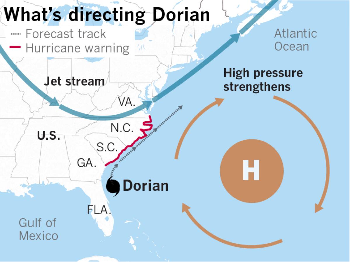
Hurricane Dorian churns dangerously close to the U.S. East Coast

- Share via
Even though it it isn’t as powerful as it was when it pulverized the northern Bahamas, Hurricane Dorian was a Category 3 storm late Wednesday, having become slightly better organized as it churned northward along Florida’s eastern coast, the National Hurricane Center said. It is still powerful and is moving to the north-northeast with sustained winds of 115 mph.
Dangerous winds and life-threatening storm surge are expected along the coasts of Florida, Georgia, the Carolinas and southeast Virginia, including the southern part of Chesapeake Bay.
“Since the NHC track prediction continues to take Dorian dangerously close to the southeast U.S. coast, all interests from northeast Florida to the Carolinas should remain vigilant to the possibility of experiencing destructive winds, flooding rains, and life-threatening storm surges from this hurricane,” the National Weather Service said.
The chief steering mechanisms over the next 12 to 36 hours will continue to be circulation around the subtropical ridge of high pressure in the western Atlantic and the jet stream. The storm will remain over warm water and in an environment of only light to moderate vertical wind shear during that period. After passing the Carolinas by about 2 p.m. Friday, the storm is forecast to accelerate northeastward into the Atlantic, away from the U.S. East Coast and toward the Canadian Maritime provinces.
More to Read
Sign up for Essential California
The most important California stories and recommendations in your inbox every morning.
You may occasionally receive promotional content from the Los Angeles Times.


