‘There’s a Land Where Mountains Are Nameless’
- Share via
Being another happy visitor to Inuvik in Canada’s Northwest Territories, I was pleased to read your article (March 10), and the letter from David Wilson (April 6). Here’s more that was not mentioned in either the article or the letter.
In late June, 1983, I flew from Los Angeles to Yukon’s capital of Whitehorse. From there I took another plane on up to Inuvik, with stops at Dawson City, “Heart of the ’98 Klondike Gold Rush” . . . then at Old Crow, a village of 250 Indians, far north of Dawson City and almost 100 miles above the Arctic Circle. The town sits in a maze of mud flats, ponds and sluggish streams, strung out along the Porcupine River. Robert Service must have had this part of the world in mind when he wrote, “There’s a land where the mountains are nameless, and the rivers all run God knows where.” From there the plane flew northeast to Inuvik.
A little over halfway, we flew over the village of Aklavik, situated on the western edge of the Mackenzie River Delta. This village was the whole reason for Inuvik being built. The Canadian government decided to relocate this community of Loucheaux (Indians) and Inuits (Eskimos) to the new town of Inuvik (elevation 223 feet on the eastern edge of the Mackenzie Delta) before poor little Aklavik sank into the ooze of the delta along with millions of muskrats. Many refused to leave. Later, many other returned from Inuvik.
In 1980 Aklavik had a population of 779 and they called themselves, “The town that wouldn’t die.” From the plane I took a picture of Aklavik, sitting down there in a network of muddy brown channels, punctured by a million ponds . . . a sight of water and muskeg for 125 miles.
In Inuvik, I spent two nights at Eskimo Inn. Their brochure claims they are 120 miles north of the Arctic Circle. Inside my door was a list of hotel rules: “No causing a disturbance by fighting, SCREAMING, shouting, singing, or otherwise causing a loud noise.” Across the street is the Hudson Bay Store where I met a woman who used to live in Los Angeles. She said, “I wouldn’t come back to your smog for anything!” But why settle in dusty little Inuvik where you have only three months in the year . . . July, August, and Winter? In summer the sun never sets from May 25 to July 18. In winter (called “Noon Moon”) the sun never rises from Dec. 7 to Jan. 5. And when do those people sleep? All night cars were driving out there, raising clouds of dust, and children were out there laughing like they thought it was high noon!
I’m glad I ate at Eskimo Inn instead of across the street at Raven’s Nest where the tab is $40. I ate reindeer steak the first night--$15.25; the second night, caribou steak--$18.75 (white wine came with both, as well as a salad bar not topped in my area). If I could have remained a third night it would have been musk ox steak.
And where else could I have taped a radio talk show in Inuit (Eskimo) language, punctuated between calls with sad songs sung in Inuit?
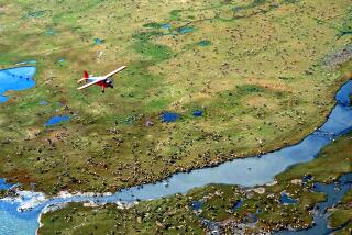
Inuvik is gateway to the village of Tuktoyaktuk (pronounce it fast . . . “tuk-ta-yuk-tuk”) 85 air miles north, on the shore of Beaufort Sea (Arctic Ocean), only 100 miles south of the permanent polar ice cap. “Tuk” has a population of 756--88% are Inuits. It is the home of PINGOS (ice-covered hills caused by squeezing ice, like in a frozen milk bottle). What powerful pictures I took on this flight: 20,000 lakes, tiny to large, many iced-over, as far as the eye could see. “Tuk” is north of the Tree Line, on a national reindeer grazing reserve. The only reindeer I saw was on my plate at Eskimo Inn.
Leaving Inuvik, I traveled the Dempster Highway in a tour’s company van. It took two days to cover its length of 450 miles, and we spent the night at Eagle Plains Hotel (pop. 12) halfway along the route. The Dempster Highway was completed in 1979, making it the only public highway in North America to stretch north of the Arctic Circle, and the only highway where you can drive to three oceans.
In winter you drive an ice road from Inuvik to “Tuk.” To preserve permafrost on this highway, tundra was not removed. A thick layer of rock was put on top of it, then fine crushed rock laid for road surfacing. Crushed shale is like driving on broken glass . . . we had a flat on the second day.
I quite agree with Eagle Plains Hotel’s claim--the sheer magnificence of the land and breathtaking scenery makes a trip on the Dempster Highway an unequalled experience for the adventure seeker. It traverses virgin wilderness that is forever changing from flat, sprawling tundra to rolling hills and pristine river valleys.
LAURA M. SCHELL
Artesia
More to Read
Sign up for The Wild
We’ll help you find the best places to hike, bike and run, as well as the perfect silent spots for meditation and yoga.
You may occasionally receive promotional content from the Los Angeles Times.


