Beauty Behind Inhospitable Agua Tibia
- Share via
Agua Tibia, place of tepid waters, refers to a warm spring that was used by the Indians for their health. Today, Agua Tibia, at the foot of the Palomar Mountains, is the name given to a mountain and a wilderness on the border of Riverside and San Diego counties in the Cleveland National Forest.
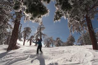
Agua Tibia Wilderness Area is on the northwest crest of the Palomar Mountains. The rugged area, three by five miles, seems inhospitable at first or even second glance. The slopes are covered with thorny chaparral. Stream erosion has carved deep and precipitous canyons. Temperatures exceed 100 degrees in summer, and as much as two feet of snow may fall on the high ridges in winter. However, despite outward appearances, this land of radical temperatures and odd foliage has much to offer the hiker.
Dripping Springs Trail takes you to an area of giant chaparral. Huge manzanita have miraculously escaped the ravages of fire for more than 100 years. Following the Dripping Springs Trail all the way to the abandoned Palomar Divide Truck Trail, now called McGee-Palomar Trail, brings you to oak- and pine-dotted upper slopes that give you panoramic views of the San Jacinto and San Bernardino mountains.
Directions to trailhead: From Interstate 15 in Temecula, exit on Highway 79 south toward Warner Springs. Proceed 10 miles to Dripping Springs Campground on your right. The signed Dripping Springs Trail begins at the south end of the campground. Obtain a wilderness permit and a wilderness map/brochure from the campground host.
For more information about the Agua Tibia Wilderness, you can drop by the Oak Grove Ranger Station, located 14 miles south of Dripping Springs Campground on Highway 79 or call: (619) 782-3221. (Rangers are often out in the field, so you may have to make several attempts to get an answer at this phone.)
The Hike: Dripping Springs Trail immediately crosses the only water en route, Arroyo Seco Creek. It climbs south and southwest, switchbacking over one false summit after another on the north side of Agua Tibia Mountain (4,779 feet). Look over your shoulder and you’ll see Vail Lake and the mighty San Jacintos. Only the buzzing banter of a multitude of bees breaks the silence. In this land of little shade, uninterrupted views are provided of San Jacinto Peak to the northeast, San Gorgonio Peak to the north, and Mt. Baldy to the northwest.
You arrive at the Giant Chaparral about 3 1/2 miles from the trailhead. Twenty-foot manzanita reside in an area watered by a seasonal spring. Sometimes when you look at a manzanita, you have difficulty deciding whether it’s a tree or a shrub. Many botanists opine that it’s a shrub, but these specimens in the Agua Tibia Wilderness are tree-sized and shaped. It’s a tree . . . er, shrub that’s particularly well adapted to its environment. In hot weather, the oval leaves turn on their sides, pointing their edges at the sun. In this way, the manzanita keeps its water supply from evaporating. About February, the manzanita sprouts pink and white lantern-shaped blossoms.
Return the same way or continue on the Dripping Springs Trail to higher and greener Agua Tibia Mountain slopes.
One-half mile beyond the Giant Chaparral, the trail descends for a short while and you get a view southeast over the Palomar Mountains. Crowning a far-off ridge, the silver dome of Palomar Observatory sparkles in the sun. You begin switchbacking again and rise above the chaparral to oak- and pine-dotted slopes.
About three miles past the Giant Chaparral, the Dripping Springs Trail intersects the McGee-Palomar Trail. If you walk a short distance south on this trail, you can look over distant peaks and valleys of Baja California and northern San Diego County and even glimpse the Pacific Ocean.
Return the same way.
Dripping Springs Trail
Dripping Springs Campground to Giant Chaparral : seven miles round trip; 1,200-foot elevation gain Dripping Springs Campground to McGee-Palomar Trail : 14 miles round trip; 2,800-foot elevation gain
More to Read
Sign up for The Wild
We’ll help you find the best places to hike, bike and run, as well as the perfect silent spots for meditation and yoga.
You may occasionally receive promotional content from the Los Angeles Times.


