A Stroll Through a Living Ecology Guide
- Share via
Harvey Moore Trail honors a 20th-Century cowboy who became the first superintendent of Cuyamaca Rancho State Park. Moore cowboyed all over the West before becoming ranch foreman for the Ralph Dyars, who owned the Cuyamaca Rancho from 1923 to 1933. When the Dyars sold the rancho to the state in 1933, they insisted Moore be made superintendent.
It’s easy to see why Moore and other cowboys loved this idyllic cow country. The Cuyamacas differ from other Southern California mountain ranges in one aspect; instead of being an elevated tumble of boulder-strewn peaks and steep canyons, they are grassy rolling hills where boulders are the exception, not the rule.
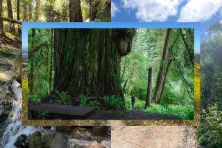
Harvey Moore Trail offers a tour of the park’s life zones: rolling chaparral, manzanita groves, oak woodlands, grass prairies, lush meadowland. Not only are the zones readily apparent, but the way the landscape changes in response to sunlight and shade, wind and water, is clearly observable from the trail. Traveling the Harvey Moore Trail is like walking through a living ecology guide.
Harvey Moore Trail meets many other park trails, so families with small children, the leg weary or anyone looking for a shorter trail can, with the help of a park map, fashion the ideal day hike. For more information about Cuyamaca Rancho State Park, stop by park headquarters or call (619) 765-0755.
Directions to the trailhead: From San Diego, drive east on Interstate 8, taking California 79 north. The trailhead is one mile south of Cuyamaca Rancho State Park headquarters (where you can pick up a map) or half a mile north of Green Valley Camp-Picnic Area on the east side of the highway. Another way to the state park: From Interstate 5 in Oceanside, take California 78 and head east through Ramona and Santa Ysabel to Julian. Take California 79 south to the park.
The hike: Harvey Moore Trail begins just above the parking area. The trail heads south, then west through rolling chaparral and begins a gradual climb through an oak woodland.
Keep an eye out for the colorfully deciduous California black oak. In winter, its very dark bark and almost barren branches stand in majestic silhouette against the gray sky. In spring, the first young shoots are pink or crimson. In summer, the mature leaves are bright green and with the coming of fall, glow yellow and red.
After two miles, you pass a junction with the Dyar Springs Trail. (Many junctions along this hike are marked with Harvey Moore Trail signs emblazoned in split logs.) A half mile past this junction, you’ll reach another. Bear left on the East Mesa Fire Road, which for the next mile or so serves as the Harvey Moore Trail and head toward Granite Springs.
The East Mesa area is a thoroughly watered upland that hosts wild oats, mustard and splashes of wildflowers. In the morning and late afternoon, deer move silently through the tall waving grasses.
Granite Springs Primitive Camp is one of the park’s two trail camps. This shady spot is perfect for a picnic.
Beyond Granite Springs, the trail heads north. Soon East Mesa Fire Road veers east, but you continue north on Harvey Moore Trail. The path takes you through lush meadowland, then begins to climb slopes dotted with pine and oak. The trail zigzags steeply down to Harper Creek, crosses it and heads down-canyon.
When you arrive at the next junction, you say goodby to Harvey Moore Trail, which veers right. You bear left on the East Side Trail, cross Harper Creek and begin hiking through the grassy Sweetwater River basin. The grassland is cut with numerous minor trails but you can’t get lost if you to keep the river on your right. The only major side trail leads to park headquarters, where there’s a small museum.
It’s an easy, nearly level hike along East Side Trail back to the trailhead.
Cuyamaca Rancho State Park Hiking Map, a color publication produced by Tom Harrison, shows all public roads and trails and highlights camping, fishing and hiking opportunities. For a copy, send your name, address and a check for $3.95 to Sunbelt Publications, Attn: Cuyamaca Map, 8622 Argent St., Suite A, Santee, Calif. 92071.
Harvey Moore Trail
Loop through Cuyamaca Rancho State Park: 12 miles round trip; 1,000-foot elevation gain
More to Read
Sign up for The Wild
We’ll help you find the best places to hike, bike and run, as well as the perfect silent spots for meditation and yoga.
You may occasionally receive promotional content from the Los Angeles Times.


