Linking Up America
- Share via
The map of America has literally been redrawn over the past 33 years. Three decades ago, auto-crazy Americans talked about U.S. 1 and U.S. 101 or the Lincoln Highway, or Route 66 and Route 99. The handful of four-lane divided highways consisted mostly of California freeways and toll roads in the East and Midwest. The grisly head-on crash was a day-to-day fact of life on the old narrow two-lane roads with no median divider and precious little shoulder. Truckers blinked their tail lights to signal it was safe to pass.
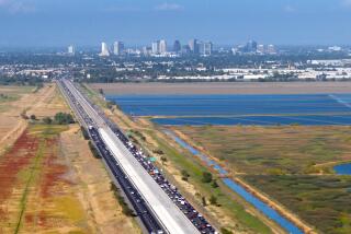
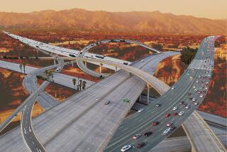
Today, America is a nation virtually defined by interstate highways, more than 41,000 miles of them. With last weekend’s opening of a seven-mile stretch in the Seattle area, I-90 is the third transcontinental interstate on which it is possible to get from sea to sea without stopping for a traffic light--almost. One tiny little link remains uncompleted in the 3,082 miles between Seattle and Boston: about a mile of two-lane Bank Street through Wallace, Ida., with one traffic signal. That gap will be closed soon.
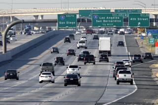
I-90 thus joins I-80 and I-10 as transcontinental interstate routes. I-40 nearly is so, running from Barstow to Greensboro, N.C. There are seven north-south routes bracketed by I-5 on the West and I-95 in the East. Alternate and business-route branches of interstates are designated by three-digit numbers such as I-405, the San Diego Freeway, and I-495, the Washington D.C. beltway.
The National System of Interstate and Defense Highways was conceived late in World War II to expedite troop and materiel movement. Work began in 1956 with the federal government putting up 90% of the money and the states 10%. Total so far: about $125 billion. A defense system perhaps, but the interstate network has revolutionized civilian travel. Among other effects, interstates helped accelerate suburban sprawl by providing speedy commuter routes to downtown offices.
Building the system involved far more than just grading hills and pouring concrete. Picking the routes was particularly controversial. Rival towns fought bitterly to get the interstate, just as towns had battled a century before to be on the railroad. In the West, isolated towns desperately opposed being bypassed. The old two-lane U.S. highways had channeled tourists right down Main Street and the merchants could see their trade whizzing on by. But bypasses were inevitable, as were interminable hearings over which bypass routes to use.
A few towns did suffer and virtually die. Usually, though, it was a matter of economic relocation that probably would have happened anyway: The old motels and restaurants downtown suffered while new Holiday Inns and chain eateries sprouted around the spanking new intersections. Businesses such as auto dealerships, farm-implement stores and drive-in movies gravitated out along the main stems toward the interstate crossings.
Oil states lobbied to have their roads surfaced with blacktop rather than concrete. Wyoming lawmakers tried to defy the interstate boys by painting their center stripes yellow instead of the federally required white. Yellow was easier to see in ground blizzards, they claimed, vainly. Trucks and earthmovers of giant construction firms like Peter Kiewit & Sons became familiar sights. Some old-timers were shocked when young women joined the corps of flagmen at construction sites.
Boys scrounged lumber from concrete forms to build forts and tree houses, and never forgot the smell of curing concrete. Construction of the system made winter travel much easier. With their gentle grades, sweeping curves and spacious lanes, the interstates were much less susceptible to closure during storms. And throughout the West today, if a stranger stops to ask where to find someone or something, chances are he’ll be told, “Well, you go out on the interstate . . . . “
More to Read
Sign up for Essential California
The most important California stories and recommendations in your inbox every morning.
You may occasionally receive promotional content from the Los Angeles Times.


