Lands Panel Today Opens 1st Public Probe of Spill
- Share via
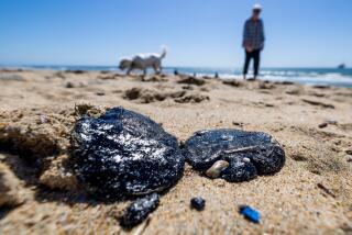
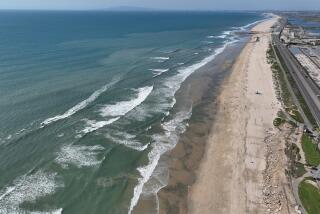
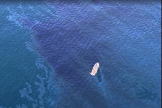
HUNTINGTON BEACH — The State Lands Commission today will conduct the first public inquiry into the cause and impact of a 394,000-gallon oil spill that last month fouled miles of Orange County shoreline and, so far, has cost more than $15 million to clean up.
Among those scheduled to appear are U.S. Coast Guard Capt. James C. Card, Lt. Reed Smith, the on-scene oil cleanup coordinator for the state Department of Fish and Game, and the mayors of Huntington Beach, Newport Beach and Seal Beach.
The 1 p.m. hearing at Huntington Beach City Hall will be carried live on Channel 3, the city’s public-access station on Paragon Cable.
“This is primarily a fact-gathering session, but it will be clearly tied to some course of action, perhaps new regulations governing offshore tanker activity,” said Dave Sebeck, a spokesman for Lt. Gov. Leo McCarthy, one of three members of the commission, which regulates offshore oil and mooring leases within three miles of the California coast. The 811-foot American Trader on Feb. 7 punctured its forward hull with its own anchor as it attempted to moor at an offshore pipeline 1.3 miles southwest of Huntington Beach and unload a cargo of Alaskan crude.
“The aim is to learn why this happened,” Sebeck said, “and what can be done to prevent this from happening again.”
The commission’s other two members, state Controller Gray Davis and state Director of Finance Jesse Huff, also are expected to attend the hearing in Huntington Beach council chambers at 2000 Main St.
If necessary, the inquiry would resume Thursday at 9 a.m. at the same location, officials said.
Meanwhile, a federal official revealed Tuesday that preliminary results from a study performed for the Coast Guard show that water at the mooring where the spill occurred was about two or three feet shallower than shown on standard navigational charts.
The study--conducted by the National Ocean Service, which is a branch of the National Oceanic and Atmospheric Administration--was prompted by investigators’ concerns that a discrepancy between the actual depth and that shown on charts might have led to the spill.
Capt. Christian Andreasen, chief of the service’s nautical charting division, said that the readings still must be adjusted to allow for tides and other factors. Final results are not expected for another four to six weeks.
“In effect we really didn’t find much change out there,” Andreasen said. “Two or three feet.
“It varies from what we’ve seen,” he said. “There are some areas with very small differences and some areas where they are a little bigger.”
Andreasen said there is “not much doubt” that sand must have accumulated on the ocean bottom around the mooring, causing the water to be shallower than indicated by the charts, which were last updated in 1975.
“It’s the California coast, and if there’s changes in the ocean depth, it’s generally caused by sand moving around,” he said.
Cleanup workers on Tuesday continued scrubbing the last remaining oil-stained jetties and rocks, which are near the mouth of the Santa Ana River and in the Huntington bluffs region. About four miles of beach remain closed in the meantime.
British Petroleum, the company that owned the spilled oil, also announced that it has spent about $15 million on the cleanup so far. Company officials say that they expect to eventually be reimbursed for the expenses by the ship’s owner, American Trading Transportation Co.
More to Read
Sign up for Essential California
The most important California stories and recommendations in your inbox every morning.
You may occasionally receive promotional content from the Los Angeles Times.


