400 years later, seeking secrets of Pocahontas : Scientific team begins an ambitious ecological and archeological probe of historic Jamestown Island.
- Share via
JAMESTOWN, Va. — After 400 years, the questions persist.
Were there American Indians living on Jamestown Island when the first permanent English settlers landed in 1607? Where did the 104 colonists build their first fort? What kind of vegetation did they encounter? And after centuries of shoreline erosion, is it possible to know where they actually landed?
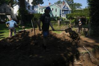
Jamestown is no reconstructed historical Disneyland in the manner of nearby Colonial Williamsburg. It is an abandoned site filled with ruins and emptiness, whose secrets lie underground or under water. Which is why a team of scientists has begun an ambitious five-year ecological and archeological assessment of the town in an attempt to solve its mysteries.
“There’s an assumption that people are interested in the way people lived in the past,” said Marley Brown, director of archeological research for the Colonial Williamsburg Foundation, one of three organizations involved in the study. “If you make that assumption, then this is an important project.”
Jamestown enjoys a rich history. Not only did it become prominent as a pioneering 17th-Century English settlement, it was also the meeting place, in 1619, of North America’s first English-speaking legislative assembly. The capital of Virginia was located here from 1607 to 1699.
Jamestown also was the site in 1614 of the marriage of Pocahontas, the daughter of Chief Powhatan, to John Rolfe--a union that is said to have helped improve relations between the American Indians and the English.
The Jamestown assessment is particularly significant because it involves a combination of traditional archeological methods, ecological studies and computer modeling. The work, which will be done by more than 40 academic specialists, has several components: an environmental study of Jamestown Island to find out what it looked like as far back as 12,000 years ago; a study of American Indian usage of the island, dating back to prehistoric times, and an attempt to discover how the town grew in the 17th Century and then declined in the ensuing 200 years.
Brown points to the island’s shoreline erosion as an example of the mysteries the assessment hopes to resolve. He estimates that the original English landing site, and the first fort erected, are now 100 yards offshore in the middle of a channel. But no one knows for sure, which is why a study of erosion patterns may solve this centuries-old question.
A significant part of the overall research will be done by scientists known as geo-archeologists, who, Brown said, “are trained to think in how the land is formed physically. They’re interested in how this affected people’s behavior, in “eco-facts,” not artifacts. They’re worried about how people have affected nature.”
What this means is the Jamestown study will depend on such arcane disciplines as palynology and pedology.
The former is the study of pollen. Certain pollens come from specific vegetation, and because pollen fossilizes, palynology can help archeologists determine what kinds of plants were on the island centuries ago.
Pedology is the study of soil formation and the factors involved in it. This helps scientists understand the environmental conditions at the time the soil was forming.
Plans call for the project to proceed in several stages. The first involves a survey of all documentation on Jamestown, as well as the computerization of data on the colony. At the same time, geologists and archeologists will begin collecting information on plants and soils on the island. Next summer, a section of the town will be probed by instruments in an attempt to find out what artifacts or remains might be underground.
No diggings have been scheduled for the first phase of the study, but they will probably come later. Reconstructions, however, are out of the question--they were banned years ago.
“You can damage the site,” said Jane Sundberg of the National Park Service, “and you can give a false idea of what’s there.”
Even though there have been several archeological digs in the past, the site consists primarily of a scattering of ruins. “With a ruin,” Sundberg said, “you still get a feeling for the scale of the place.”
Both Brown and Sundberg said they feel that the assessment will shed a great deal of light on the island’s physical development and early 17th-Century lifestyle of the colonists. But Sundberg is equally excited about the multidisciplinary approach of the project and the technological advances that allow scientists to study a site without destroying it.
“Computers are such a great tool,” she said. “And we don’t know in what ways we’ll be able to use them in 10 or 20 years. But with them we can find out as much as possible without destroying anything. The thing about archeology is, once it’s dug, it’s gone.”


