Wednesday Special : HISTORIC BOTTLENECK: Crossing the Newhall Pass
- Share via
Cranky commuters trying to get through the Newhall Pass are discovering what has been known to travelers for hundreds of years: Getting in and out of the valleys is no simple trek.
Long before the Jan. 17 Northridge earthquake crippled the interchange of the Golden State and Antelope Valley freeways, travelers ranging from Native Americans to early motorists struggled to find a convenient way to cross the mountains at the northwest end of the San Fernando Valley. They never did.
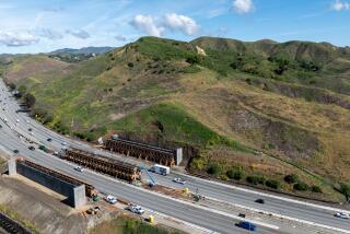
The Golden State and Antelope Valley freeways finally forged a better link between the Valley and parts north. Before the collapse, 318,00 vehicles passed through the interchange each day. Caltrans says it will take a year to repair the interchange--the latest roadblock confronting travelers at an obstinate pass.
ROUGH ROAD: A history of attempts to clear the mountains.
1769: Explorer Don Gaspar de Portola leads a Spanish expedition across the Newhall Pass.
1800s: Early commuters use a Native American trail over the mountains, employing ropes and pulleys to hoist stagecoaches up and down. In one bizarre attempt, the U.S. Army tries leading camels over the hills. It was an unsuccessful experiment.
1862: Under the direction of U.S. Gen. Edward Fitzgerald Beale, workers using picks and shovels cut a 90-foot-deep gash through the mountains, creating a narrow passage for horses, stagecoaches and foot traffic. Beale’s Cut, as it was called, can still be found just be found just east of Sierra Highway and Clampitt Road.
1875: Chinese engineers and stonemasons carve a 6,976-foot-long railroad tunnel, through the heart of the Santa Susana Mountains. The tunnel, still used today, passes below the crumbled freeway interchange.
1910: The 434-foot-long Newhall Tunnel is bored through the mountains west of Beale’s Cut. It’s so narrow two trucks can barely pass simultaneously.
1938: The Sierra Highway, at four lanes across, seems to offer a respite. In its first year it is carrying 4,000 cars a day.
1955: First segment of Golden Sate Freeway opens. Final segment opened in 1975.
1963: First segment of Antelope Valley Freeway opens. Final segment opened in 1974.
BEALE’S CUT
Today Beale’s Cut is a mostly forgotten historic site east of Santa Clarita. But in its heydey the cut was a bustling place.
A tollbooth was erected and 25 cents was charged for a single horse and rider. Teams of 12 or more required a $2 toll and loose animals cost a dime each.
GETTING THROUGH
A rundown on the routes around the Newhall Pass.
* Golden State Freeway: With a portion of the freeway closed, The Old Road has been rebuilt as a four-lane detour between Weldon Canyon Road and Calgrove Boulevard.
* Antelope Valley Freeway: Two southbound lanes open, one as a car-pool lane. Northbound lanes open.
* Angeles Crest Highway: The mountain road takes a roundabout route through Angeles National Forest, linking the Antelope Valley with east San Fernando Valley.
* California 126: From the Santa Clarita Valley, take State 126 west to California 23, driving south to either the Simi Valley or Ventura freeways. It’s a circuitous route.
METROLINK EXPANDS
New stations and extra commuter trains have been added to the Metrolink system in the Valley region. Metrolink tickets from Antelope or Santa Clarita valleys--10-trip packets cost $44 and a monthly pass is $145--may be purchased at the stations. For information and additional ticket counter locations, call (800) 371-LINK.
*Lancaster, 420 W. Lancaster Blvd.
*Palmdale Station, 40007 5th St. East.
*Vincent Grade-Acton Station, 550 W. Sierra Highway.
*Canyon Country, 19201 Via Princessa
*Santa Clarita, 22122 Soledad Canyon Road
*Sylmar/San Fernando, 12219 N. 1st St.
*Burbank, 201 N. Front St.
*Glendale, 400 W. Cerritos Ave.
*Los Angeles, 800 North Alameda St. Sources: Caltrans, “Santa Clarita: Valley of the Golden Dream”; Researched by ABIGAIL GOODMAN
More to Read
Sign up for The Wild
We’ll help you find the best places to hike, bike and run, as well as the perfect silent spots for meditation and yoga.
You may occasionally receive promotional content from the Los Angeles Times.


