On Top of Old Black Butte
- Share via
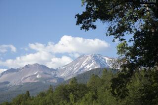
To the motorist cruising Interstate 5 through the Mt. Shasta area, dark, forbidding Black Butte attracts almost as much attention as the great snowy volcano. Locals claim that on foggy days they regularly spot travelers snapping photos of Black Butte in the mistaken belief that it’s Mt. Shasta.
Contemplating barren and precipitous Black Butte from I-5, one concludes considerable technical climbing skill or a mad rock scramble is required to reach the top; actually, a well-engineered footpath leads to the 6,325-foot summit, where magnificent views await the hiker.
The butte is a young volcano, formed when rocks, ash and lava exploded from a crack in the unsettled earth. Geologists estimate the butte was created about 10,000 years ago, about the same time as the crater of Mt. Shasta.
Getting to the trail head is difficult because of a lack of signs at crucial junctions and the confusion of dirt roads that travel every which way near the base of Black Butte. Call the Mt. Shasta Ranger Station for the latest road condition information.
Directions to trail head: From Interstate 5, take the Central Mt. Shasta exit and wind through the resort town for almost a mile on Lake Street, which curves left to join Everett Memorial Highway. Drive two miles and turn left (west) onto a dirt road signed Black Butte. After 0.1 mile, turn right (north) and proceed one mile to a junction. Turn left (west) for 0.4 mile, then swing right (north), sticking to the main dirt road. The road soon curves left (west) again as you continue 1.2 miles to a junction, where you turn left (south). This road curves right (west) as it climbs a final three-fourths of a mile to the trail head, a turnout at road’s end.
The hike: The path ascends over the talus-covered north side, dotted with a surprising number--and variety--of trees: western white pine and white fir on the lower slopes, lodgepole pine and red fir at higher elevations. After a mile-long contour, the trail makes its first switchback, then rounds the butte to its west side.
As you near the top, the going gets rockier and you discover Black Butte is not the perfectly symmetrical cone that it appears from the highway, but rather a combination of cones and peaks. A final quarter-mile of steep switchbacks takes you to the top.
(BEGIN TEXT OF INFOBOX / INFOGRAPHIC)
Black Butte Trail
WHERE: Shasta-Trinity National Forest.
DISTANCE: 5.2 miles round trip; 1,800 foot elevation gain.
TERRAIN: Steep, rocky volcano.
HIGHLIGHTS: Panoramic views of Mt. Shasta and beyond.
DEGREE OF DIFFICULTY: Moderate to fairly strenuous.
FOR MORE INFORMATION: Mt. Shasta Ranger District, Shasta-Trinity National Forest, 204 West Alma, Mt. Shasta, CA 96067; tel. (916) 926-4511.
More to Read
Sign up for The Wild
We’ll help you find the best places to hike, bike and run, as well as the perfect silent spots for meditation and yoga.
You may occasionally receive promotional content from the Los Angeles Times.


