Ground Control
- Share via
If agronomist John LeBoeuf had waited until the leaves of his cantaloupe plants turned yellow, it would have been too late.
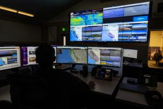
As it was, before shriveling set in, LeBoeuf converted aerial images of the field into computer-enhanced maps that revealed an overly dry area, prompting him to douse that patch with extra irrigation water. The result? A greater-than-expected harvest of juicy melons.
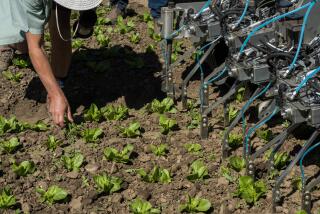
In the name of “precision farming,” LeBoeuf has embraced a bushelbasketful of satellite and computer technologies designed to enhance the efficiency, productivity and profitability of Fordel Inc., the big grower for which he works in Mendota, Calif.
He is one of a rising number of California crop advisors and farmers who are following the lead of Midwestern corn, wheat and soybean growers in using emerging technologies to better manage crops and land.
They are using such tools as the global positioning system, or GPS, a network of satellites controlled by the Defense Department that can help a ground-based unit pinpoint its location; geographic information systems, or GIS, software that analyzes and interprets data; and remote sensing, the capturing of images or other data from airplanes, satellites or ground-based sensors that are not in direct contact with the object or landscape.
Many of these uses have sprung from decades’ worth of military and weather research conducted by the Pentagon, the National Aeronautics and Space Administration, universities and private research centers.
Call these the fields of high-tech dreams. If you plant it, experts will come and help you dissect a wealth of information about it--variations in soil types, soil pH, drainage and nutrient requirements and how all these conditions affect crop yields over time.
Proponents are agog at the prospects for outmaneuvering Mother Nature to boost harvests and better manage costs for fertilizers, pesticides and water by using them only when and where necessary. The bottom line, they maintain, will be a better bottom line for farmers and for the environment.
“It’s very exciting,” said Shrini Upadhyaya, a professor of biological and agricultural engineering at UC Davis. “Agriculture has been low tech. This gives us a way to bring high tech into ag.”
For decades, scientists and researchers have talked glowingly of the potential for “eye in the sky” imagery and computer technology to join forces to aid agriculture, the nation’s biggest industry. With more precise information, the reasoning went, growers could manage small problem areas differently and track yields by specific locations over several years. But only recently have GPS, GIS and remote sensing matured enough for commercial use in agriculture.
The push into this brave new world of farming is giving rise to a bumper crop of business opportunities. Equipment makers, notably Case Corp. and Deere & Co., have begun installing GPS units and yield-monitoring equipment on harvesters that can then use satellite signals to help determine their locations in a field or orchard.
GIS companies, such as Environmental Systems Research Institute in Redlands, have developed software applications that enable growers to assess field conditions and how those relate to yield.
Meanwhile, within the next year, two Colorado companies plan to launch the first high-resolution private-sector satellites to bolster the Defense Department’s 24-satellite Landsat system and other systems backed by the French and Indian governments. And dozens of consulting, mapping, measuring, monitoring and sampling companies have sprung up to help dazed farmers figure it all out.
Even skeptics acknowledge that “precision farming,” or “site-specific farming,” is the wave of the future. Growers, they acknowledge, will routinely use information gathered from satellites orbiting the Earth, and GPS could be used to pinpoint areas of a field where pests appear most prevalent, allowing the grower to spot-treat.
In addition to farmers, others are expected to tap the trove of knowledge that can be gleaned from GPS and GIS. Crop-dusting outfits such as Inland Crop Dusters Inc. in Shafter, Calif., are already using the technology to eliminate the need for human “flaggers,” who must wear cumbersome protective gear and respirators as they signal to pilots where to drop pesticides and other chemicals.
Other potential customers include insurance companies, lenders, commodity speculators, investors and farm chemical suppliers.
But adapting the technologies to California’s diverse conditions and crops--everything from tomatoes to nuts to melons to cotton to rice--is proving problematic.
“In the Midwest, they have grain crops that are nonirrigated or use low-cost irrigation,” said Michael Cahn, a farm advisor with the UC Cooperative Extension for Sutter and Yuba counties. “The fields are very large, and there are only three or four main crops.”
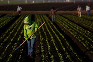
In California, by contrast, irrigation needs dictate that farmers work with smaller fields. And hundreds of different commodities are grown, requiring a wide variety of equipment on any given farm. The prospect of outfitting each tractor or combine with GPS and yield-monitoring technology--at an extra cost of about $8,000, on top of the $50,000 to $100,000 for the machinery--can seem daunting. And for most crops, the yield-monitoring sensors are still under development.
“It’s going to be a little more work [in California] to make it work,” Cahn said. “Here, we’re going a bit slower.”
Many farmers wonder about the payoff. Can they make money with micro-management?
Not if they’re in a big hurry. Until farmers get several years’ worth of color-coded yield maps, the experts point out, they won’t have a good understanding of what’s going on with their land.
What this will mean, if anything, for consumers and food prices is also unclear. Though the technology is expensive, it could help growers salvage crops that otherwise might fall victim to pest invasions or water shortages, thus staving off regional shortages that might bump up prices.
Doug Harford, a farmer in Mazon, Ill., an hour’s drive southwest of Chicago, can testify to the difficulty of quantifying effects. An early adopter, Harford began delving into high-tech mapping four years ago. He has quickly learned that one year’s poorly performing field can turn around and be a champ the next year, depending on weather and other conditions.
Initially, “we were making decisions based on one year’s worth of data,” Harford said, “but you need to have four or five years’ worth.” And at that point, Harford said, the issue for farmers will be figuring out how to manage the flood of information. The technology, after all, can only indicate a problem; it can’t diagnose what’s causing it.
Even though he still considers himself a novice, he views the technology as a powerful tool that will help his operation keep pace in the global food-production market.
“I view our investment in precision farming as our effort to retrain ourselves to avoid obsolescence,” Harford said.
Researchers and entrepreneurs are quick to acknowledge that the industry has been guilty of over-promising and under-delivering. With early Landsat and other satellites, it took weeks to get an image, process it and extract information. That was too long for a farmer trying to make adjustments for the season’s crops. And the service was quite costly. (The expense of these technologies today ranges widely, from $1 to $30 an acre.)
Now, with GPS and GIS maturing in tandem, the drawbacks are diminishing. And key improvements are in the wings.
EarthWatch, based in Longmont, Colo., plans soon to launch a satellite that will feature 3-meter resolution. On its heels, next January, Space Imaging Eosat of Thornton, Colo., plans to be the first company to offer 1-meter resolution on a commercial basis. The company’s funding comes in part from Lockheed Martin Corp., the aerospace and defense giant.
As resolutions sharpen, the potential exists for farmers to manage orchards on a tree-by-tree or even branch-by-branch basis. A single tree beset by spider mites could be treated; a dry, sandy pocket could be watered.
“We are on the verge of a great era here,” said Susan Moran, a physical scientist with the federal Agricultural Research Service who is experimenting with remote sensing technologies in Tucson. She added, however, that given the industry’s history, “I have high hopes, but I’m cynical.”
Jon H. Arvik, who heads up Space Imaging’s agriculture development, has no such reservations. “It just flat fits agriculture,” he said.
One company eagerly awaiting Space Imaging’s launch is VESTRA Resources Inc., a GIS consulting firm in Redding that will resell the satellite services. VESTRA, a leader in implementing GIS in forestry, last year ventured into agriculture. It has focused on permanent crops, including vineyards and orchards, using GIS software from Environmental Systems Research Institute. Among its customers is Robert Mondavi Inc., the pioneering winery in Napa Valley.
Don Gordon, a VESTRA partner, acknowledged that many older farmers will balk at going digital. But the younger, techno-savvy set will jump on board.
“We’ll continue to see this technology advance,” Gordon said. “We have to start somewhere.”
*
Martha Groves can be reached by e-mail at martha.groves@latimes.com or by fax at (213) 237-7837.
More to Read
Inside the business of entertainment
The Wide Shot brings you news, analysis and insights on everything from streaming wars to production — and what it all means for the future.
You may occasionally receive promotional content from the Los Angeles Times.


