State Holds El Nino Readiness Summit
- Share via
SACRAMENTO — Except for one Southland drenching, most people only know El Nino 1997 as the colorful patina blossoming on computerized images of the Pacific’s water temperature.
But if El Nino is still an infant as a weather phenomenon, it has already become a full-blown one in the media.
On Monday, Gov. Pete Wilson opened the first of two dueling El Nino summits this month, each offering separate demonstrations of preparedness and commitment by the state and the federal governments.
The governor’s event proved that there is an appetite for every bit of news about the tropical weather chute aimed at the West Coast--most directly at Los Angeles.
There was little new information during the three-hour summit except for a $7.5-million allocation that Wilson approved to help in the disaster preparation. But the overflow crowd in the governor’s council room included 19 television cameras from across the country, more attention than Wilson has seen in months.
“The fact is, El Nino is on the way,” warned the governor, who left the briefing after his introduction to sign dozens of bills from the last legislative session. “We are not sure what it will bring, but we have to be prepared for the worst that could come.”
State officials said that getting information to the public through the media is one of the most important functions of disaster preparedness.
Monday’s summit was geared so much toward the media that the session was halted once and a speaker was asked to repeat part of his testimony under better lighting.
Wilson also scheduled seven regional hearings that the state will sponsor over the next month in an effort to focus more attention on storm preparedness.
The current El Nino condition was first spotted by scientists last spring. It is most obvious in the plume of warmer-than-normal water that has grown in the eastern Pacific Ocean to more than 1 1/2 times the size of the United States.
The change in water temperature is disruptive to climates worldwide, scientists say. It causes droughts in the South Pacific, flattens hurricanes in the Atlantic and sends a gusher of tropical moisture to California.
The periodic weather pattern may have contributed to last month’s tropical storm that soaked Los Angeles and caused severe flooding in Southern Arizona when three inches of rain fell in a 24-hour period.
On Monday, officials declined to predict what Southern California might expect from this year’s El Nino. They cautioned that, like Halley’s Comet, this could be a scientific phenomenon that fails to live up to its billing.
“Anything is possible,” said Bill Mork, the state’s climatologist. “We can’t be sure what will happen. But the potential is very high for a lot of storminess this winter. And potential is what you have to plan for.”
In California, officials said they are most concerned about the southern parts of the state. Looking at storm data from past El Nino conditions, Mork said weather patterns should be about normal at the state’s northern border and increase in severity as they move south.
He said past El Ninos have produced a 25% to 35% increase in rainfall for the Bay Area and the Central Valley around Sacramento. In the South, he declined to make predictions except to say it would be the state’s hardest hit region.
This El Nino condition is also unprecedented in two ways: Some of the water temperature reports are the highest on record, and the condition is beginning earlier than in the past.
“This is quite an abnormal event,” Mork said. “It’s very significant.”
Officials identified two primary concerns for property damage in the state--one along the Southern California coast and the other along the levee system in the central and northern parts of the state that was severely damaged in floods last winter.
On Monday, Wilson wrote a letter to President Clinton urging the federal government to do more to repair the damaged river levee system.
About 600 levee sites remain on the federal repair list, and the federal government hopes to complete 500 of those by November.
The repairs, totaling about $120 million, are necessary to restore the system to the integrity it had before last January’s flooding. Officials are worried that the network of mostly old, earthen walls could be in jeopardy, especially if heavy rains begin before November.
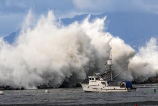
In Southern California, officials hope that they might be able to predict the height of waves days before they crash into the coast.
Ron Flick, an oceanographer at the Scripps Institution of Oceanography in La Jolla, said computer-generated models of wave patterns could be a significant help in preparing for coastal damage before it occurs.
He said the greatest damage to the coast has happened when storm waves occur at the same time as the twice-monthly cycle of peak tides.
More to Read
Sign up for Essential California
The most important California stories and recommendations in your inbox every morning.
You may occasionally receive promotional content from the Los Angeles Times.


