By the Numbers
- Share via
Just a few decades ago, we identified everything from ourselves to our roads only by proper names. Now, complex numbering systems define and route our telephone calls, mail, earnings and transportation. What was the initial rhyme and reason behind these numbers and what is next?
AREA CODES
* When: The first telephone area code, 201 in New Jersey, became effective in 1951.
* Why: To automate long-distance dialing and prepare for the postwar boom in phone service.
* The Plan: Initially developed by Bell Labs in 1947, the North American Numbering Plan was based partially on telephone traffic. Since telephones then had rotary dials, with lower numbers requiring the least dialing distance, areas most frequently called were assigned lower digits and areas rarely called the highest. Los Angeles and New York City were 213 and 212 respectively, while Alaska was 907. Neighboring geographic area codes were made very different to avoid confusion, such as 714 in Orange County and 213 in Los Angeles. Initially, middle digits of all area codes were 0 or 1, signaling a long distance call rather than a local prefix. The 0 indicated the code was the only one in that state and 1 was given to states with multiple area codes. The number of possible codes with 0s and 1s as middle digits was expected to be sufficient until 2000.
* Since Then: In 1994, as a result of population growth and proliferation of cell phones, faxes, modems and beepers, area code numbers with 0s and 1s in the middle ran out, and the system was altered to allow other middle digits. Since Jan. 1, 1995, 80 new-style area codes have been assigned, with 560 possibilities remaining.
* Future: In Southern California in April 1998, the 714 area code will be split into 714 and 949. In June 1998, the 213 area code will be split into 213 and 323. It is projected that all possible three-digit area codes will be in use by 2031. After that, more digits may be added. For information on area codes on the Web, visit https://www.bellcore.com/NANP.
For California, see https://www.pacbell.com/about-pb/areacodes/index.html.
ZIP CODES
* When: 1963
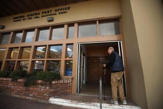
* Why: As a result of changes in mail transportation and an explosion in business mail, a numbering plan was needed to enable computers to sort mail.
* The Plan: The first digit of the five-digit ZIP code designated a broad geographic area, starting with 0 in the Northeast and ending with 9 in the far West. The next two digits more closely pinpointed population concentrations and large mail-processing plants. The final two digits designated small post offices or postal zones in large zoned cities.
* Since Then: In 1981, four digits were added (ZIP+4). The first two digits define a delivery sector, such as a group of blocks or a high-rise building. The last two digits define a segment of the sector, such as a floor of an office building or a group of post office boxes. In 1993, the Postal Service began stamping two additional digits to place mail in delivery sequence for mail carriers’ walking routes.
* The Future: No changes anticipated. For more information, visit https://www.usps.gov on the Web.
SOCIAL SECURITY NUMBERS
* When: 1935
* Why: To track mandatory worker contributions to the new Social Security program, part of Franklin D. Roosevelt’s New Deal legislation. Because many people shared the same names or changed names, it was decided to use numbers as identifiers.
* The Plan: Each worker received a nine-digit number, broken into three parts. The three-digit first section, called the area number, reflected the state where the applicant first applied for a card. Lowest area numbers were assigned to New England states, and the area numbers grew progressively higher in the South and West. (The whole 700 series was given to the Railroad Retirement Board.) The two-digit second section, called the group number, had no geographic significance, but helped break numbers into blocks for use in internal operations and order of issuance. The four-digit final section, called the serial number, represented a straight numerical series of numbers from 0001-9999 within each group.
* Since Then: No changes.
* The Future: Even at the current rate of 6 million new numbers issued every year, there will be no need to reissue the same numbers, revise the system or devise a new numbering system for several generations. For more information, see https://www.ssa.gov.
U.S., INTERSTATE HIGHWAYS
* When: 1926
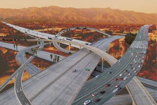
* Why: To remove highways from rivalrous private management and make order of the mishmash of variously named roads that crisscrossed the country and confused motorists, state and federal officials came together in 1926 to form a numbered U.S. highway system. These highways have open access from roads as small as farm lanes. In 1956, partially as a result of national defense concerns--for the ability to move military equipment--the controlled-access interstate highway system was introduced.
* The Plan: For the U.S. highway system, even numbers were assigned to principal east-west routes, starting with U.S. 2 in the north, the numbers growing larger to the south. Odd numbers were assigned to principal north-south routes, starting with U.S. 1 on the East Coast. To allow room for expansion, not all numbers were used. Alternate and connecting routes were given the principal route number prefaced by a 1, 2, 3 or 4. (For example, the first branch of U.S. 50 was called U.S. 150, followed by U.S. 250, etc.)
The interstate highway system numbering plan followed the U.S. highway plan in that even numbers were assigned to major east-west routes and odd numbers were assigned to major north-south routes. Opposite to the U.S. highway numbering system, numbering for north-south interstates began in the West, and numbering for east-west interstates began in the South. Spurs into a city were given the principal route number prefaced by an odd number. Routes through or around a city were given the principal route number prefaced by an even number.
* Since Then: No changes in the system.
* The Future: No changes planned.
LOS ANGELES BUS ROUTES
* When: 1981
* Why: To logically restructure route numbers inherited from the private bus lines that the Rapid Transit District (now the Metropolitan Transit Authority) took over when it began in 1963.
* The Plan: Buses that provided local service to and from downtown Los Angeles received numbers 1-99, starting with 1 heading north from downtown and progressing counterclockwise--due west from downtown corresponded to 25, south to 50 and east to 75. Local east-west routes that didn’t serve downtown were numbered 100-199. In numbering those routes, a line was drawn through downtown and, beginning at that line, routes were numbered from 100 to 149 progressing south from the line and from 150 to 199 progressing north of that line. Local north-south routes that did not serve downtown were numbered 200-299. In numbering those routes, a line was drawn through downtown and routes were numbered from 200 to 249 progressing west from that line, and from 250 to 299 progressing east.
Buses that provided limited-stop service along local routes were numbered 300-399. (In general, the last two digits of the local route were appended with a 3.) Express routes that did not follow local routes that served downtown Los Angeles were numbered 400-499, according to the freeway they ran on, with the numbering starting at the Pasadena Freeway and progressing counterclockwise. Express buses that did not serve downtown were numbered 500-599, using the same pattern as the local bus routes. The 600 series of numbers was designated for special services to events, local shuttle lines and privately contracted services. In all cases, to leave room for growth and flexibility, not all numbers were assigned.
* Since Then: As bus routes were added, a few numbers got out of sequence. Some routes were combined for cost-efficiency.
* The Future: No changes in the system planned.


