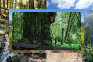
Redwood, Meadow Paths in Pogonip
- Share via
Few universities can boast the scenic surroundings of the University of California at Santa Cruz. Set amid stands of redwood and mountain meadows, the campus commands a grand view of Monterey Bay.
One way to visit the university is to walk the campus itself, which is divided into eight colleges, each constructed in a different architectural style. Another way to go is to hike Pogonip, a wild city park adjacent to the campus. Pogonip, a 600-acre preserve of shady glens and sunny meadows, is a walker’s delight.
Henry Cowell, who left his mark on Santa Cruz in so many ways, owned a limestone quarry and lime-making operation during the last decades of the 1800s and into this century as well. In 1961 a 2,000-acre parcel of the old Cowell Ranch was purchased by the state of California as the site of UC Santa Cruz. The 600-acre Pogonip was acquired from Cowell’s heirs in 1989.
The native Ohlone, acute observers of the natural world, called this land Pogonip, meaning “icy fog.” Fog, both chilly and tepid, often enshrouds Pogonip’s evergreen forest (oak, madron~o, bay) and the park’s second-growth redwood groves. One recently seen denizen of the wet forest floor is the banana slug, the popular mascot of UC Santa Cruz.
A network of trails and service roads crosses Pogonip, a Santa Cruz municipal park. The trails are mostly unsigned, so first-time visitors need to pay heed where they’re going. Some trails on the park map, such as Pogonip Creek (overgrown, no footbridges) and Haunted Meadow (incomplete), are inviting but difficult to negotiate for a newcomer to the area.
Two loops explore the south and north areas of the park. My favorite, the southern loop (about four miles), uses Brayshaw Trail to Spring Trail to Overlook Trail to Pogonip Creek Trail. Redwoods, views and a feeling of really getting away from it all are highlights of this circuit.
Directions to trail head: In Santa Cruz, from the junction of California Highway 1 and California Highway 9, head north on Highway 9 half a mile and turn left on Golf Club Drive. Park in the lot at the corner.
The hike: Head up Golf Club Drive one-quarter mile, passing under a railroad trestle, to the entrance of Pogonip. You’ll walk along the back of Pogonip Club, a premier polo club of the 1930s and 1940s. After World War II, the facility became a social club. It’s now closed.
Join Old Stables Trail, crossing a meadow and passing an unsigned junction with Pogonip Creek Trail. The trail joins Brayshaw Trail, a service road, and ascends to a junction with Spring Trail. Go right (north) to the handsome meadow at the junction with Ohlone Trail. From Haunted Meadow, those experienced with Pogonip pathways might improvise a return route via Haunted Meadow Trail or Overlook Trail, but first-timers should return the way they came.
Old Stables, Brayshaw, Spring Trails
WHERE: Pogonip, city of Santa Cruz.
DISTANCE: 4 miles round trip with 200-foot elevation gain.
TERRAIN: Redwood groves, mixed evergreen forest, meadows.
HIGHLIGHTS: Superb backdrop to UC Santa Cruz; views of Monterey Bay, San Lorenzo Valley.
DEGREE OF DIFFICULTY: moderate.
FOR MORE INFORMATION: Santa Cruz City Department of Parks and Recreation (408) 429-3777 or park ranger office (408) 429-3039.
More to Read
Sign up for The Wild
We’ll help you find the best places to hike, bike and run, as well as the perfect silent spots for meditation and yoga.
You may occasionally receive promotional content from the Los Angeles Times.


