Volcanic Ash Danger Grows for Aircraft
- Share via
SAN FRANCISCO — Scientists warn that commercial jets face an increasing hazard from clouds of gritty ash spewed by volcanoes, even as efforts to detect eruptions improve.
Researchers at the American Geophysical Union meeting said fast-growing flight paths crisscross the Ring of Fire region rimming the Pacific Ocean, which coincidentally contains most of the world’s active volcanoes.
In the last year, U.S. Geological Survey officials say, at least three jets have been damaged by ash, including an incident on May 20 when a commercial airliner tried to land in Guatemala City just when the nearby Pacaya volcano was erupting.
Since 1980, more than 100 commercial jets have suffered significant damage after flying unknowingly into volcanic ash clouds, the USGS researchers said.
In at least 10 of those incidents, the aircraft lost power for minutes after their jet engines sucked in the ash and it melted in the turbines. Although no crashes or fatalities have been blamed on ash damage, the incidents are harrowing.
Pilots and passengers have reported their aircraft suddenly being enveloped in a sulfurous darkness, then plummeting helplessly over rugged terrain and vast, frigid oceans.
“Pilots are unlikely to see ash clouds, and radar is not tuned to see them in front of the aircraft,” said Thomas Casadevall, deputy director of the USGS. “When they got their engines restarted, they thought the engines would shake themselves off the wings.”
An international network of nine volcano hazard offices analyzes eruption and ash cloud information collected automatically by satellites and ground-based sensors as well as pilot reports.
The information is shared daily by major commercial carriers and the military, and pilots are beginning to receive ash cloud updates in their preflight briefings, officials said.
“People who are flying are better off this holiday season as compared with the last holiday season,” Casadevall said.
But most volcanoes are not regularly monitored, researchers say. And ash clouds are difficult to assess because they travel thousands of miles, resemble harmless weather clouds and can be difficult to see, even in daylight.
“These clouds can drift for thousands of miles for several days, and we have big holes in our coverage,” said volcanologist William Rose of Michigan Technological University. “We need a bulletproof method of detecting these clouds.”
None of the scientific satellites orbiting Earth are designed to specifically monitor volcanoes.
For the first time, researchers are training the sensors on a variety of satellites to take snapshots of volcanoes and look for clues of impending eruptions. Right now, their coverage is limited to the Americas and the Caribbean basin.
At least seven satellites would be needed to adequately watch volcanoes worldwide, including along busy aviation routes, they said.
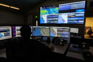
Volcanologists from the University of Hawaii at the conference used a desktop computer to view an eruption of Popocatepetl, a volcano 50 miles southeast of Mexico City, within a few minutes of the event Dec. 9.
Luke Flynn clicked the computer mouse through snapshots of the eruption recorded by a pair of Geosynchronous Environmental Satellites operated by the federal government.
The GOES use infrared sensors to spot heat rising from a volcano. The result appears as a red pin dot on the planet’s surface. But, in this case, Popocatepetl appeared as a larger red blob.
“Something pretty hot is going on there right now,” Flynn said. “That’s about four times as large as we usually see.”
Under most circumstances, it takes about 10 minutes for the Hawaii team to post eruption information on the Internet. That’s because the researchers have forged a close relationship with the federal agencies that operate GOES.
But that’s not the same as issuing an alert to pilots and airports, Flynn acknowledged.
“This eruption might have generated an ash plume,” Flynn said. “The hard part is getting the data across.”
In cases such as the Pacaya eruption in Guatemala, satellite information might have generated a precaution.
The Hawaii team say they spotted indications that Pacaya might erupt on May 13 a week in advance. The researchers say they used the same method on Sept. 15 to predict an eruption in the Galapagos Islands and alerted the Darwin Research Station there of the impending danger.
“We saw the eruption three hours before the scientists on the ground,” said Peter Mouginis-Mark.
The system is not foolproof, however. The GOES satellites orbit 22,000 miles overhead and can provide only hints of impending eruptions, since they cannot always distinguish between volcanoes, forest fires and other heat sources. It might take several days for lower-flying satellites to view the same volcano using other sensors besides heat thermometers.
More to Read
Sign up for Essential California
The most important California stories and recommendations in your inbox every morning.
You may occasionally receive promotional content from the Los Angeles Times.


