High-Tech Solutions to a Low-Tech Problem: Catching the Bus
- Share via
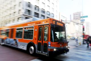
Not long ago I tried to exercise my civic responsibility by leaving my car at home and taking the bus from suburbia to the Times building in downtown Los Angeles.
But I eventually gave it up, primarily because I hated standing on a street corner waiting for a late bus while I could have been doing something constructive, like drinking another cup of coffee.
Now, high tech--with a little help from low tech--may be coming to the rescue.
Seattle, one of four major metropolitan areas in the country participating in pilot projects aimed at improving the lot of the commuter through technology, recently unveiled its latest project. Customers of King County Metro Transit can now use a cell phone that has access to the World Wide Web to locate their bus, within a few hundred feet, and determine precisely when it will depart their stop.
“Now you don’t have to stand out in the rain until you really have to,” said Stuart Maclean, a researcher with the University of Washington’s Intelligent Transportation Systems group, which developed the technology for the transit program.
Maclean wrote the software that allows the cell phones to cram the necessary information onto their tiny screens. Although it’s too early to tell if the program will increase ridership, at least “people are using it,” he said.
That’s a bit surprising, because it would seem likely that most people with Web-accessible cell phones would head for their BMWs instead of the bus. But that could change as the devices become more prevalent.
It’s also something else to do with these hyped gizmos besides just check the price of your latest stock acquisition.
If nothing else, the new program at least validates the U.S. Department of Transportation’s efforts to stimulate the development of technology that could ease the nation’s traffic woes. The department is pumping millions of dollars each year into pilot projects in Seattle, Phoenix, San Antonio and New York.
Seattle’s project, called Smart Trek, uses computers and tracking devices to relay information to customers about everything from traffic jams to bus schedules. It is a somewhat desperate effort to respond to vehicular congestion in one of the nation’s most rapidly growing metropolises.
The area’s traffic problems are monumental. Think of it as Los Angeles with rain and snow.
The cell phone project is the latest iteration in a program aimed at encouraging people to ride the bus. For more than a year now, customers have been able to check on the whereabouts of their bus from a personal computer through a highly touted program called MyBus, which also was developed by the University of Washington group.
Each bus in the system automatically transmits information back to the transit district that gives its position fairly accurately. It’s an old program that relies on measuring the number of revolutions of the tires on the bus and then extrapolating from that figure the distance traveled.
It might seem Seattle would rely on the widely used Global Positioning System--a satellite-based navigation system--to track buses. But transit officials were comfortable with the low-tech, cheaper system they already had in place. There was also some concern that high-rise buildings downtown would interfere with GPS signals.
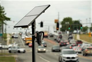
Sensors buried in the roadway relay information about traffic congestion, and that data is fed into the formula, further refining the location of the bus.
Commuters can tap into the information through a Web site, but initially that meant they had to be at their computer to check on their bus, or they had to have a hand-held, wireless computer.
It is surprisingly simple to check on a specific bus. By going to the Web site https://www.mybus.org, users can click on a map showing the area in which they catch the bus. Then a specific location can be picked from a listing of all bus stops in that area.
A user catching the bus at 3rd Avenue and Pike Street, for example, need only click on that location to see a listing of the next few buses that stop there and what times they can be expected.
The program has proved popular, but it has its limitations.
“After all, where you really need this information is walking down the street to your stop, or while you’re waiting for your bus,” said Dan Dailey, an electrical engineering research professor at the university and chief architect of the mobile system.
Thus the decision was made to extend the program to cell phones. The cell phone program works much the same as the broader MyBus program, but the data are presented in a truncated form to fit the smaller screen. The bus stop at 3rd Avenue and Pike Street near Seattle’s popular fish market, for example, is shown as “3 PIKE.”
Meanwhile, other projects are underway to help those who insist on getting around by car. Sensors planted in roadways, for example, relay information about congestion that can be accessed by personal computers so drivers can plan alternative routes.
According to Transportation Department officials, a key goal of the pilot projects is to encourage companies to develop technologies that will make the life of the commuter a bit easier. And there is evidence that companies are taking the challenge seriously.
Partners in the Seattle project, for example, include Microsoft Corp., Cue Corp. and several other companies that are developing the technology to make commuter information more readily accessible.
Of course, knowing that the road ahead is jammed won’t help if the alternatives also are clogged, but at least part of the mystery will be gone.
We’ll know then to settle back for a slow grind rather than try to dash across several lanes of traffic and head for the nearest freeway exit.
And who knows? Maybe some of us will even give the old bus another try.
*
Lee Dye can be reached via e-mail at leedye@gci.net.
Connect
Check out other Science Watch columns at www.latimes.com/sciwatch
More to Read
Sign up for Essential California
The most important California stories and recommendations in your inbox every morning.
You may occasionally receive promotional content from the Los Angeles Times.


