Mapping the Earth in 3-D
- Share via
For the next five days, the space shuttle Endeavor will continue to bathe the Earth in radar beams, creating a 3-D image of the planet unrivaled in its scope and detail. Everyone from firefighters and backpackers to pilots, geologists and archeologists is clamoring for the resulting maps.
“We’ll get a near-global snapshot of the face of the Earth,” said Diane L. Evans, director of the Earth Science Program at the Jet Propulsion Laboratory in Pasadena, which is overseeing the Shuttle Radar Topography Mission for NASA. “For some areas of Earth, it will be the only map of its kind.”
Earth, she said, is less well mapped than Venus and Mars--the objects of previous radar mapping missions.
The best image of the Earth available today is a piecemeal one, cobbled together from smaller space mapping missions, topographic data gleaned from the ground, and countless small aerial surveys made from planes. Trying to compare such different maps is onerous.
“You see all these warps and bumps. You see cliffs that aren’t there,” Evans said. “You can’t use that for science.”
The space shuttle, sweeping the Earth in more than 100 orbits, will provide reams of mapping data for the entire planet--all of it consistent.
“It’s all going to line up,” said Louise Veilleux, a JPL engineer who helped create the orbiting radar system. “Everything’s going to match. It’s going to be perfect.”
The computer work required to piece the map together will take more than a year. But the few images beamed down are clear and extremely detailed. Areas already mapped include Stonehenge and Mt. Vesuvius.
Maps that rely on photographs taken from planes or satellites often are plagued by clouds. But clouds, fog and smog are no match for this mission, said Michael Kobrick, the project’s lead scientist. “Radar sees right through them,” he said.
The radar hardware itself is a marvel--the largest rigid structure ever put out into space. At 200 feet, it would tower above the 151-foot Statue of Liberty.
Two radar units aboard the shuttle are separated by a 200-foot graphite-epoxy and titanium mast, which, after the shuttle launch last Friday, uncoiled smoothly from its 56-inch stowed length in the shuttle cargo bay. That’s equivalent to pulling 7-foot, 1-inch Lakers center Shaquille O’Neal out of a 2-inch box, engineers said.
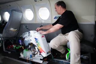
“It’s a pretty impressive-looking piece of machinery,” said Paul Dye, project flight director. The mast was built by AEC-Able Engineering Co. Inc. of Goleta, Calif..
For the radar to work, the mast must remain extremely still, not moving more than an inch even as the shuttle fires its thrusters and orbits the planet. To accomplish this, shuttle astronauts performed a tricky bit of piloting called “fly casting”--turning thrusters on and off with split-second timing to limit the swaying of the mast. A wrong move and the mast could have snapped at its base.
The resulting map will have a resolution of 30 meters--enough to easily make out local landmarks such as runways at LAX, the Rose Bowl, Dodger Stadium and even individual streets. While such maps already exist for Los Angeles and most of the United States, the radar maps will be about three times better than those for much of the rest of the planet, Kobrick said.
Dozens of scientists taking part in the mission plan to use the maps to answer a variety of questions. They will:
* Assess global warming by looking at snow cover.
* Better understand mountain building by studying the rising Himalayas.
* See how much sediment is flowing into the ocean and affecting algae and plankton.
Better maps also could help airplane pilots avoid flying into mountains and could guide improved placement of cellular telephone towers.
John Stubbs, vice president of the nonprofit World Monuments Fund, plans to use the maps to encourage responsible development around the spectacular temples of Angkor in Cambodia. More detailed information, he said, could fine-tune placement of new hotels, roads and airport runways with less impact on the historical site.
In addition, archeologists plan to pore over the maps to identify ancient moated villages now inaccessible because they are hidden in dense jungle that may contain explosive mines.
“The space shuttle, in a sense, is giving us a treasure map,” Stubbs said.
The radar will collect so much data that it cannot all be beamed down to Earth. It will be collected on massive tapes aboard the shuttle that hold the equivalent of about 15,000 CDs. Project leaders hope to beam some of the images down as the shuttle is in space. These can be viewed on the Internet at:
https://www.jpl.nasa.gov/srtm/.
One disappointment for scientists was a decision by NASA to shorten the mission. In the original 10-day mission, the shuttle would have covered a swath of Earth between 60 degrees north (to the southern tip of Greenland) and 60 degrees south (including all of South America). A nine-day mission will mean that some regions are not swept by radar twice; those areas, sprinkled randomly around the globe, will probably have poorer resolution.
NASA officials shortened the $800-million mission to allow for a spacewalk to reel in the mast in case it does not retract automatically. Earlier, they had planned on jettisoning the $8-million mast if it did not retract. Later, they became interested in bringing it back so it could be studied, Dye said.
“I won’t say we disagree [with shortening the mission], but I wish it were otherwise,” Kobrick said.
The mission may be shortened even more because of a balky thruster on the end of the mast, which should help stabilize the mast but is not firing. The shuttle crew is compensating by using shuttle thrusters, a move that uses up crucial energy supplies. It is now assumed that the project will not be able to map 80% of the Earth’s land mass as planned.
The mission is co-sponsored by the National Imagery and Mapping Agency, a secretive governmental agency that provides maps for the military and the CIA.
The mapping agency is interested in keeping the high-resolution, 30-meter maps classified and allowing scientists access only to 90-meter maps, particularly for areas of the globe deemed militarily sensitive. While negotiations on the matter are continuing, agency officials said scientists would be granted the 30-meter data on a case-by-case basis.
*
Sources: NASA/JPL/Caltech; National Imagery and Mapping Agency; AEC-Able Engineering Co.; Researched by JULIE SHEER/ Los Angeles Times
More to Read
Sign up for Essential California
The most important California stories and recommendations in your inbox every morning.
You may occasionally receive promotional content from the Los Angeles Times.


