Views Over Four Counties From Top of Gilman Peak
- Share via
Rising to about the same height as another, far more famous metropolitan range--the Hollywood Hills--the Chino Hills top out at about 1,800 feet. But even short summits can deliver long views, particularly on a clear winter day.
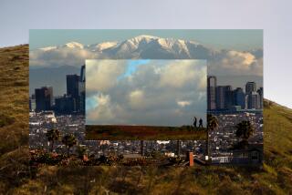
The hills’ 1,685-foot Gilman Peak is far from the top of the world but offers magnificent vistas. The San Gabriel Mountains, frosted with snow, rise to the north above the San Gabriel Valley. The Santa Ana Mountains border the southeastern vista, and to the southwest the Orange County suburban-opolis spreads to the sea.
To the approaching hiker, Gilman Peak does not inspire great expectations. It appears as little more than a bump on the ridge top, a bald crown scarcely higher than neighboring small peaks. Ah, but the inspirational views from the summit more than make up for the peak’s dull appearance.
The three reasons for Gilman Peak’s success at delivering views are location, location, location. The peak is at the far frontier of three counties: Los Angeles, Orange and San Bernardino. Parts of a fourth county--Riverside--can be seen from the top also.
Surrounded by development as well as four freeways, the wilder parts of the Chino Hills indeed form an island on the land. The range’s “island” nature is apparent to the Gilman Peak hiker.
Considering the proximity of so much 21st century civilization, the hills harbor an admirable biodiversity. Lovely oak woodlands and stands of native California walnut thrive in the park’s larger canyons.
Directions to trail head: From the Orange Freeway (57) in Brea, exit on Lambert Road. Drive four miles east on Lambert (which changes to Carbon Canyon Road) to the entrance of Carbon Canyon Regional Park. There’s a vehicle entry fee. Limited legal parking (free) also exists on the south shoulder of Carbon Canyon Road. Join the dirt road angling southeast just below the road.
The hike: Walk up the dirt road past a citrus orchard to a state park bulletin board and a signed junction. Telegraph Canyon Trail, a dirt road, heads south, but you join North Ridge Trail (also a dirt road) on a climb past scattered California walnut.
A bit more than two miles from the trail head, the path gains a sparsely vegetated ridgeline and travels across it. After dipping and rising to a couple of “false” summits, you’ll reach Gilman Peak. A wide trail takes you to the top.
*
For more of John McKinney’s hiking tips and trails, visit https://www.thetrailmaster.com.
(BEGIN TEXT OF INFOBOX / INFOGRAPHIC)
North Ridge, Gilman Peak Trails
WHERE: Chino Hills State Park
DISTANCE: 7 miles round trip with 1,200-foot elevation gain.
TERRAIN: Rolling hills dotted with native California walnut.
HIGHLIGHTS: Panoramic southland vistas.
DEGREE OF DIFFICULTY: Moderate.
PRECAUTIONS: Park subject to closure after heavy rains.
FOR MORE INFORMATION: Chino Hills State Park; tel. (909) 780-6222
More to Read
Sign up for The Wild
We’ll help you find the best places to hike, bike and run, as well as the perfect silent spots for meditation and yoga.
You may occasionally receive promotional content from the Los Angeles Times.


