Forward march
- Share via
Hiker Steve Tabor seeks trails less traveled. OK, he doesn’t need much of a trail at all.
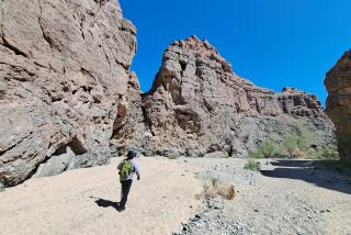
Tabor fled New England snow 30 years ago, settled in California and embarked on two mega-treks across the desert, where basin and range country inspired him to pursue a new hiking experience: a route free of mileage markers, signposts or identifiable paths over some of the world’s most inhospitable terrain.
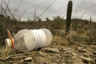
Not a one-canteen, back-by-noon day hike either, but a trek along a route that rivals the Pacific Crest, the Appalachian and the Continental Divide trails. Only Tabor’s route has no rivers, no trees, no greenery. It begins in the Sonoran Desert in Mexico, passes through the Mojave, continues into the Great Basin region and ends up in Canada.
Tabor joined Oakland-based Desert Survivors, a 1,000-member nonprofit that advocated blazing the new route and showing others how to cross a seemingly featureless desert unassisted by route markers and other trappings of what he calls the “preprogrammed wilderness experience.”
The 54-year-old customer sales representative for an Emeryville, Calif., art supplier isn’t against hiking marked trails. He’s traversed much of Yosemite National Park and the Pacific Crest Trail. But freelance hikers, he says, need more freedom.
“They stamp your park passport and tell you when the sun angle is best for photography” in national parks, Tabor says, squelching exploration and serendipity. “In the desert,” he adds, “it’s like no one’s ever been there before.”
Beaver trappers, missionaries and wagon trains relied on geological landmarks, stars, crude maps and compasses to find their way. Desert Survivors says plans for a border-to-border desert hike date to 1972, but Tabor gave it legs in 1997. Before that, he rode freight trains or hitchhiked to Idaho to pick potatoes during the week and hiked in the desert on weekends. He’s spent $2,000 on maps and other resources that show people how to cross the deserts.
Beginning in 2001, members of Desert Survivors hiked the 656-mile southern portion of the “trail,” traveling from Jacumba west of Calexico to Kelso Dunes in the eastern Mojave. They hiked the central part of the route in sections over the next few years, meandering through Death Valley, crossing into Nevada and then heading north to the Stillwater Mountains. They’re on to the Oregon line next year.
Along the way, blizzards and dust storms ravage hikers, and the group spies bighorn sheep, wild burros and rattlesnakes. Rarely do they encounter other hikers.
“You should have been there,” Tabor says of one recent trip. “We saw 55 antelope and three owls.”
But you probably can’t get there and back safely without the Desert Survivors’ 13 guidebooks (the next one is due by Jan. 1). They contain desert information, mileage estimates, maps, compass points, GPS coordinates and photos. It’s up to travelers to put it all together and work out the way. The guidebooks parcel the route into sections, and each leg takes two to nine days between paved roads.
Working in conjunction with the Oregon-based Desert Trail Assn., Tabor aims to complete the route through Idaho and Montana to Canada, although the exact course remains uncertain. He says the association is working to identify appropriate routes through public and private lands north of Nevada.
For more information, visit www.desert-survivors.org.
More to Read
Sign up for The Wild
We’ll help you find the best places to hike, bike and run, as well as the perfect silent spots for meditation and yoga.
You may occasionally receive promotional content from the Los Angeles Times.


