CONSUMER BRIEFING / TECHNOLOGY
- Share via
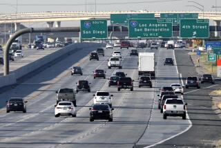
Google Maps has added traffic updates to many of the Southland’s major streets, allowing motorists with smart phones to get off the freeway and find a speedier route home.
The new traffic information covers urban centers in Los Angeles, Orange and San Diego counties. To view traffic info, click the “Traffic” button on the upper right of the Google Maps window.
Google Maps imports much of its real-time traffic information from companies that monitor the nation’s roadways. But it’s adding a high-tech twist: crowd-sourcing. When mobile users call up Google Maps on their phones, the service harvests anonymous location data to enhance its picture of live road conditions.
Clearly, the next step is to develop software that lets the GPS technology in your phone process the Google Maps data and display the best route home. In the meantime, knowing that Beverly Boulevard is green should be good enough.
More to Read
Inside the business of entertainment
The Wide Shot brings you news, analysis and insights on everything from streaming wars to production — and what it all means for the future.
You may occasionally receive promotional content from the Los Angeles Times.


