Season’s first significant rain brings flash flood watches to Southern California

- Share via
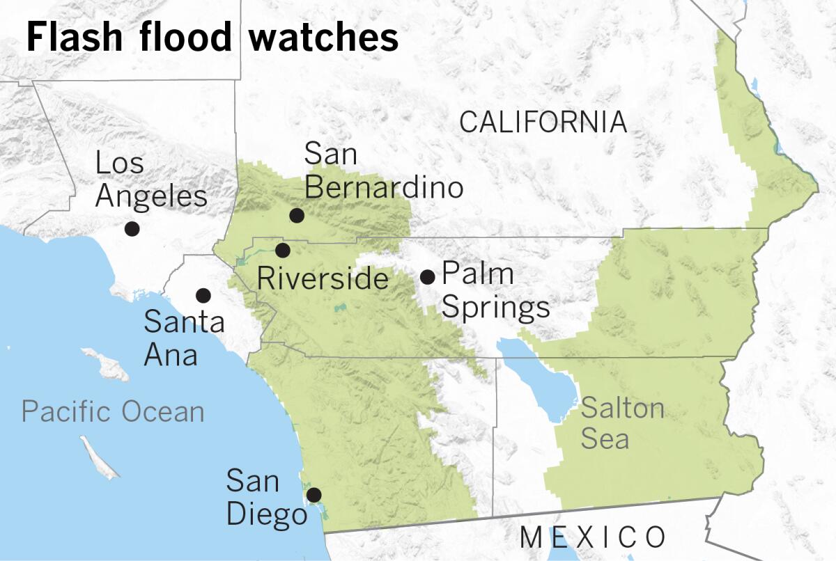
Widespread moderate to locally heavy rain is expected across Southern California through Wednesday, prompting the National Weather Service to issue flash flood watches for large portions of the region.
A flash flood watch means that conditions may develop that could lead to flash flooding.
A cold low-pressure system arriving from the north will produce the first significant precipitation of the season as it moves directly over the Southland on Wednesday morning and Wednesday afternoon. Flash flood watches include the mountains, coast and valleys of San Diego County, as well as large parts of the Inland Empire.
When the system is directly overhead, locally heavy cells could develop, resulting in heavy rain and flash flooding, according to the weather service. The highest risk of thunderstorms is from dawn through evening Wednesday, when instability is the greatest. The thunderstorm risk is highest close to the coast in San Diego County, but isolated thunderstorms could occur anywhere west of or in the mountains.
The flash flood watches generally expire at 1 a.m. Thursday.
Many areas west of the mountains in these areas could receive 1 to 2 inches of rain, and possibly as much as 3 or more inches. The low deserts are expected to be in a rain shadow, with light showers, but the high deserts could get some heavier rain cells.
As the storm moves in, temperatures are expected to plunge, and snow levels are now expected to drop to about 5,000 feet. At elevations of 6,000 to 7,000 feet, snowfall could be 6 to 10 inches; above 7,000 feet, 10 or more inches of snow could accumulate. Winter storm warnings are in effect at higher elevations of Inland Empire mountain ranges through Thursday evening.
The storm will gradually move out of the region Thursday and Thursday evening, with warmer, drier conditions beginning to return.
More to Read
Sign up for Essential California
The most important California stories and recommendations in your inbox every morning.
You may occasionally receive promotional content from the Los Angeles Times.


