A record 75-foot wave off California coast was produced by big storm

- Share via
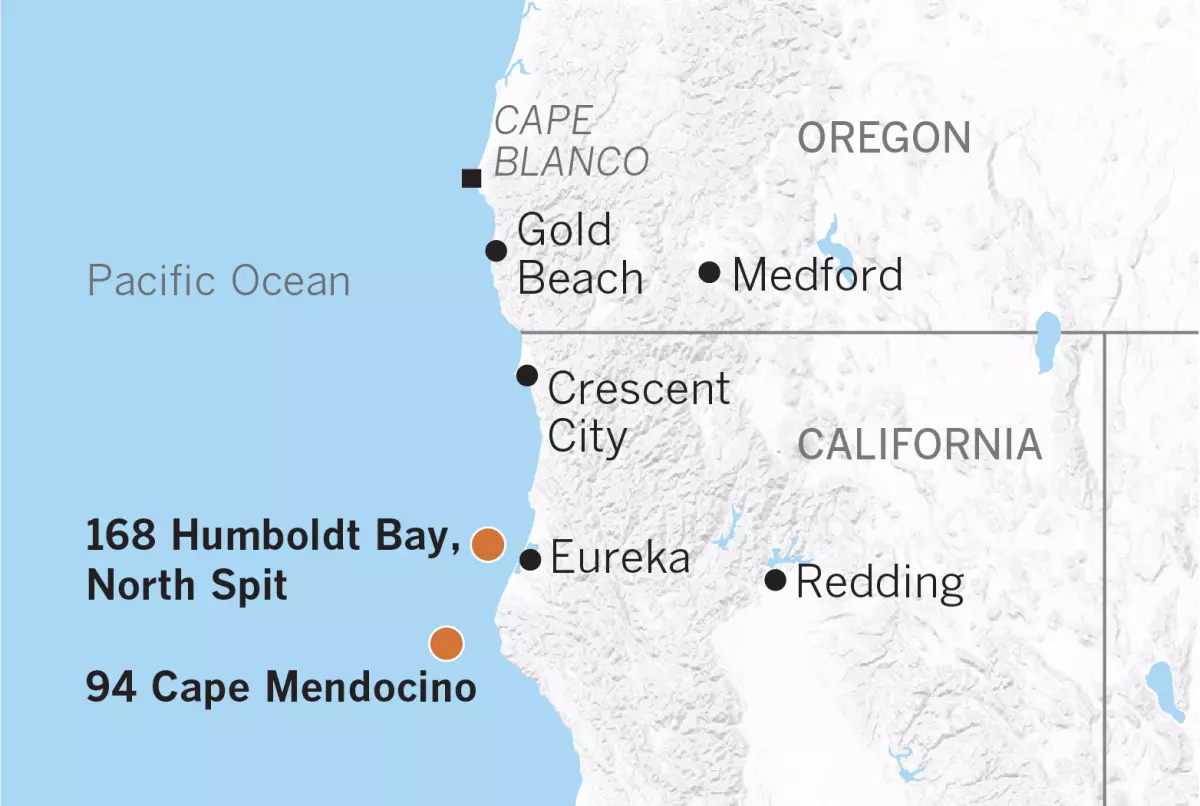
The Thanksgiving-week “bomb cyclone” storm that drenched California not only set a record for the lowest pressure recorded in the state, but also generated a 75-foot wave off Cape Mendocino.
At 7:33 p.m. on Nov. 26, the No. 94 Cape Mendocino buoy operated by Scripps Institution of Oceanography Coastal Data Information Program recorded a maximum significant wave height of 43.1 feet, and that night also measured a wave of 75 feet. These waves were in water 1,132 feet deep and were at 13.3-second intervals.
Also at 7:33 p.m., the program’s No. 168 Humboldt Bay North Spit buoy recorded significant wave heights of 37.6 feet, but in shallower water.
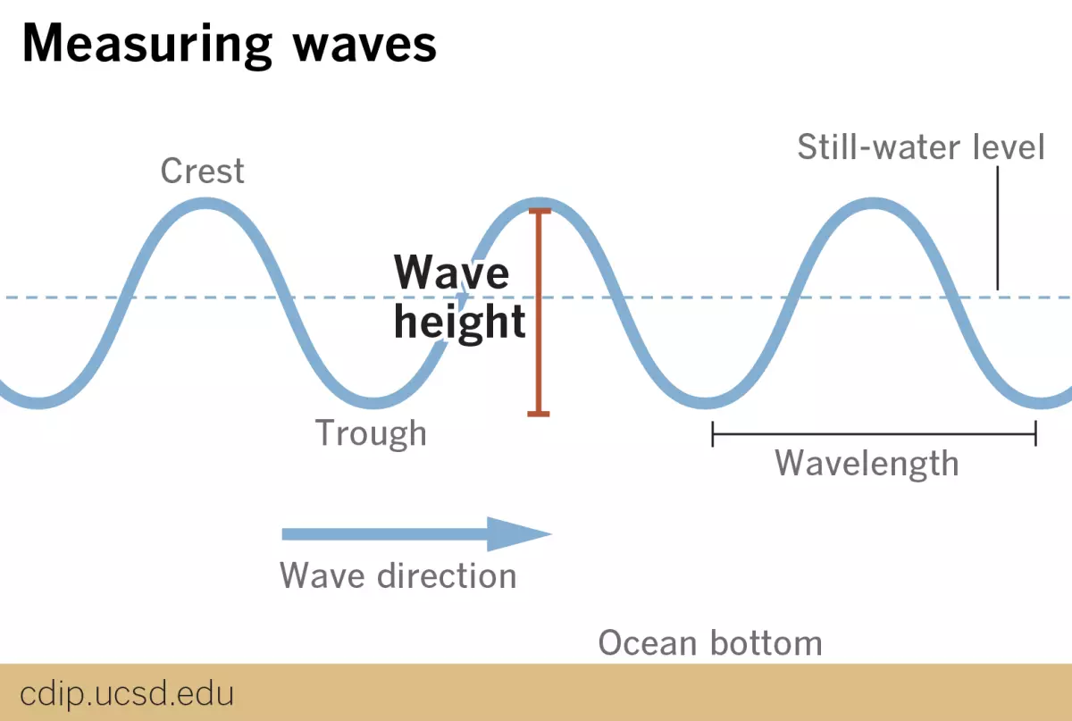
Significant wave height is the average of the biggest one-third of waves over a 30-minute period, according to James Behrens, a program manager at the Coastal Data Information Program. Typically, some waves at a given station are expected to be about twice as large as that average, hence the 75-footer.
The only significant wave height that the program has measured — higher than the one recorded at Cape Mendocino — was on a buoy at Ocean Station Papa, far out in the North Pacific, in December 2012. That was 49.8 feet.

The big waves from the west-northwest on Nov. 26 were generated by an exceptionally deep low-pressure system approaching the coasts of Oregon and Northern California. The storm set the preliminary low-pressure record for California with a reading of 973.6 millibars at Crescent City. Generally speaking, the lower the atmospheric pressure, the more intense the storm.
The record for intensity in Oregon was also set that evening with a reading of 974.6 millibars at Gold Beach Airport.
Medford, Ore., and Eureka, Calif., set low-pressure records with 981.4 millibars and 984.8 millibars, respectively.
The storm closed parts of Interstate 5 in Northern California. Cape Blanco, Ore., had sustained winds of 85 mph with gusts to 106 mph that afternoon. Crescent City had a wind gust of 69 mph.
“Ocean waves develop when wind blows over a body of water,” said Bill Patzert, retired Jet Propulsion Laboratory climatologist and oceanographer. “During large storms, winds transfer energy to the water, creating both waves and surface currents.”
Three things govern the size of waves, he said: wind speed, duration of the storm, and fetch — the size of the area of water over which the wind blows. The longer the fetch and the faster the wind, the larger and stronger the wave.
“Waves are truly world travelers,” Patzert said. “Large swells generated south of New Zealand can create giant surf in Southern California.”
As the historic pre-Thanksgiving “bomb cyclone” took aim at the Oregon-Northern California coast, winds gusted to more than 100 mph — hurricane strength — causing chaos on the ocean surface and generating monster waves. As “an old ex-surfer,” Patzert surmised that the fetch wasn’t long enough to create anything like the clean swell that surfers crave.
“But if anyone was at sea in a small boat near that storm,” Patzert said, “it must have been hell and, possibly, deadly.”


Sign up for Essential California
The most important California stories and recommendations in your inbox every morning.
You may occasionally receive promotional content from the Los Angeles Times.

More From the Los Angeles Times


Podcasts

In this episode, we discuss the history here, what lessons were learned — and not — and how that can inform what we we do this time around as we attempt to rebuild Altadena and the Pacific Palisades.

Alexis Linkletter & Madison McGhee unpack the chaotic Justin Baldoni vs. Blake Lively lawsuit, separating fact from fiction, and its career impact.

Sammy Roth visits Ioneer’s proposed Rhyolite Ridge mine in Nevada with managing director Bernard Rowe, who details responsible lithium/boron extraction and Tiehm’s buckwheat protection.


