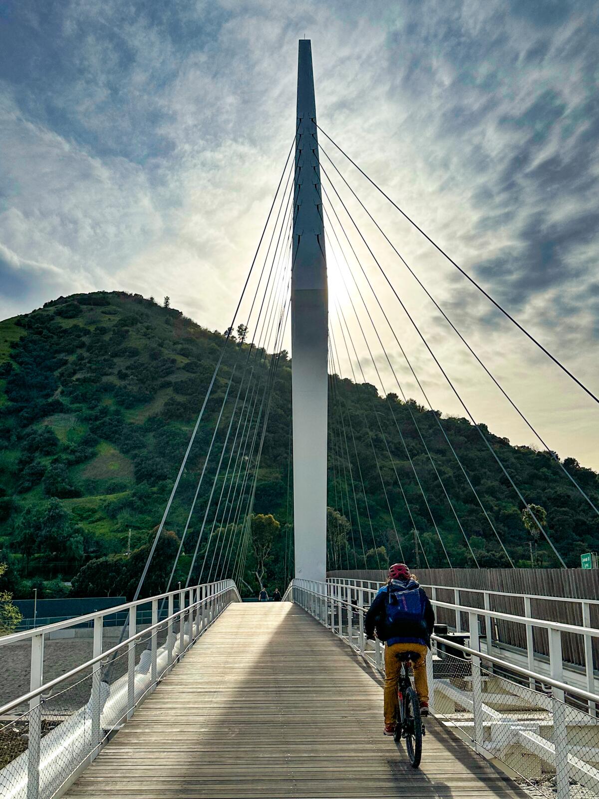
9 lovely walks to explore L.A.’s most beautiful bridges
- Share via
Quick: Name a few famous bridges in L.A.
If the first ones that come to mind are Jeff or Beau, you’re probably not alone. Unlike, say, San Francisco, New York or London, our city doesn’t have water-spanning structures that represent us on the world stage.
But make no mistake about it, L.A. is absolutely a bridge destination. There are more than 450 of them in our county, ranging from humble overpasses to architectural masterworks that soar high over rivers and channels. Of the latter category, former Mayor Eric Garcetti went so far as to gush to documentarians that the L.A. River’s arch bridges are some “of the most stunning architectural assets in this country.”
They aren’t just good for looking at (or driving over), either. If you’re like me, always searching for new places to get outside for fresh air and exercise, then L.A.’s arches also happen to make perfect centerpieces for a walk. Some of the bridges on this list are sizable strolls unto themselves, while others are connected to trails or walkways that make for a nice loop. Either way, they can help you get the daily steps that research recommends to keep us healthy and happy.
As a bonus health benefit, these walks are engaging for your brain, no matter your interests. For fans of L.A. history, bridges offer a link back to some of the city’s earliest inhabitants. For art and architecture buffs, plenty of graceful railings to ogle. For engineers, gravity-defying design to inspect. For pop culture connoisseurs, a chance to follow in the footsteps of Ryan Gosling, Charlie Chaplin and other stars who’ve filmed iconic moments atop the city’s arches. And all of us can benefit from learning about how our communities have grown and adapted to their natural environments, from the banks of the Arroyo Seco to the beaches of Venice.
The nine walks on this list are each designed to give you a pleasant stroll — some slightly longer and more challenging than others, as noted. I’ve opted for loops that offer the best balance of easy parking, enjoyable walking and photo-worthy views of these architectural wonders. Since many of L.A.’s coolest (and most historic) bridges are concentrated around the L.A. River, there are even a few walks that combine views or crossings of multiple structures.
Not sure which one to go on first? Don’t worry. You can cross that bridge when you come to it. (Sorry, I had to.)
Adam Markovitz is a writer and editor based in Los Angeles.
Colorado Street Bridge
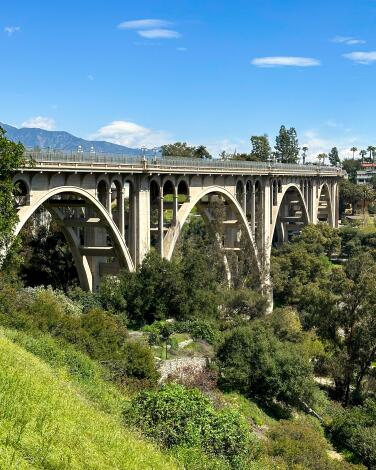
Although you can walk over the bridge itself, I don’t recommend it at the moment. As a public safety precaution in 2017, the city of Pasadena lined the sidewalks of the upper deck with a high chain-link fence. Plans are underway for a permanent barrier that will fit in better with the bridge’s design, but until then, the nicest way to experience the bridge is to go underneath it.
Start your walk by parking at Desiderio Neighborhood Park (10 N. Arroyo Boulevard, Pasadena, CA 91105), or on nearby Westminster street if the park’s tiny lot is full. There’s no one best route here, but you’ll clock about three-quarters of a mile if you wander the park’s web of footpaths, taking in the towering structure from different angles.
For a longer walk, use one of the dirt paths on the west side of Arroyo Boulevard to access the Arroyo Seco Trail, which stretches past La Loma Bridge downstream, before heading back to the park.
Hours: Monday-Sunday, dawn to dusk.
La Loma Bridge
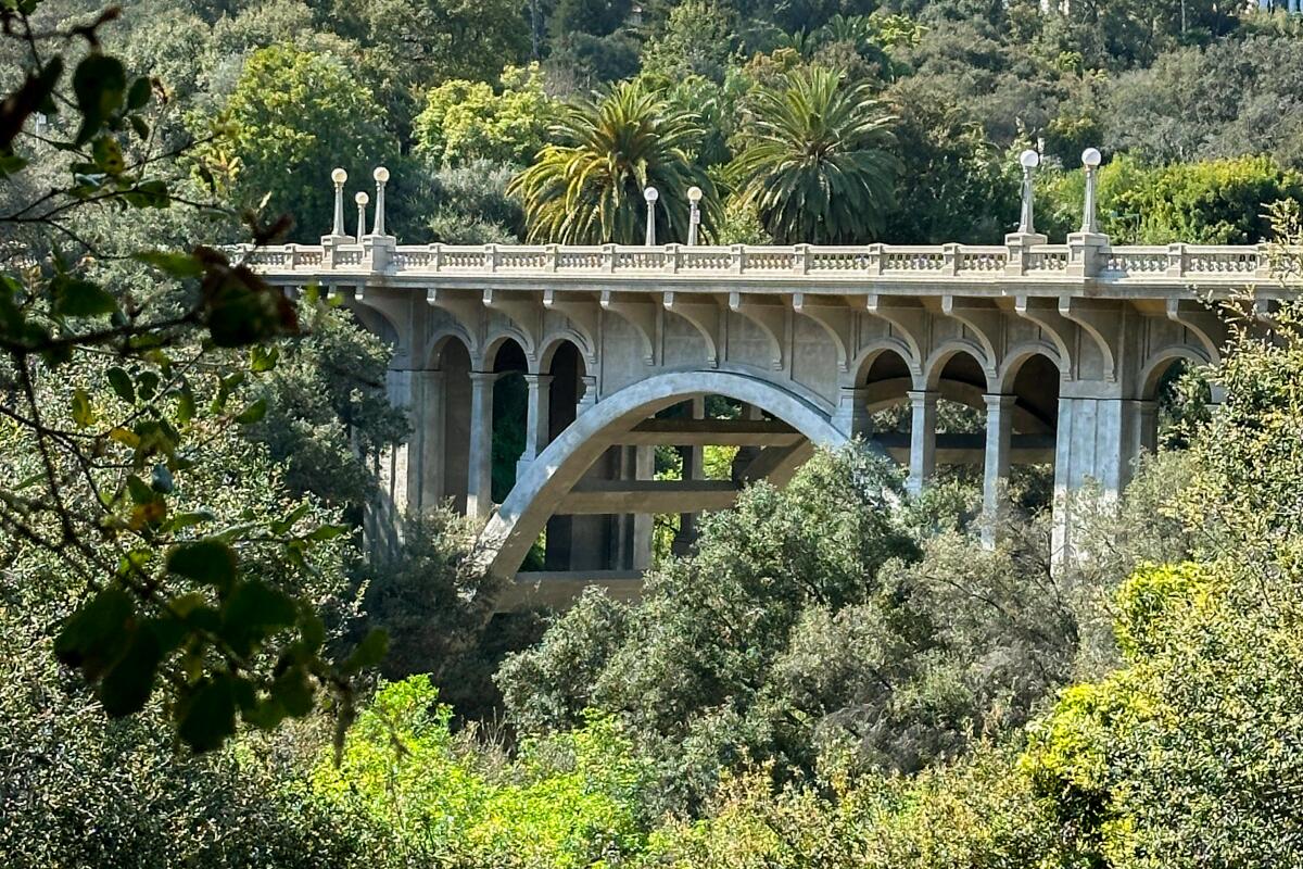
It’s also perfect for a 1.3-mile loop that takes you along both sides of the arroyo, up across the bridge itself and back again. For easy parking, start at the Lower Arroyo Park Area. Cross the arroyo on the small footbridge near the northern end of the parking lot, and then take a left to follow the Arroyo Seco Trail south along the western bank of the channel. If you want some free entertainment with your walk, come on Sunday mornings when the Pasadena Roving Archers use this spot for their weekly competition. (Kids in particular might get a kick out of watching the arrows fly — from a safe distance of course.)
As you head down the tree-lined arroyo, you’ll catch your first glimpses of La Loma connecting the two sides of the ravine. A few yards upstream from the bridge, you’ll find the footpath that leads up to street level and onto the bridge itself, where you can check out its pretty railings and impressive (though not original) lampposts. When you reach the east side of the arroyo, turn right and walk along South Arroyo Boulevard for a minute until you find stone steps leading back down into the ravine. Follow the path north to your starting point, enjoying views of the Colorado Street Bridge and the San Gabriel Mountains upstream.
Hours: Monday-Sunday, dawn to dusk.
Venice Canals Bridges
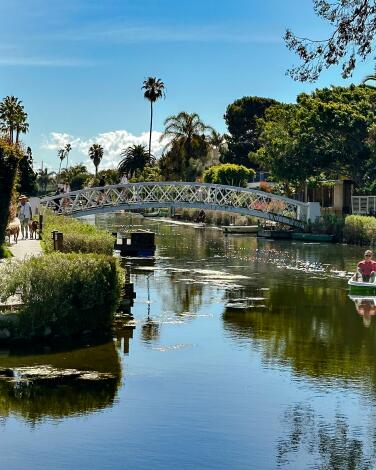
Parking around the canals can be rough, especially on summer weekends. For street spots, your best bets are nearby Ocean Avenue or 28th Avenue. Among the paid lots nearby, the city-run beach parking area at the end of South Venice Boulevard is often cheaper than the lots further inland.
Once you’re walking on the canals, beach traffic fades into a tranquil, park-like atmosphere, where pedestrians rule and the local ducks have their own private playground (the aptly named Venice Canals Duck Park, on Linnie Canal at Dell Avenue). The architecture here is like a microcosm of L.A. itself, with colonial cottages and Italian villas lined up next to glass-walled modern designs. Gardens along the sidewalks are lushly landscaped with succulents and fruit trees, and each wood-and-steel arch bridge seems to make for a better photo op than the last. In all my years visiting, I’ve never once seen a local using one of the many pretty rowboats tied along the canals.
On a recent walk, I clocked 1.2 miles in a curlicue path, although it would take even longer to explore every inch of the interconnected islands. For a treat at the end (or the beginning), grab a coffee or sandwich in the peaceful, bougainvillea-lined courtyard of the Canal Market (600 Mildred Ave.). Or plan your visit for a Friday morning, when the Venice Farmers Market pops up just across South Venice Boulevard.
Starting point: The Canal Market
Hours: 8 a.m.-7 p.m. Sunday-Wednesday, 8 a.m.-8 p.m. Thursday-Saturday
6th Street Viaduct
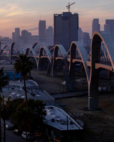
It also happens to make for a great walk in and of itself, since the bridge spans about two-thirds of a mile, with wide, protected footpaths. You could start the loop on either side, but I like to begin and end in the Arts District, since it has the best options for post-walk snacks.
Parking isn’t the easiest around here, but you can sometimes grab a street spot on South Santa Fe Avenue or nearby cross streets (like Jesse Street). Otherwise, try one of the pay lots around 6th and Mateo streets. Then walk onto the viaduct via the ramps on Mateo or the staircase at Santa Fe. As you cross the river, be sure to look south at the 7th Street Bridge and north to the 4th Street Bridge — two of the most beautiful L.A. River bridges of the early 20th century.
When you reach Boyle Heights, cross the street at Whittier Avenue and South Boyle Avenue before heading back to the Arts District side. There, you’ve got your pick of culinary delights, including turmeric lattes at Zinc Café (580 Mateo St., Los Angeles, CA 90013) or combo platters at Chuy’s Tacos Dorados (1335 Willow St., Los Angeles, CA 90013).
Shakespeare Bridge
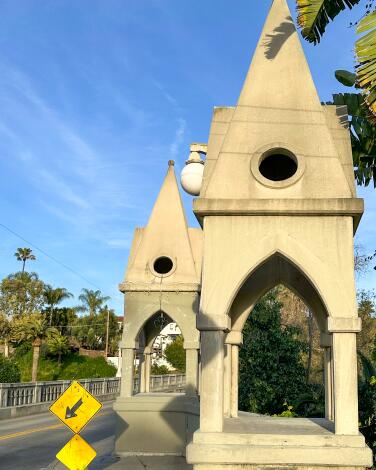
Historians aren’t sure exactly how the bridge got its name, or what its connection might be to the Bard. (Maybe its Gothic arches and pointed turrets just struck someone as dramatic?) So you can feel free to make up your own story as you park on Franklin Avenue just west of the bridge near Myra Avenue and stroll across the picture-perfect 262-foot span.
Another local nickname is the “Disney Bridge,” on account of a few landmarks nearby. Take a left onto St. George Street after you cross the bridge, and a quick walk down the hill will bring you to Lyric Avenue where Walt Disney himself once lived in the brown, storybook-style home on the corner (2495 Lyric Ave., Los Angeles, CA 90027). Continue down St. George , past the Rapunzel-esque tower of John Marshall High School, and take a right onto Griffith Park Boulevard. On the northeast side of the street, you’ll soon arrive at the “Snow White Cottages,” a cluster of eight cozy homes, built in 1931, that supposedly inspired animators working on the classic Disney film. (They were also in David Lynch’s “Mullholland Drive,” but that’s another story.)
Head back up the hill and over the Shakespeare Bridge again to give this 1-mile loop a proper fairy-tale ending.
La Kretz Bridge
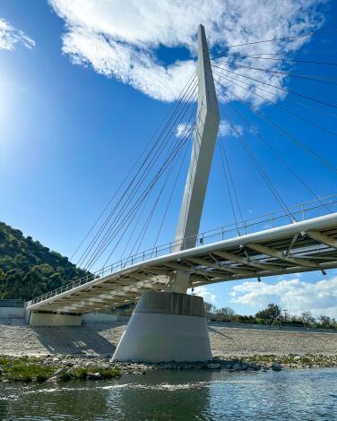
Originally, La Kretz Bridge was only supposed to carry riders from the fancy-sounding Atwater Village Equestrian Historic District to the trails in Griffith Park — but funding problems opened the path up to pedestrians and bikers too. To walk across the bridge, head to North Atwater Park (3900 Chevy Chase Drive, L.A., CA 90039) and park in the lot next to the wooden “North Atwater Park” sign. You’ll be able to see the top of the bridge from there, and a short dirt trail leads you to the eastern ramp. Check the sign on the bridge to find your lane: horses and riders to the right, everyone else to the left.
Once you’re on the other side of the L.A. river, you can either turn back, continue your walk along the L.A. River Bike Path or head on to Griffith Park. If you pick the park, you’ll go down the equestrian ramp to a dark (and often muddy) tunnel that crosses underneath the 5 Freeway and reemerges just south of Griffith Park’s Crystal Springs Picnic Area, about a third of a mile from where you started.
If you didn’t see any steeds on your walk, don’t give up yet. When you finally head back across the bridge, be sure to peek over the fences on the Atwater side, where you can often catch sight of horses in the nearby stables.
Hours: dawn to dusk Monday-Sunday
Taylor Yard Bridge
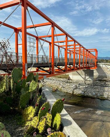
Still, you can make a nice 1-mile walk out of it by parking in nearby Rio de Los Angeles State Park and then exiting the park on foot at N. San Fernando Road. Head southeast, and turn right when you see the sign for “Metrolink Central Maintenance Facility.” Follow this road toward the river and under the train tracks until you see the bridge in front of you. (For a shorter walk, you can also park along the gravel here, although it isn’t an official lot.)
According to the bridge’s architects, who refer to the structure as “Rumblefish,” the bridge “playfully takes its name (and its bold orange color) from the 1983 Coppola film about rival gangs.” But you don’t need to have seen that movie to enjoy the bridge’s bold design or its views over the L.A. River. As you head back to the park, check out some of the city’s proposals for this area and imagine the green spaces that might be here someday soon.
Cesar Chavez Avenue Viaduct
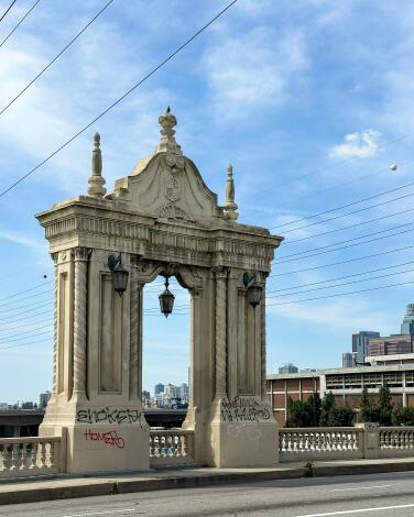
Unfortunately, they don’t all make for great walking. But the Cesar Chavez Avenue Viaduct (also known as the Cesar Chavez Bridge) is my favorite thanks to its unobstructed walkways and easy access from nearby Union Station. Park there (or better yet, arrive on public transit) and begin your 1.2-mile loop from Union Station East. Walk across Patsaouras Plaza to the corner of North Vignes Street and East Cesar E. Chavez Avenue. Head east on Chavez toward the river, preferably along the north sidewalk, which is less overgrown.
Once you’re on the bridge, check out the swirling design of the balusters (the little posts in the railing). It’s a nod to Spanish Colonial style, which was chosen because this bridge lies on a portion of El Camino Real and was originally dedicated to mission founder Junipero Serra. (It was renamed for activist and civil rights leader Cesar Chavez in 1993.) You’ll see those swirls again when you reach the fantastic pylons, which are decorated with spiral columns, shells and a replica of the city’s seal.
When you reach the Boyle Heights side of the bridge, turn back to complete the loop. If you’re hungry for more L.A. history — or just some delicious food — keep going past Union Station to Olvera Street, where you can check out some of L.A.’s oldest buildings and tastiest taquitos, like the ones at Cielito Lindo (23 Olvera St., L.A., CA 90012).
Hours: 4 a.m.-2 a.m. every day
Glendale-Hyperion Bridge, Red Car Bridge & Sunnynook Pedestrian Bridge
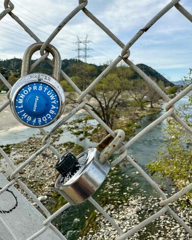
Start by parking in Atwater Village at Red Car River Park, near the intersection of Glendale Boulevard and Ferncroft Road. Walk toward the river and onto the Red Car Bridge, a pedestrian path opened in 2021 that was named after the historic trolleys that once ran along this spot. As you cross the river, take in the views of the Glendale-Hyperion. Built in the Streamline Moderne style (a cousin of Art Deco) in 1929, the structure is capped by towering pylons that look a bit like lighthouses. Although the bridge has been a local landmark since its debut, Disney recently raised its profile when a replica was added to California Adventure Park, replacing the Golden Gate Bridge.
When you reach the L.A. River Bike Path on the west side of the river, turn north and walk under the viaduct until you reach the Sunnynook Pedestrian Bridge. While the bridge itself isn’t much to look at, its charm comes from the hundreds of locks clipped to the chain-link railings. Each one is a tiny token of love, à la the Pont des Arts in Paris.
From the Atwater side of Sunnynook, you’ve got two options for getting back to where you started. Either retrace your steps, enjoying more time on the bridges, or — if you’re feeling brave — follow the dirt path along the river from the Sunnynook Bridge to the Glendale-Hyperion. There, you’ll duck underneath the arches and come back up on the southeast side of the bridge, where the loop began.


