Major storms barrel into California: ‘Every field is a big lake’
- Share via
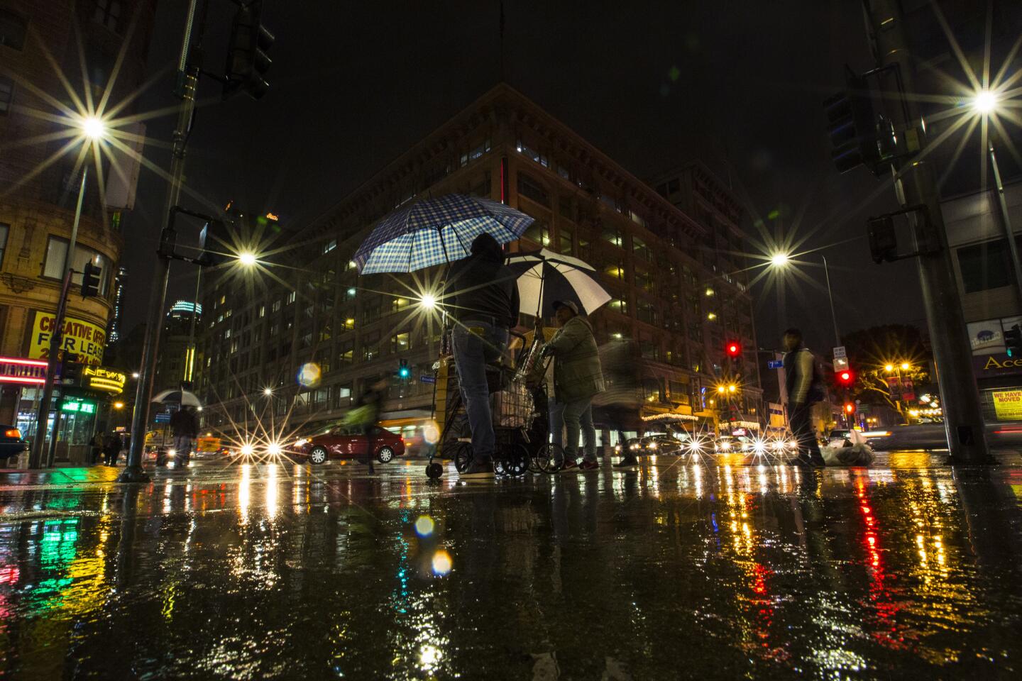
In Southern California, rains started moving in Thursday afternoon.
The storm is expected to drop 1 to 3 inches of rain by Friday morning,
But the situation in Northern California was more dramatic, with one small town in the North Bay Area receiving nearly 7 inches of rain over the last 24-hour period, forecasters said.
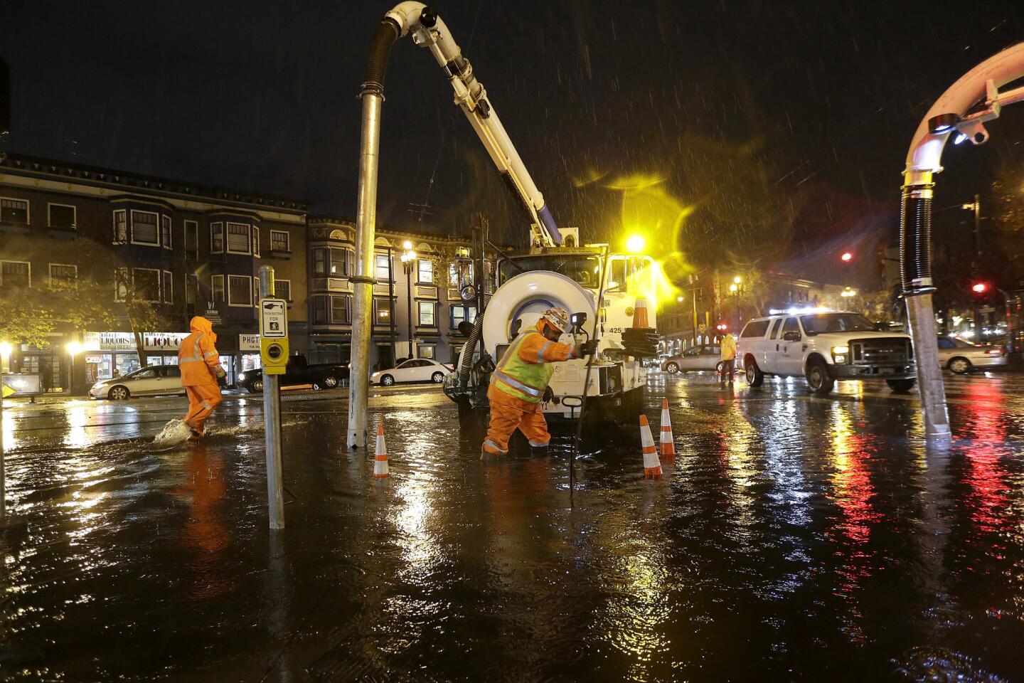
Flash flood warnings are in effect for southern Sonoma County and northern Marin County. The remote town of Venado, west of Healdsburg, was hit the hardest as the storm moved from the North Bay into San Francisco and the Central Coast.
Some creeks in those counties are over flood stages, and other areas are poised to get a good soaking later Thursday.
“We are expecting some enhanced activity later Thursday in the Santa Cruz Mountains and possibly the Santa Lucia Mountains and Monterey County,” National Weather Service hydrologist Mark Strudley said.
The storm could soak the region with as much as 2 inches of rain throughout Thursday in San Francisco and the East Bay. Double that amount is expected in parts of the South and North Bay.
Strudley said that by midday Friday, the storm should work out its way out of the Bay Area and the Central Coast.
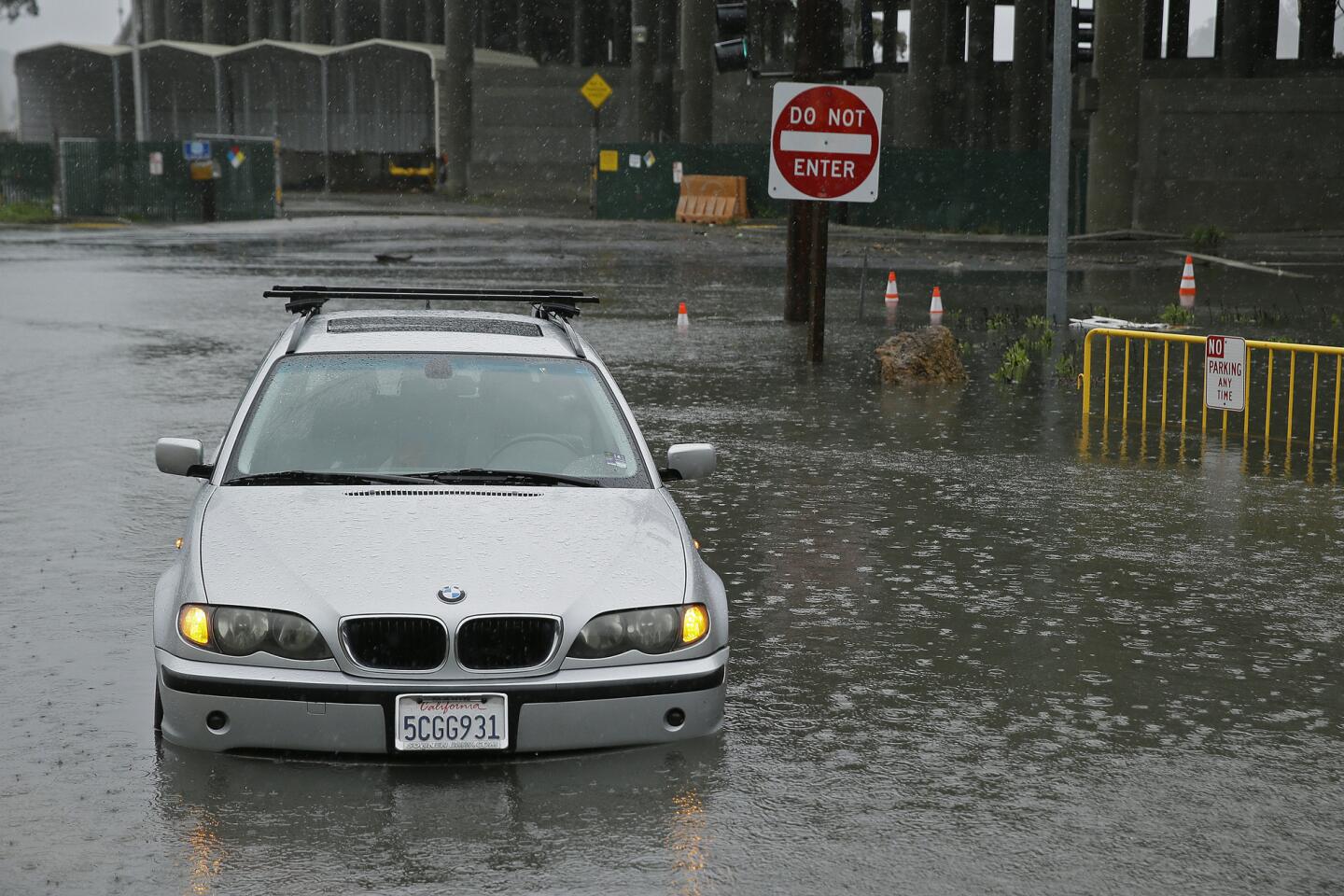
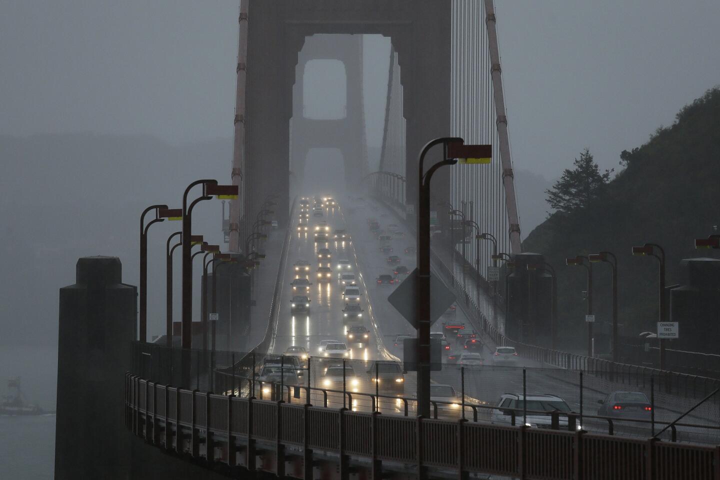
California Highway Patrol Officer Andrew Barclay said drivers should take it slow to avoid driving through standing water and losing control.
“My biggest suggestion right now is slow down and have patience,” Barclay said Thursday while in Marin. “It’s going to take longer than normal to get home tonight, don’t rush.”
In Healdsburg, antique dealer Greg Sheldon said driving conditions were difficult.
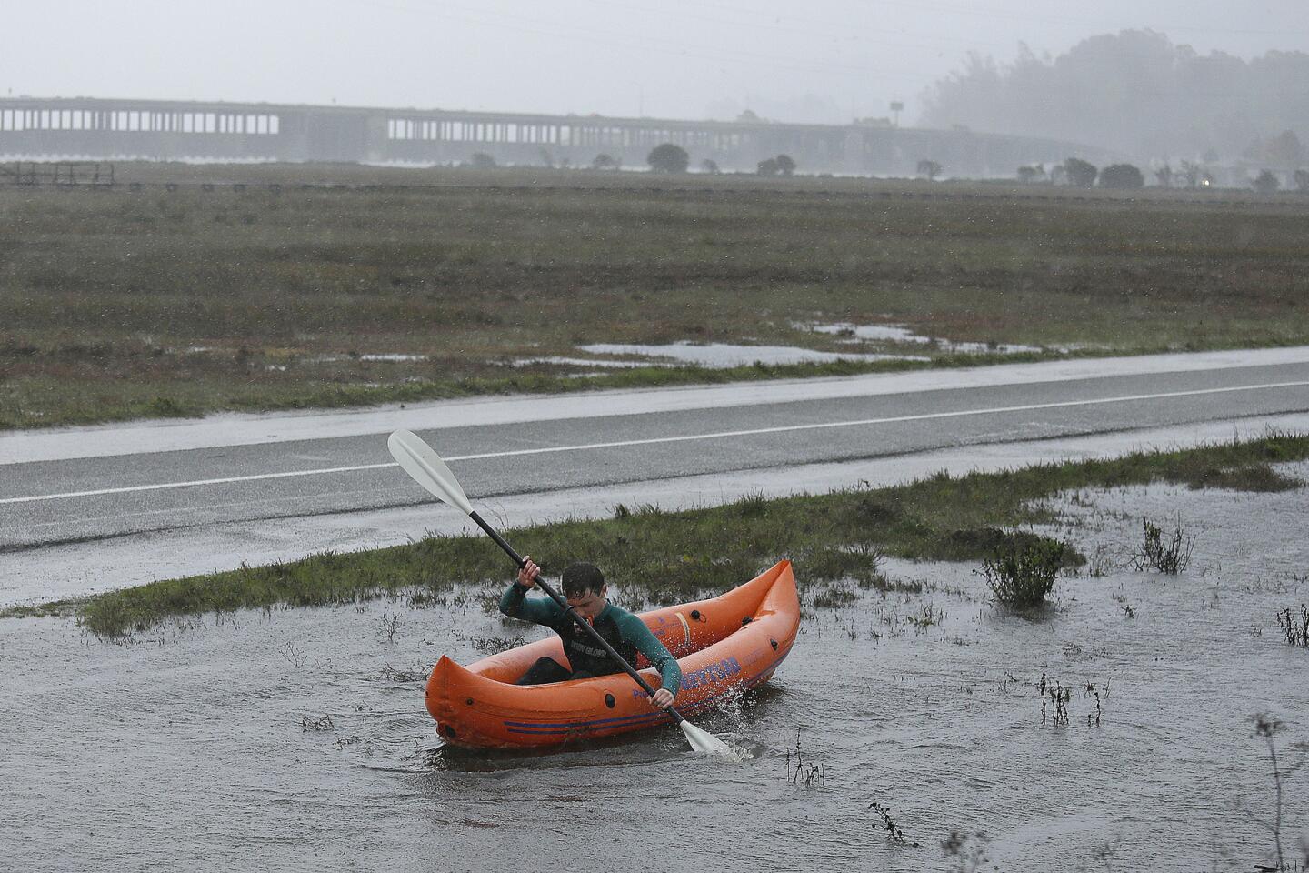
“Some of our streets are flooded here. I had 2 feet of water in one of my lanes,” said Sheldon, who works at Antique Harvest. “There’s just tons of water coming off, the ground is so saturated right now. Every field is a big lake.”
Chris Daniels, who also works in Healdsburg and lives nearby in Windsor, said she is worried about getting home Thursday night.
“I have a creek behind my house. It’s just about ready to go over our road,” she said. “I’m just hoping I can get back into my house.”
The storm is adding to an already soggy past few months.
Forecasters say San Francisco’s 12 days of rain in October were the most in that month in more than a century.
San Francisco received 2.43 inches of precipitation in October, which was more than double the total from a year earlier.
South of San Francisco in the city of Pacifica, leaders are set to raze a neglected apartment that is at risk of crumbling due to coastal erosion.
Over the weekend a massive sinkhole opened near the building following rains and king tides.
Workers pumped sand and concrete into the hole, which closed access to a popular beach and caused concerns about recurring erosion due to heavy rains and high waves.
The National Weather Service issued a winter storm warning and flash flood watch for Thursday through Friday for the
Elsewhere, trees dried by drought could be downed by the wind and the rain, leading to possible power outages.
In the Sierra Nevada, winds are gusting to nearly 100 mph over the ridge tops, downing power lines in the Reno area and slowing traffic ahead of a major winter storm off the Pacific.
A winter storm warning remains in effect through 4 a.m. Friday around Lake Tahoe, where 1 to 3 feet of snow is expected at the upper elevations. Flood watches and warnings have been issued for many streams and rivers along the Nevada-California border.
In Southern California, mud flows are possible when it rains more than two-tenths of an inch in 15 minutes, and the incoming storm is expected to drop rain at a significantly higher clip than that, Sirard said.
Downtown and the coast will get at least a half inch of rain, he said.
It will also be windy, Sirard added. In the Antelope Valley, gusts may reach 60 mph Thursday night, while much of the rest of the Southland will see winds of 15 to 25 mph, according to Sirard.
Snow levels could drop to 4,000 feet along Glendora Ridge Road in the San Gabriel Mountains. Glendora Ridge Road from Glendora Mountain Road to Mt. Baldy Road will be closed at 4 p.m. Thursday. The stretch of road will reopen Monday after the snow and debris have been cleared.
The storm is expected to last all day Thursday and dissipate by Friday afternoon.
ALSO
Police killing of unarmed, 73-year-old grandfather sparks anger, anguish
Ex-owner of dog that had 42-pound tumor is charged with animal cruelty
Robert Durst's lawyers challenge evidence and accuse prosecutor of 'deceptive' jailhouse interview
Sign up for Essential California
The most important California stories and recommendations in your inbox every morning.
You may occasionally receive promotional content from the Los Angeles Times.
