Hurricane warnings issued as Tropical Storm Arthur grows

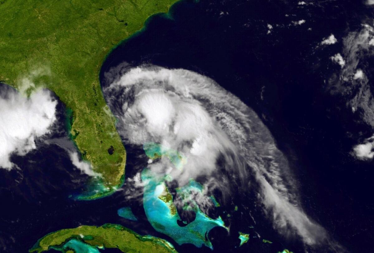
In this handout provided by the National Oceanic and Atmospheric Administration (NOAA) from the GOES-East satellite, weather system Arthur travels up the east coast of the United States in the Atlantic Ocean pictured at 17:45 UTC/GMT on July 2, 2014.
- Share via
A hurricane warning has been issued for large swaths of North Carolina as federal officials expect Tropical Storm Arthur to become a hurricane later Wednesday or Thursday.
Local officials issued a a mandatory evacuation order Wednesday for residents and visitors on Hatteras Island, a small barrier island off the state’s north coast.
Dare County officials told people to evacuate during daylight hours on Thursday “before the effects of Tropical Storm Arthur begin to bring high winds, rough seas, dangerous rip currents, and the potential for water and sand overwash on NC Highway 12.”
North Carolina Gov. Pat McCrory declared a state of emergency earlier Wednesday for coastal counties as Tropical Storm Arthur threatened to bear down on the state’s coast with winds reaching 70 mph, according to the National Hurricane Center.
McCrory told the public and tourists visiting for the Fourth of July weekend not to underestimate the storm and to avoid going into the water.
Key (Click map for details)![]() Current location
Current location![]() Forecast locations
Forecast locations![]() Forecast track
Forecast track![]() Potential track area
Potential track area Storm warning
“Let’s hope for the best, pray for the best,” he said at a news conference. “Again, don’t put your stupid hat on, let’s be smart.”
A hurricane warning is in effect from Surf City, N.C., to Duck, N.C., as well as the Pamlico and Eastern Albemarle Sounds, as Arthur slowly drifts north.
Coastal Hyde County issued a voluntary evacuation order for Ocracoke Island as the National Hurricane Center also warned of potential flooding in coastal areas. The state also waved ferry fees Wednesday as people left Ocracoke Island.
The latest potential storm surge flooding map for Arthur is now posted on the NHC internet at https://t.co/y2yKPdzc4L pic.twitter.com/L00L8oJqaf— Natl Hurricane Ctr (@NHC_Atlantic) July 2, 2014
A hurricane warning has been issued for most of the coast of eastern North Carolina #Arthur pic.twitter.com/PnVW1wJMp2— Natl Hurricane Ctr (@NHC_Atlantic) July 2, 2014
It’s unclear what effect Arthur will have on North Carolina, state emergency management director Mike Sprayberry said, but the state has National Guard members ready to help evacuate coastal areas.
“It is still too early to tell what kind of impact this event is going to have,” he said. “We intend to be prepared for any eventuality.”
UPDATES
3:54 p.m.: This post was updated with information about the mandatory evacuation of Hatteras Island.
2:45 p.m.: This post was updated to say that Tropical Storm Arthur was expected to develop into a hurricane as well as to add details about where a hurricane warning was in effect and where voluntary evacuations had been ordered.
The first version of this post was published at 10:35 a.m.
Follow @jpanzar for breaking news
More to Read
Sign up for Essential California
The most important California stories and recommendations in your inbox every morning.
You may occasionally receive promotional content from the Los Angeles Times.


