
(Jim Cooke / Los Angeles Times)
9 little-known ways to see the Hollywood sign
- Share via
Whether you love it, hate it or are completely indifferent to it, spend enough time in L.A. and eventually someone will ask you how to get to the Hollywood sign.
Built as a temporary real estate advertisement in 1923, those big white letters have been a beacon for generations. Luckily, to get a postcard-perfect glimpse of the iconic landmark, you don’t need to take a trip to the crowded Griffith Observatory or clog up the residential streets of Hollywoodland. Here are nine little-known ways to see the Hollywood sign — either by foot or by horseback.
Showing Places
From the walkway at Ovation Hollywood
Hollywood Shopping Center
(Al Seib/Los Angeles Times)
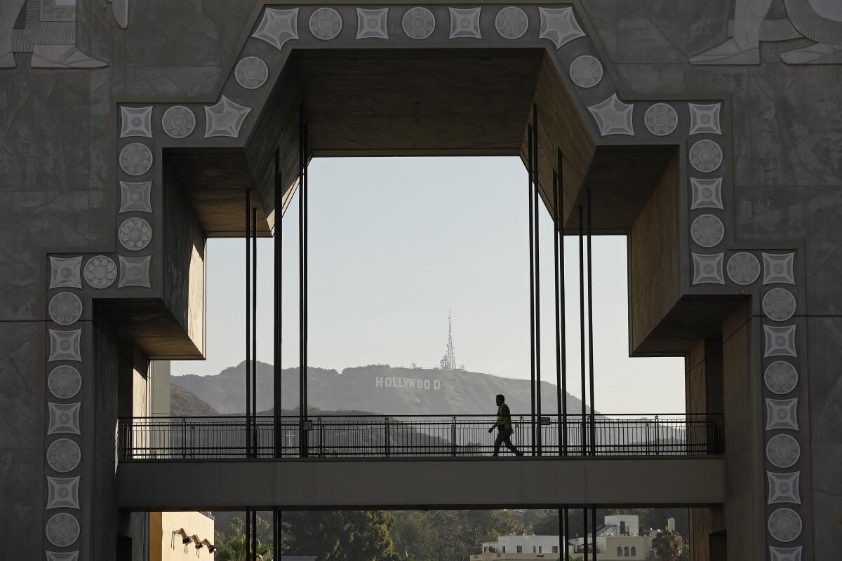
The Hollywood and Highland shopping and entertainment complex might not be an obvious choice for viewing the Hollywood sign, but on the north side of the plaza, you can climb up a few floors and find a walkway that points directly at it. Ovation Hollywood has an underground parking garage and is also easily accessible by DASH and Metro buses, as well as the B Line (Red) subway. Plus, if you’re bringing out-of-towners, you’ll be right on the Walk of Fame and within easy distance of landmarks such as the El Capitan Theatre, TCL Chinese Theatre (originally Grauman’s Chinese Theatre) and Hollywood Roosevelt hotel. The sign is about 2.4 miles from the viewpoint here, so you may want to skip this if the air is hazy that day.
Show more Show less
Route Details
From the Mulholland Dam
Hollywood Hills Urban Trail
3.3-mile loop
Easy
(Casey Schreiner)
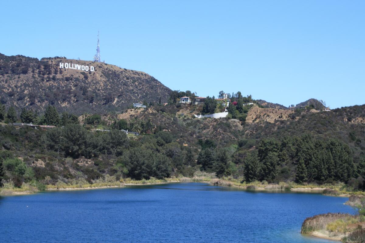
Completed in 1924, the Mulholland Dam is the second-to-last dam designed and built by William Mulholland. When his final dam — the St. Francis — catastrophically collapsed in 1928, engineers reinforced this dam perched above Hollywood and covered most of its base in earth. Today, it’s a unique spot to see the Hollywood sign with the waters of the Hollywood Reservoir beneath it. This mostly flat, mostly paved path is popular with neighborhood joggers and is open from 6:30 a.m. until dusk, with closures on some holidays and after storms or red flag days (the L.A. Department of Water and Power maintains the site and controls pedestrian access). Getting to the dam is an easy walk — about a mile from a gate on Lake Hollywood Drive and just a stone’s throw from the gate at Weidlake Drive. Both gates are in residential neighborhoods, so get there early (the Lake Hollywood Drive area has more available parking).
Show more Show less
Route Details
From Lake Hollywood Park
Hollywood Hills Urban Trail
6.0-mile out-and-back
Moderate
490
(Casey Schreiner)
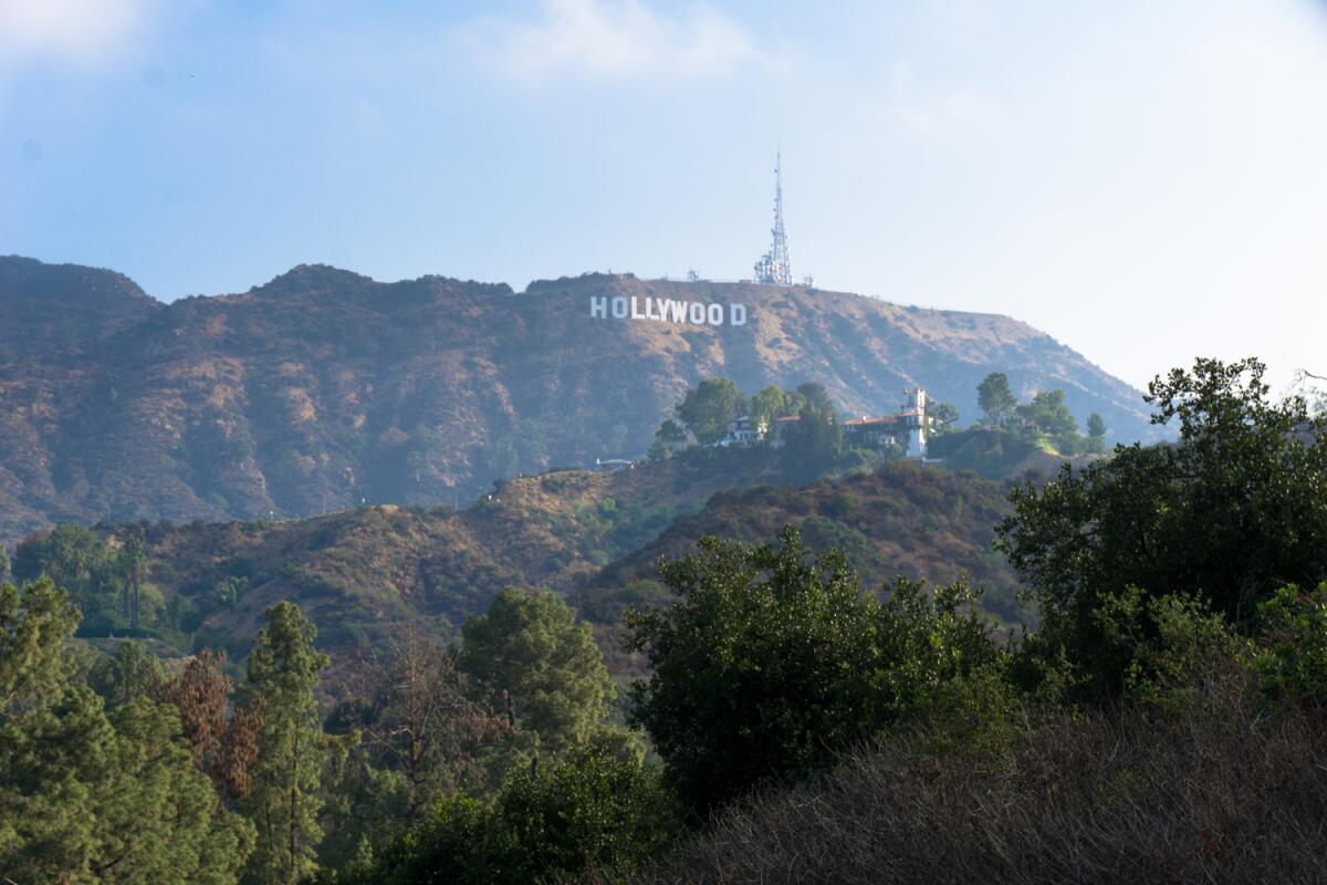
Lake Hollywood Park at the intersection of Canyon Lake Drive and Mulholland Highway has become a Hollywood sign hot spot over the last few years, with selfie-snappers and tour buses often clogging the nearby narrow residential streets. It’s a lovely park, though, and there’s a way to be kinder to the neighborhood and have a more unique experience. Start your hike at the Hollywood Reservoir north gate, crossing the Mulholland Dam, then hop onto the dirt path of Mulholland Highway. This old road was intended to connect with Mulholland Drive on the west side of the 101, but the project was never completed, so now you get to enjoy a lovely hike through sage scrub instead. Enjoy exceptional views of the Hollywood sign before the trail ends at Lake Hollywood Park, then continue walking north on Canyon Lake Drive to the Innsdale Trail — a short dirt road in Griffith Park that gets you as close to the front of the sign as you can legally get.
Show more Show less
Route Details
From Mt. Lee via Burbank Peak
Hollywood Hills Mountain Trail
3.0-mile out-and-back
Strenuous
1240
(Casey Schreiner)
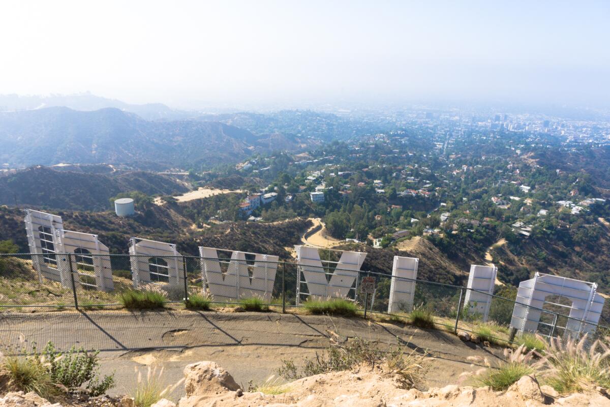
Although it can be confusing, the Hollywood sign is not on Mt. Hollywood — it stands atop Mt. Lee, the third-tallest peak in Griffith Park. There are several ways to reach Mt. Lee, where you can see the Hollywood sign from behind. This is the shortest route you can take without dealing with a parking headache in Hollywoodland, and it happens to be one of the best, toughest hikes in the park.
Park on Lake Hollywood Drive and walk uphill, then head east on Wonder View Drive (no parking is allowed on that street, so don’t waste time looking). Pass through a gate open sunrise to sunset and start your climb on the Burbank Peak Trail, a steep, rugged single-track trail that is often underestimated by visitors. Take a quick detour to visit the Wisdom Tree on Burbank Peak, then head east on the Aileen Getty Ridge Trail, which hits Cahuenga Peak (the tallest in Griffith Park) before crawling toward paved Mt. Lee Drive via some steep and narrow sections. This is a popular hiking route, so get going early — and even earlier if you’re heading out on a weekend. Wear hiking shoes and bring water, snacks and sunscreen. For extra karma points, bring a trash bag and collect some litter if you can.
Park on Lake Hollywood Drive and walk uphill, then head east on Wonder View Drive (no parking is allowed on that street, so don’t waste time looking). Pass through a gate open sunrise to sunset and start your climb on the Burbank Peak Trail, a steep, rugged single-track trail that is often underestimated by visitors. Take a quick detour to visit the Wisdom Tree on Burbank Peak, then head east on the Aileen Getty Ridge Trail, which hits Cahuenga Peak (the tallest in Griffith Park) before crawling toward paved Mt. Lee Drive via some steep and narrow sections. This is a popular hiking route, so get going early — and even earlier if you’re heading out on a weekend. Wear hiking shoes and bring water, snacks and sunscreen. For extra karma points, bring a trash bag and collect some litter if you can.
Show more Show less
Route Details
From Mt. Lee via Brush Canyon
Hollywood Hills Mountain Trail
5.9-mile out-and-back
Moderate
1,330 feet
(Casey Schreiner)
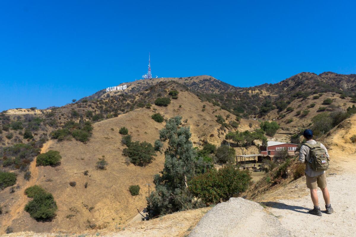
At just under 6 miles round-trip, this is a longer hike to the summit of Mt. Lee, but the elevation gain is gentler and the trails are wider than the route via Burbank Peak. There is a decent amount of parking along the end of Canyon Drive near the Bronson Canyon Playground (a gate locks access to the park at sunset). Walk north to the end of Canyon Drive, which becomes the dirt Brush Canyon Trail. After a few quick switchbacks, you’ll start to see nice views of the sign to the northwest, but since you’re here, you might as well head all the way up, right? Head west on the Mulholland Trail, then turn right to head north on the paved Mt. Lee Drive, which wraps around the north side of Mt. Lee before reaching its summit. For a secret photo spot, take a quick detour on the Hollyridge Trail for a great view near Sunset Ranch. A one-way gate prevents access to this area from Beachwood Drive — you can get out that way, but you can’t get in.
Show more Show less
Route Details
From Bronson Cave (a.k.a. the original Batcave)
Hollywood Hills Mountain Trail
0.6-mile out-and-back
Easy
60
(Casey Schreiner)
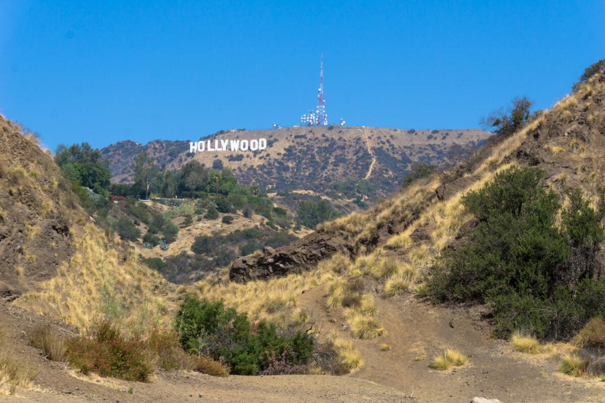
Also located at the end of Canyon Drive, the quick hike to Bronson Cave is a blip of a hike at just 0.6 miles round-trip. This site of the old Union Rock Company’s quarry provides one of the most accessible views of the Hollywood sign in addition to its also-famous Bronson Cave attraction, which is perhaps best known as the original Batcave. The cave itself has been closed due to unstable rocks, but you can still reach a spot with a great view of the Hollywood sign with some rugged Santa Monica Mountain terrain in the foreground.
Show more Show less
Route Details
From the West Observatory Trail
Mountain Trail
1.9-mile loop
Moderate
710 feet
(Casey Schreiner)
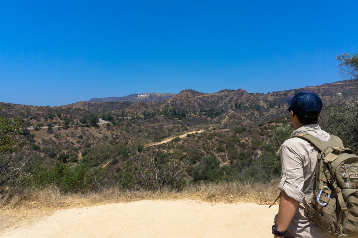
While the Griffith Observatory is an “official” Hollywood sign viewpoint, it’s often swarming with crowds. However, some of the best alternate viewpoints are just a short hike away. The West Observatory Trail climbs toward its namesake from the playground near the Trails cafe on Fern Dell Drive, which not only gives you a chance to avoid the steep parking fees near the Observatory but also lets you see some of the best views of the Hollywood sign anywhere in Griffith Park. The West Observatory Trail has a few steep sections but is mostly manageable — and although it’s a well-traveled trail, folks tend not to linger in the areas with good sign views.
Park on Fern Dell Drive and take the Fern Dell Trail there, or park near the Trails. (There is a good-sized overflow lot just north of the Trails on Western Canyon Road.) You can also hike up from the Metro B Line stop at Hollywood/Western. A full loop heading up to Griffith Observatory on the West Observatory Trail and coming down on the East Observatory Trail is 1.9 miles round-trip.
Park on Fern Dell Drive and take the Fern Dell Trail there, or park near the Trails. (There is a good-sized overflow lot just north of the Trails on Western Canyon Road.) You can also hike up from the Metro B Line stop at Hollywood/Western. A full loop heading up to Griffith Observatory on the West Observatory Trail and coming down on the East Observatory Trail is 1.9 miles round-trip.
Show more Show less
Route Details
From the Mt. Hollywood Trail
Mountain Trail
1.2-mile out-and-back
Easy
60
(Casey Schreiner)
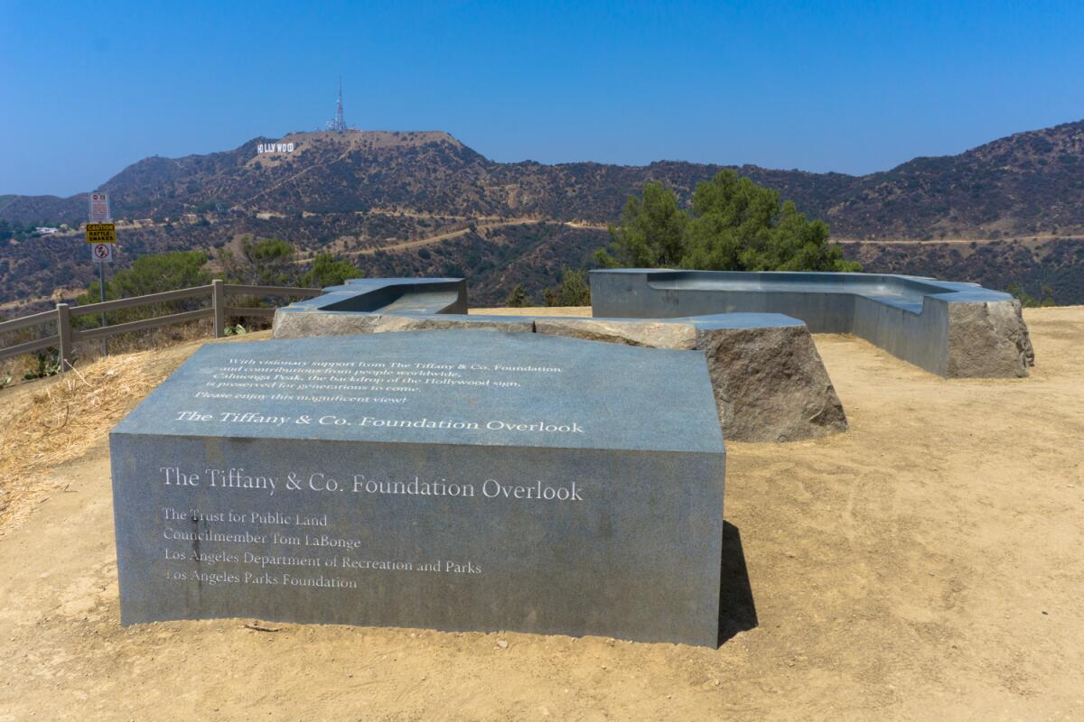
Just to the north of the Griffith Observatory is the Charlie Turner Trailhead, the gateway to the hiking trails in the heart of Griffith Park. Even when the parking lot and restrooms nearby are swarming with people, you can usually find some solace with a quick hike north into the Berlin Forest. This forested picnic area celebrates our sister city status with the German capital. If the view of the Hollywood sign isn’t enough for you, keep hiking on the broad Mt. Hollywood Trail for about another half-mile to the Tiffany & Co. Foundation Overlook, a popular photo spot for the sign. Although there is almost always activity here, it’s a fraction of what you’ll find at the Observatory. Paid parking at the Observatory is $10 an hour Monday through Friday from noon to 10 p.m., and weekends from 10 a.m. to 10 p.m. (fees help fund park improvements like the new bike lanes on Riverside Drive). If you arrive and leave before those times, you can park here for free. Otherwise, take the DASH Observatory in or take a short, steep walk from the Greek Theatre. Even better, make this a longer hike day by starting at Fern Dell and heading all the way up to Mt. Hollywood.
Show more Show less
Route Details
By horseback
Hollywood Hills Mountain Trail
Want a truly unique way to see the Hollywood sign? Strap on a helmet, stretch those hip flexors and hop into the saddle for a guided tour that runs on all-natural horsepower. Sunset Ranch Hollywood offers tours that begin near the excellent Hollyridge Viewpoint and continue to the summit of Mt. Hollywood. These rides are popular, so book in advance. Tours start at $65 on weekdays and $75 on weekends.
Show more Show less
Route Details
No matching entries.
Please reset filters to see all entries.
No matching entries.
Please reset filters to see all entries.
Top


