Forecasters Were All Wet in This One
- Share via
So the series of weak storm fronts rolling in from the Pacific was only going to cast a little gloom over Southern California’s three-day Presidents Day weekend, eh? So much for that forecast.
The gloom was coming down pretty good Friday afternoon, causing umbrellas to pop up like toadstools, running three or four inches deep in the gutters and triggering hundreds of accidents on drenched freeways.
“We were expecting just some scattered showers in Northern California,” said Cary Schudy of the private Earth Environment Service in San Francisco. “This thing just bloomed overnight, dropped four or five inches in the San Francisco Bay Area and spread. It was a lot more rain than anyone expected.”
After no more than a little cloudiness today, Schudy said, the next front should drag through Sunday. That, he predicted, will be followed Tuesday by one even wetter than Friday’s.
“It looks like we’re getting them about every two days,” he noted.
The Los Angeles Civic Center had .40 of an inch of rain by late Friday afternoon, bringing the season total to 5.95 inches--still far below the normal to date of 9.60.
Monrovia recorded .48, Culver City and Northridge had .42, San Gabriel had .63, Woodland Hills had .46, Santa Monica and Torrance had .22 and Santa Barbara had 1.30. Some other Southland communities had only a trace.
The Civic Center high temperature Friday was 60 degrees after an overnight low of 58. The high relative humidity was 93% and the low was 83%.
Skiers had something to grin about as the National Weather Service predicted snow down to about the 7,000-foot level in Southland mountains.
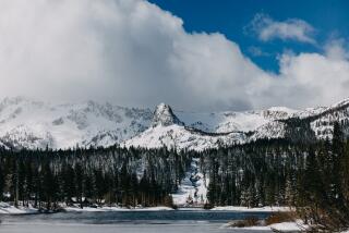
In Northern California, where ski resorts have been having their worst season in years, the storm brought a thick blanket of new snow to much of the Sierra. The Lake Tahoe area had a foot or more of snow by Friday morning. At Mammoth Mountain, more than 30 inches of snow fell between 1 a.m. and 7 a.m.
The reservations desk telephones began to ring.
The Mammoth ranger district, however, warned of high avalanche danger in areas outside developed ski resorts. Winds up to 55 m.p.h. added to the risk, officials reported.
The storm, which was picking up tropical moisture as it came in off the ocean and was not cold enough to drop snow at lower altitudes, was the strongest of the season as far as Northern and Central California were concerned. It was wet enough to cause flooding in numerous communities near San Francisco.
More than seven inches of rain were reported in the Santa Cruz Mountains and more than 11 inches fell at Chews Ridge in Monterey County’s coastal mountains. The rain set off mud slides about 15 miles south of Big Sur, forcing closure of both lanes of scenic California 1.
A California Highway Patrol dispatcher said the highway will probably remain closed until about June. “It’s an annual thing,” she said.
Extensive flooding and road closures were reported in San Benito, San Mateo, Alameda and Contra Costa counties.
Downtown Oakland had 4.23 inches of rain, and downtown San Francisco had 3.13.
The San Joaquin Valley was well doused too, with rain spreading across virtually all points by Thursday night.
By Friday afternoon, wide loads, large trucks and campers were restricted on the Antelope Valley Freeway between Kern County and Ward Canyon because of high winds.
The rain and the snow was good news for the Hetch Hetchy water system in the Tuolumne River watershed, which supplies more than 2 million people in the San Francisco Bay Area. The lower-than-normal snowpack and the threat of a poor runoff had posed a threat of a severe water shortage.
More to Read
Sign up for Essential California
The most important California stories and recommendations in your inbox every morning.
You may occasionally receive promotional content from the Los Angeles Times.


