Sugarloaf Mountain --A Sweet Way to Go
- Share via
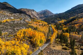
Sugarloaf Mountain, highest peak in the San Bernardinos outside the San Gorgonio Wilderness, is a fine early autumn destination. The ridge line leading to the summit is forested with pine, fir and cedar. A breeze cools the massive round shoulder of the mountain.
Sugarloaf National Recreation Trail is an invigorating path to take before the first serious snowfall covers the high peaks. Keep this trail in mind if you plan a trip to Big Bear Lake, which is near the trailhead.
During the 1920s and ‘30s, wild horses roamed the lower slopes of Sugarloaf. As the story goes, after World War I, the U.S. Cavalry realized that modern warfare would not include the use of horses and allowed their animals to run wild. The horses wandered from Lucerne Valley over to Sugarloaf Mountain, where a site today is known as Wildhorse Meadow.
In recognition of its scenic qualities, the route to the top of Sugarloaf has been designated a National Recreation Trail by the U.S. Forest Service. The first part of the trail--as far as Wildhorse Trail Camp--offers a family trip of moderate difficulty. Well-conditioned hikers will enjoy the challenge of the second part of the trail--a vigorous ascent of 9,952-foot Sugarloaf.
For more information about trails and recreation in the Big Bear area of the San Bernardino National Forest: (714) 866-3437. The ranger station is off California 38, three miles east of the village of Fawnskin, on the north shore of Big Bear Lake. Office hours are 8-11:30 a.m., 12:30-4:30 p.m., Monday through Saturday.
Directions to trailhead: From Big Bear City, head east on California 38. The highway soon turns south. About 3 miles from town, turn right on Forest Road 2N84, a dirt road. (Keep a sharp eye out for this turnoff; it’s not marked well). The forest road is rocky and rutted, but passable for passenger cars with good ground clearance. Drivers of low-slung cars shouldn’t attempt this road. Proceed 1 1/2 miles to the signed beginning of Sugarloaf National Recreation Trail. Park in a safe manner on the shoulder of the forest road.
The hike: Ascend on the trail, which begins as a steep four-wheel-drive road. The trail stays close to Green Creek, now just a trickle. Two miles of travel brings you to a saddle on the ridge line and a signed trailhead.
(Straight ahead, the trail continues a short distance to Wildhorse Meadow and a trail camp--fine picnic and rest stops).
Turn right (west) onto the trail to Sugarloaf Mountain. Above 9,000 feet, the trail passes through thick stands of lodgepole pine. The trail contours around Peak 9775 (Anybody have a more lyrical name?) and dips to a saddle. Gnarled and picturesque junipers hug the ridge line. The trail then ascends to the forested summit of Sugarloaf Peak. Eastern San Bernardino Mountain peaks and the San Gorgonio Wilderness are part of the fine view.
Sugarloaf National Recreation Trail
Green Canyon to Wildhorse Creek Trail Camp: five miles round trip; 700-foot elevation gain . Green Canyon to Sugarloaf Mountain : 10 miles round trip; 2,000-foot elevation gain .
More to Read
Sign up for The Wild
We’ll help you find the best places to hike, bike and run, as well as the perfect silent spots for meditation and yoga.
You may occasionally receive promotional content from the Los Angeles Times.


