U.S. Reconnaissance Satellites Aren’t All-Seeing, so Don’t Expect Miracles : Intelligence: Our eyes in space tell us a lot about what the Iraqis are up to, and how effective allied bombing is, but they can’t see through rubble.
- Share via
WASHINGTON — At the daily press briefings in Riyadh, Saudi Arabia, and the Pentagon, and in newsrooms across America, reporters can frequently be heard complaining about the answers defense and military spokesmen are giving them on how the war against Iraq is going. Why can’t the United States, which has “satellites that can read license plates on cars,” locate Scud mobile-missile launchers, provide immediate and definitive damage assessments of the allied bombing campaign and verify that no civilians are being sheltered in military facilities subject to attack?
Much of the apparent contradiction is the result of overestimating U.S. space and aerial reconnaissance capabilities. Understanding what those capabilities are is necessary if you want to know when the military spokesmen truly can’t deliver satisfactory answers or when they simply don’t want to.
U.S. reconnaissance capabilities are extraordinary. KH-11 and Advanced KH-11 satellites--the United States has four to six in orbit--are astounding technological achievements. They have provided massive amounts of valuable intelligence. Photo satellites can send back pictures of missile launchers, troop deployments or airfields almost instantaneously (in “near real-time”). Passing over any point on Earth, they can photograph a target several hundred miles ahead, to the side, or to the rear. And, indeed, in the best pictures you can pick out a license plate lying on a road--but you can’t read it.
One imaging limitation that does affect military decision-making is imposed by the satellites’ low-earth orbits--necessary to obtain detailed images of targets. Each KH-11 satellite, traveling 17,000 m.p.h. and tracing an elliptical path around the Earth, passes over the Persian Gulf twice a day for between five and 10 minutes. As a result, the United States can only monitor some events or targets in “near real-time.”
A 1984 study concluded it would take more than 60 satellites to provide continuous coverage of the entire globe. Even a constellation of imaging satellites whose designated orbits covered Iraq and Kuwait would have to be far larger (and far more expensive) than the current group to provide such coverage.
Weather and darkness can severely crimp reconnaissance capabilities as well. Only one U.S. imaging satellite, the Lacrosse radar-imagery satellite, can peer through clouds. Thus, on overcast days, U.S. reconnaissance efforts are limited to two or three passes over their targets.
Also, U.S. space reconnaissance capabilities are degraded at night. The Advanced KH-11s have a limited nighttime photography capability. But since the KH-11s have none, they lack eyes during their nightly pass over the Gulf. No U.S. satellite can peer inside buildings, shelters or under rubble.
Reconnaissance aircraft have their own limitations. Some--the U-2/TR-1, for example--can’t see through cloud cover. If they fly below the clouds, they would be more vulnerable to anti-aircraft artillery and surface-to-air missiles. Whether flying above or below cloud cover, they are flying far lower than reconnaissance satellites and thus are inspecting a much smaller area.
These technical shortcomings all translate into limited intelligence of where, for example, Scud missiles and their mobile launchers are. The combination of launcher mobility, the relatively small window of detection opportunity, the Iraqi tactic of keeping missiles in shelters, caves or underground structures during the day and the limited nighttime capability of U.S. satellites--all prolong the pursuit. The identification of mobile launchers, even in a country the size of Iraq, thus requires weeks of satellite reconnaissance operations--not hours or days.
Reconnaissance limitations impair the ability to conduct bomb-damage assessments. To the extent that targets are fixed sites or have been reduced to immobility, a satellite will eventually be able to send back imagery for photo interpreters to scrutinize. But a few days of bad weather may mean a few days with only one U.S. satellite (Lacrosse) transmitting photos. Some attacked targets will thus be temporarily bypassed. Furthermore, because Lacrosse’s images are not as detailed as those of the KH-11 and Advanced KH-11 satellites, there may be some cases when its images complicate attempts to assess damage.
Still, the ability to determine if a building has been completely or partly destroyed doesn’t translate into a parallel ability to know the number, or type, of stored weapons also eliminated in the attack. Estimates may be made, but they are usually based on a combination of assumptions and hard data. When a major Soviet munitions depot exploded in 1984, for example, U.S. reconnaissance satellites photographed the effects of the blast in great detail. But estimates of the number of missiles destroyed were, in part, based on assumptions concerning the type of missiles stored and the internal layout of the depot.
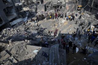
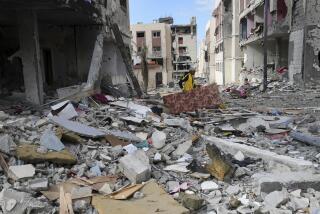
Reporters have also been especially interested in the extent of civilian casualties in Iraq--most recently those involved in the air attack on a Baghdad bomb shelter. It is certainly possible for a KH-11 or Advanced KH-11 satellite to be instructed to send back an extraordinarily clear picture of civilian installations to learn whether they have been damaged. Such photos can yield information on whether the damage was the result of anti-aircraft fire or a bomb or missile (which could be a stray surface-to-air missile). But there is no way for satellites to see potential casualties buried under rubble.
Similarly, that an air-raid shelter has been converted into a military command center while still being used for civil-defense purposes may not be apparent on the basis of reconnaissance data. Civilians may enter the shelter in less than an hour in the dead of night. The short period of time in which U.S. imaging satellites are overhead, combined with their limited nighttime capability, make it difficult to detect the presence of civilians. And any signals intercepted from such a facility are likely to be of a purely military nature.
While U.S. reconnaissance capabilities are--and will continue to be--of tremendous significance in conducting the allied air campaign and in transmitting valuable information on efforts to locate Scud missile launchers and produce bomb-damage assessments, they cannot provide answers overnight. In other cases, they may never provide answers.
More to Read
Sign up for Essential California
The most important California stories and recommendations in your inbox every morning.
You may occasionally receive promotional content from the Los Angeles Times.


