Scout’s Oath: Lost Is Found : Map Maker’s Device Will Pinpoint User’s Location--Anywhere
- Share via
IRVINE — Every person reading this story has gotten lost at one time or another and will probably do so again someday, despite earnest efforts to avoid it.
In the best of times, getting lost is an annoying inconvenience, but in the worst of times it can be deadly.
However, a new hand-held device to be marketed next spring by a local map-making company promises to make getting lost virtually impossible for its users. Weighing less than a pound, the device can pinpoint its exact location anywhere on the Earth, accurate to within a few dozen feet. At the same time, it makes finding unfamiliar places as easy as adding numbers on a calculator.
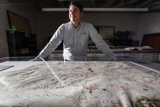
“This is something that’s never been done before in map making,” said Warren Wilson, owner of Irvine-based Thomas Bros. Maps, whose indexed color road guides provide the map coordinates that make the system work.
Wilson said the device, which will be formally unveiled in San Francisco on Jan. 20, is one of several innovations designed to save time, money and human life. With increasingly powerful computer and satellite technology available, new electronic mapping and navigation systems will help improve transportation, make school districts and government agencies more efficient, ensure that oil tankers and airplanes stay on course, and speed search-and-rescue teams to the lost or injured.
Starting next spring, Thomas Bros. and its partner, Sunnyvale-based Trimble Navigation, will market the Scout, a hand-held computer that translates microwave signals from U.S. navigation satellites into precise and easily identifiable map coordinates. The units, which are a consumer version of the same devices used by troops in Desert Storm, are programmed to display locations based on their page and grid numbers of the Thomas Bros. guides.
“With this new technology, you do have an increased sense of security,” said Glen Jansma, business development manager. “If something were to happen, you could locate your position quickly and call for assistance. In many ways you can look at it as the leading edge of a new technology that will someday evolve into having (computerized) Thomas Bros. maps in the car.”
The device, which can show information in seven languages, looks a little like an oversized calculator, with several buttons on the face and a flat display screen in the center. The Scout does not specify which highways to travel but does relay much information about a destination’s distance and direction relative to the unit, said Arthur Woo, project manager for Trimble Navigation, which manufactures the device.
For example, once a destination is keyed in, the Scout will display whether that location is to the right or left, in front of or behind the traveler. The three-dimensional tracking device also shows the distance remaining on the trip and the average rate of travel, as well as other information, including elevation and current speed.
When marketed within the next few months, the Scout will cost less than $1,000, with the price expected to drop after it is introduced. Woo also said that the product will probably spur Thomas Bros. to increase the number of places for which it produces detailed maps: “Today the U.S., tomorrow the world,” he said.
The Scout is one of a host of map and navigation innovations that began in the 1980s, Wilson said. “Five years ago, Thomas Bros. decided that its future would be closely related to computer technology. (Until then,) all maps were made by manual cartographers working with pen and ink.”
Revised repeatedly by hand over the years, the maps’ spatial distortions grew, making them increasingly inaccurate. However, with aerial photography and satellite photos, Thomas Bros. created new maps that were accurate to within five feet (although recent earthquakes have caused the maps’ accuracy to fall slightly, to within six feet, as the ground shifted).
“Before, maps were never used as anything more than a reference point,” in part because of their distortions, Wilson said. Now, because they are precise and easily manipulated by computer, they have become a powerful labor-saving tool that will make government agencies more efficient and cost-effective.
“We can now spread demographic information on a (computerized) map, which we’re doing with the Los Angeles Unified School District,” Wilson said. “We can show boundaries of the district and show the size of its classes, the ethnic orientation of the students, the addresses of the students” and also how those characteristics would change if the district boundaries were altered, he said.
As a result, school district officials will be able to better plan bus routes and more efficiently determine class sizes and potential boundary changes. But now, instead of being produced after hours or even days of backbreaking work, the information can appear with the touch of a button.
“We’re basically enabling people to do things they didn’t know they needed,” Jansma said.


