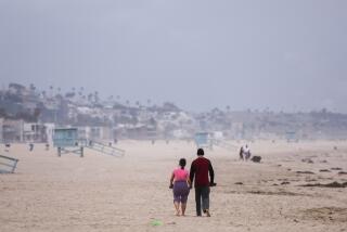
Sun Goes South for the Summer : Weather: Persistent marine layer keeps the mercury from rising into its accustomed 90-degree range.
- Share via
Thanks to the persistent low clouds that have blanketed the San Fernando Valley for most of the past few weeks, 1993 could be remembered as the year that summer almost didn’t happen.
According to meteorologists, a weather pattern traditionally associated with June--the fabled “June Gloom”--has lingered through July, often shrouding the sun until the afternoon and resulting in average high temperatures that are 10 degrees below normal.
“What’s going on is usually we get a lot of low clouds in June and less and less in July,” said National Weather Service forecaster Ivory Small. “This year, it just keeps on going. The low clouds just won’t go away.”
Far from the norm of relentless heat, the Valley weatherscape this month has featured an unremitting diet of overcast gloom with temperatures ranging from a less-than-sweltering high of 88 degrees on July 7 to a distinctly chilly overnight low of 59 degrees last Thursday.
“We haven’t even had one temperature above 90 degrees in July,” Small said, referring to readings at the service’s Van Nuys station. “Usually, the average is above 90 in July.”
The unusual weather pattern is the product of a stubborn trough of low pressure anchored over the western United States and created by the jet stream of high-altitude, high-velocity wind. The jet stream, which normally lies in more northern latitudes, has guided storms from the trough into the Midwest, contributing to the devastating floods in that region. As for the Southland, “the same thing is bringing low clouds in here,” Small said.
While the persistent marine layer of “stratus” clouds may have cut into beach time, there has been a payoff in reduced smog levels. So far this year, not one first-stage smog alert has been recorded in the San Fernando Valley and only one in the Santa Clarita Valley, according to the South Coast Air Quality Management District (AQMD).
A first-stage alert is issued when smog levels exceed 200 on what is known as the Pollution Standard Index. At that point air is considered to be very unhealthful.
According to the AQMD, pollutants in the Los Angeles Basin have exceeded federal clean air standards on 70 days so far this year compared with 82 during the same period of 1992.
Usually by this time of year, thermal inversions--a layer of warm air on top of cool marine air--clamp a lid 1,000 to 1,500 feet above sea level around the Los Angeles Basin, trapping the pollution below it. Emissions interacting with sunlight throughout the day make things worse.
This year, said Joe Cassmassi, senior meteorologist with the AQMD, instead of a high-pressure system that fosters an inversion, there has been an upper level, low-pressure system that promotes the dilution of pollutants. And the low clouds have prevented the pollutants from reacting with sunlight and causing more smog.
“You generally need three things to create smog in Southern California--inversion, weak winds and sunshine,” Cassmassi said. “This year, they’re being negated by the low clouds. None of them have occurred.”
The cool weather may take a bite out of utility bills. The Department of Water and Power is forecasting that 2,113 gigowatt hours of electricity will be used in Los Angeles this July, 8% lower than projected. And Ted Mureau, supervisor of load forecasting at the agency, said demand may be even lower in the Valley.
“You’ll probably see a little bigger impact in the Valley because the Valley has more air-conditioning than other areas,” he explained. “That’s where we get the majority of residential air-conditioning load.”
Water consumption is also down about 8%, according to the DWP, although it’s impossible to say how much of that is due to the weather or to the 20% savings resulting from the carry-over of drought conservation measures.
The question of when the normal Valley summer will happen--and the smog will thicken--has the experts scratching their heads. “We’re looking at the weekend for high pressure to rebuild over the western United States,” Small said. “That will mean the jet stream moving to Canada and less clouds for us . . . . It should be in the mid-80s to 90s starting this weekend.”
But Small added that the forecast was only “a best guess.”
Cassmassi was similarly uncertain. “Our forecast indicates a break in the pattern by the end of the week,” he said. “The question is whether it’s going to be short-term or long-term back toward normal. The indication is things should start to trend toward normal in August.”
‘June Gloom’ in July The month of July has been unseaonably cloudy and cool because of an unusal combination of coastal weather conditions. The Cause Usually during summer, smog is compounded by thermal inversion-when cool wet ocean air gets trapped below warm dry air. This year, the presence of a low-pressure system and a more southern flowing jet stream are bringing lower temperatures and cleaner air. Jet Stream: The high-altitude, high-velocity wind has guided storms to the Midwest and brought low clouds to the Southland. Low stratus clouds shield against the sun’s heat and prevent pollutants from reacting with sunlight and causing more smog. Cleaner Air The lack of stage 1 smog alerts is a result.
Year-to Same date period 1993 1992 Burbank 0 0 Lancaster 0 3 Reseda 1 2 Santa Clarita 0 0
Not So Hot High temperatures in Van Nuys for first 25 days of July, in degrees Fahrenheit. Normal July average: 91 1993 July average: 80.8 Stage 1 alerts: Called by AQMD when ozone reaches 0.20 p.p.m. All persons should avoid vigorous outdoor excercise. Susceptible people, especially those with heart or lung disease, should stay indoors. Source: National Weather Service
More to Read
Sign up for Essential California
The most important California stories and recommendations in your inbox every morning.
You may occasionally receive promotional content from the Los Angeles Times.


