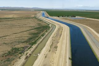
Santa Clarita / Antelope Valley : Major Developer Prepares Santa Clara River Blueprint : Environment: Newhall Land and Farming Co. proposes 49 construction changes along a 15-mile stretch.
- Share via
SANTA CLARITA — A major developer here has prepared a blueprint for construction along 15 miles of the Santa Clara River that is expected to influence development along the entire waterway.
The document outlines 49 changes to the river--bridges, levees, bank controls--over the next 15 to 20 years and is subject to approval by the U. S. Army Corps of Engineers. The agency is accepting written comment from the public through April 16.
“It’s a real balance between wildlife values, resource values, utilities and development issues,” said Mark Subbotin, vice president of planning for Newhall Land and Farming Co., which wrote the plan.
Newhall Land has been working toward comprehensive river management guidelines since 1986, including this specific plan for the past 18 months, and has spent more than $500,000 on river-related studies, Subbotin said.
The plan calls for preserving the Santa Clara River’s natural soft bottom and adding materials to riverbank sections where erosion occurs.
About 10% of the 1,300 acres of river land addressed by the document would be somehow modified, with a net addition of five acres of riverbed. Earth would be deposited to build up 62 cumulative acres of riverbank land and inhibit erosion, and another 67 acres would be excavated to widen the waterway in spots.
The work regulates the river’s path without narrowing the banks and covering them with concrete. Concrete channels speed up water flow, scour a riverbed farther downstream, disrupt river wildlife and prohibit water from seeping into the ground.
Environmentalists agree that the plan can set a precedent for future construction along the 100-mile river, but are cautious to endorse it. Few have yet read the plan’s two 4-inch-thick bundles of supporting documents, and cursory glances haven’t erased their skepticism.
“From what I can see, there’s a lot of bank stabilization going on and I’m distressed about that,” said Lynne Plambeck, vice president of the Santa Clarita Organization for Planning the Environment.
Any plan for the Santa Clara River should call for both a soft river bottom and natural banks to allow as much absorption of water into the ground as possible, Plambeck said.
Members of Friends of the Santa Clara River are to meet with Newhall Land officials today to discuss the plan. Chairman Ron Bottorff is concerned that the document is too restrictive for the waterway.
“Even though they don’t call it much of an impact by their standards, we think it is significant in how much it (limits) the meandering of the river,” Bottorff said.
Environmentalists said they hadn’t examined the plan enough to comment on its creation of additional riverbed land.
They said the plan should be discussed in public hearings before the Army Corps of Engineers rather than simply addressed by written letters.
City officials also have had only a cursory read of the document, but say any long-range plan for the river will assist their efforts to prepare for the river’s future.
“We’re looking forward to learning more about it,” said Jeff Kolin, deputy city manager.
More to Read
Sign up for Essential California
The most important California stories and recommendations in your inbox every morning.
You may occasionally receive promotional content from the Los Angeles Times.


