Hot Footing It Up the Lava Beds
- Share via
Millions of years of volcanic activity have left a landscape of lava tubes, and spatter and cinder cones in remote northeastern California. Something about the fiery origins of this land and the resultant caves and chasms attracts visitors to Lava Beds National Monument.
John Muir explained his fascination with the lava landscape in “Modoc Memories”: “The Modoc lava beds have an uncanny look that only an eager desire to learn their geology could overcome.”
The lava beds, along with surrounding lakes, mountains and forest, are the ancestral home of the Modoc. It was to this natural fortress created by the lava beds that the Modoc retreated during the Modoc War of 1872-’73. A Modoc group escaped the Oregon reservation where they had been confined and fled back to their homeland with the U.S. Army in pursuit. Modoc leader Captain Jacks and his greatly outnumbered warriors holed up in the rugged terrain and held off the Army for more than five months before surrendering.
For a majority of visitors, Lava Beds’ leading attraction is its many caves. They are not your basic, drippy, stalactite-hung limestone caverns, but caves fashioned by lava that erupted from Mammoth Crater about 30,000 years ago.
When hot (1,800 degrees Fahrenheit) lava flows from a volcano, the surface and edges cool quickly; the molten lava beneath, however, continues to flow, like a river that’s frozen on top but continues to run below--as park rangers are fond of explaining. When the flow stops, a so-called lava tube has been formed inside the hardened crust.
Catacombs, Hopkins Chocolate, Hercules Leg and Mushpot are among the colorfully named caves accessible from turnouts off Cave Loop Road. Hard-hats and flashlights are available from the visitor center for adventurers wishing to check out the network of underground passages. More elaborate caves, two with labyrinths a mile long, are open only to experienced spelunkers.
Early in this century, cave enthusiasts, joined by nature lovers, historians and local residents pushed for preservation of the lava beds. President Calvin Coolidge proclaimed Lava Beds National Monument in 1925.
In its early years, the national monument was managed by the U.S. Forest Service, but it was transferred to the National Park Service in 1933. During the 1930s, the Civilian Conservation Corps labored mightily to make the national monument more visitor friendly.
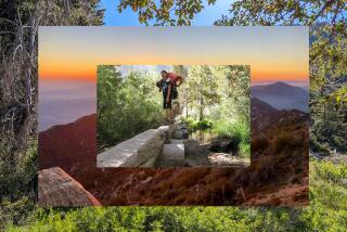
The national monument has many above-ground attractions too. Hikers can ascend several large cinder cones, such has Schonchin Butte, which has a lookout on the summit. Another butte is Whitney, which affords panoramic views of the volcanic landscape, including mighty Mt. Shasta.
Lava Beds National Monument is open all year. Summer is a popular time to tour the volcanic terrain, but many visitors prefer a spring or fall outing in order to see millions of migratory birds at adjacent Tule Lake National Wildlife Refuge.
Schonchin Butte Trail (1.5 miles round trip with 250-foot elevation gain) climbs a cinder cone for great views of the national monument. Sunrise and sunset are particularly good times to be on or around Schonchin Butte. The patterns of light and shadow on the cinder cone and surrounding lava fields can be dramatic.
The butte is named for Schonchin John, second in command to Captain Jack during the Modoc War. On the summit is an old fire lookout offering terrific vistas of the volcanic landscape--particularly the Schonchin Lava Flow to the northeast.
Because of its proximity to the visitor center, the short but steep ascent up the juniper-dotted slopes of Schonchin Butte is a popular one.
Directions to trail head: From the visitor center, follow the park road 2.5 miles north. Turn right at the signed turnoff for Schonchin Butte and drive a mile on dirt road to the trail head.
Captain Jack’s Stronghold is a volcanic rock field where a 1.5-mile-long interpretive trail tells the sad story of the battle that took place here. It was a heartbreaking and all-too-familiar story in the saga of how the West was won: Native Americans forced off their ancestral land onto a reservation. In the case of the Modoc, not only were they displaced to Oregon but also confined on a reservation with the Klamath, their longtime foes.
As you walk the rocky stronghold, you’ll note the obvious: It’s an almost perfect natural fortress, with ideal sniper positions. The Modoc had excellent views of the approaching U.S. Army. Less obvious is the defensive value of the surrounding environs, which look relatively flat and easy to negotiate; actually this terrain contains deep fissures and sharp rocks, which took their toll on the advancing soldiers.
Along with military history, a visit to the stronghold offers some insights into Modoc culture: the importance of the medicine flag believed to have magic powers and a ring called Curly Headed Doctor’s Medicine Circle, where the Modoc gave ritual expression to their feelings before battle.
At the trail head, pick up the park service interpretive pamphlet, Captain Jack’s Stronghold, which succinctly sums up the events of 1872: “The cultural identity of an entire people was lost here . . . so settlers could graze a few cows.” In addition to the 1.5-mile loop trail, a shorter half-mile loop also explores the stronghold.
Directions to trail head: From the visitor center follow the main park road north 13 miles to the signed parking area for Captain Jack’s Stronghold.
Whitney Butte Trail (seven miles round trip with 500-foot elevation gain) tours a Great Basin-like landscape and offers grand monument views from atop a small volcano. It’s one of three trails in the wilderness area of the national monument. Though an official Wilderness with a capital W, it’s not a particularly remote area. Ranches and rural development are visible in the near distance. Still, roads and vehicles don’t penetrate this land, which offers hikers some memorable views.
Whitney Butte Trail travels the wide-open spaces, tours a high desert environment of sagebrush, juniper and mountain mahogany, then approaches the massive Callahan Lava Flow. From atop 5,004-foot Whitney Butte, a small volcano, are great views of the national monument, nearby Modoc National Forest and Tule Lake National Wildlife Refuge, as well as that lord of all volcanoes--distant Mt. Shasta.
Hike past bunch grass and black basaltic rock as you gaze north toward Tule Lake. About 3.3 miles from the trail head is the short connector route to the summit of Whitney Butte. Enjoy your view from atop the small volcano, then return to the main trail.
Heading west, Whitney Butte Trail ends at the massive Callahan Lava Flow, an intriguing, but not-very-welcoming-to-walkers sheet of basalt.
Directions to trail head: From the park visitor center, drive two miles north to the signed turnoff for Merrill Cave. Turn left (west) and proceed half a mile to the parking area and signed trail head.
(BEGIN TEXT OF INFOBOX / INFOGRAPHIC)
Schonchin Butte, Captain Jacks, Whitney Butte Trails
WHERE: Lava Beds National Monument
DISTANCE: 1-7 miles round trip.
TERRAIN: Cinder cones, lava fields.
HIGHLIGHTS: Lava tube caves, Modoc War history.
DEGREE OF DIFFICULTY: Easy to moderate.
FOR MORE INFORMATION: Lava Beds National Monument, P.O. Box 867, Tulelake, CA 96134; tel. (916) 667-2282.
More to Read
Sign up for Essential California
The most important California stories and recommendations in your inbox every morning.
You may occasionally receive promotional content from the Los Angeles Times.


