Special Team Prepares as Linda Heads North
- Share via
The storm drains have been cleaned, the pumping stations are tuned up and the sand bags sit ready to be filled.
“We’re as ready as we can be,” said Pete Dalquist, a supervisor with Orange County’s team of engineers that prepares for and remedies storm problems. “We’re just sitting back, waiting for it to happen, and we’re ready to jump.”
Come Sunday, emergency workers could be doing just that.
The most powerful hurricane ever observed off the west coast of Mexico is headed toward Southern California, and forecasters say the leading edge of the storm could strike before the end of the weekend.
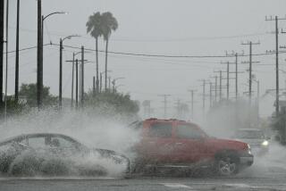
If Hurricane Linda--packing winds of up to 170 mph late Friday--does get here, the wind and rain almost certainly will have diminished, but gale-force gusts, heavy seas and downpours capable of triggering destructive mudslides and flash floods are still a possibility.
While the much-discussed El Nino meteorological condition did not create Linda, it has intensified the storm, according to Wes Etheredge, a meteorologist with WeatherData Inc., which provides forecasts for The Times.
“We’ve never seen one this big before in the eastern Pacific,” Etheredge said.
The last time Southern California felt the effects of a hurricane was in September 1976, when the remnants of a diminishing storm hammered the southern deserts of California with up to 13 inches of rain, causing widespread flood damage, the forecaster said.
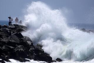
Linda also is expected to bring high surf and dangerous swimming conditions to the county’s coastline beginning Sunday afternoon, authorities said.
Hurricane Linda “is a very, very strong hurricane for this part of the world,” Etheredge said, “and it is so strong because of the abnormally warm waters off of Mexico, an effect of El Nino.”
Etheredge said that by nightfall Friday, Linda was centered about 320 miles south of Cabo San Lucas, the southern tip of the Baja California peninsula, and continuing to intensify. Etheredge said the storm’s projected track would place its center about 100 miles west of Scammon Lagoon, roughly halfway up the peninsula, by Sunday afternoon.
“After that, one of two things will happen, and we can’t be sure which, so the track after that isn’t certain,” he said.
Either an upper-level low pressure system farther west will pull the storm safely out to sea, or an upper-level trough of low pressure over the Southwest will pull the storm inland over Southern California.
In either case, Linda will be moving over cooler water, which will lessen its intensity. But this is an El Nino year, which has tossed a wild card into the deck.
El Nino is the term used to describe the unusually warm waters in the tropical Pacific Ocean off Peru, Etheredge said, adding that this year’s El Nino could be the most extreme since the early 1980s.
With all this in mind, local officials are keeping a close eye on the progression of Hurricane Linda.
Dalquist, with the Orange County Public Facilities Resource Department, said workers began about a month ago to make sure the storm drain system was in prime condition. It’s standard procedure to begin at the end of summer, he said, but the prospect of El Nino causing more severe weather prompted workers to accelerate their schedule, he said.
“We have literally cleaned every flood control channel of debris,” he said. The county has more than 300 miles of flood control channels, the biggest of which is the Santa Ana River.
The pumps at pumping stations, which help the waters flow evenly, have all been checked and “everything is tuned up,” he said.
Workers know where some of the county’s trouble spots are--such as the slide-prone canyons--but until rain hits, no one can predict exactly which areas will have trouble, he said. It can all depend on how much rain comes, how hard it comes down and the location of “cells”--big clumps of rain that can drench a small area.
“Everyone is prepared for winter storms a little earlier, and this [predicted rain] will be a good little test run to see if everything is in order,” he said.
WeatherData’s Etheredge said a heavy rainfall on dry, sun-baked ground can increase the chance of flash flooding.
“The drier your summer was, the better conditions you have for flash floods,” he said. Fires can reduce vegetation, and the ground will be more likely to slide, he said.
To combat flooding and slides, empty sandbags are available at many of the fire stations, an Orange County Fire Authority spokesman said. Dalquist said the county also is providing them a facility at 10852 Douglas Road, Anaheim. Sand is available at the Anaheim facility, but takers have to fill the bags themselves.
Regardless of whether Hurricane Linda produces rain for Southern California, it can be counted on to churn up big surf, said Sean Collins, a forecaster with Surfline.
The first big waves are expected to arrive Sunday afternoon at the south-facing beaches, from Laguna Beach northward, he said. He expects the Newport and Huntington beaches to get 5- to 8-foot waves, with sets of up to 10 feet.
The surf will continue to grow through the night, and on Monday, all of the county’s beaches should be getting pounded, he said. Southern Orange County’s shoreline will get 5- to 8-foot waves, and Newport and Huntington beaches could get waves of 12 to 15 feet on Monday, he said. The conditions also will produce a longshore current, which creates riptides and can be hazardous to swimmers, he said.
Scattered high clouds from the fringes of the storm are expected over parts of Southern California late today. If Linda continues to head this way, warm, muggy weather should be the rule by midday Sunday.
More information on the hurricane is available through a National Weather Service website on the Internet at https://www.nhc.noaa.gov/products.html
(BEGIN TEXT OF INFOBOX / INFOGRAPHIC)
Wet Weather Ahead?
Should Hurricane Linda make its way in some form to Orange County to begin a season of El Nino-related rain, it could be the start of a particularly wet winter. In two of three El Nino seasons beginning 1982-83, rainfall was about 11 inches more than the average. County rainfall in inches:
Legend: El Nino seasons
1982-83: 24.80
1991-92: 15.40
1994-95: 25.83
Note: Rainfall as measured in Santa Ana
Source: WeatherData Inc.
More to Read
Sign up for Essential California
The most important California stories and recommendations in your inbox every morning.
You may occasionally receive promotional content from the Los Angeles Times.


