Road Scholars
- Share via
For most people, the thought of doubling the number of cars on the Southland’s crowded highways inspires dread and maybe a little road rage. But for a group of research engineers along the Tech Coast, it is something of a Holy Grail.
These researchers at UCLA, USC, UC Irvine and UC Riverside are developing intelligent transportation technologies that, when fully implemented, could boost freeway capacity as much as 200% while reducing travel time and cutting back on air pollution.
“Certainly there’s been a whole sequence of technological innovations since Henry Ford, but the thing that hasn’t changed since Henry Ford’s time is the interaction between the vehicle and the roadway,” said Steven Shladover, deputy director of Partners for Advanced Transit and Highways, a research effort administered by UC Berkeley that receives about $6 million a year from the California Department of Transportation, as well as funding from other sources.
PATH’s goal is to make cars “smarter” by enabling them to communicate and synchronize their positions with other vehicles on the road. That would allow for a smoother flow of traffic, which--in theory--would prevent collisions, reduce congestion and cut hydrocarbon emissions 10% to 20%.
“These technologies offer an opportunity for making some really significant improvements in the way the transportation system works, just like modern electronics have improved many other aspects of life,” Shladover said. “This makes it possible to significantly improve the efficiency and safety and comfort and convenience and emissions and fuel economy associated with travel.”
Futurists have envisioned intelligent transportation systems since the 1930s, but not until last summer were researchers able to provide a practical demonstration of an automated highway: 10 driverless Buicks cruising along a carpool lane in northern San Diego County.
Moving from that stage to implementation, however, will require more research.
In order for cars to coordinate with one another, they must have intelligent cruise-control systems. Instead of merely maintaining a constant speed, a car with intelligent cruise control could, in theory, maintain a constant distance behind another car, automatically speeding up or slowing down in response to changes in the lead vehicle. Intelligent cruise-control systems could also guide cars around curves or into another lane when necessary.
In prototypes under development at UCLA and elsewhere, tiny sensors mounted on a car gather data about nearby vehicles and lane markers, then feed the information to an on-board microprocessor, which uses it to calculate relative speed and distance. The microprocessor sends commands to chip-size machines called actuators, which control the car’s throttle and brake to make it speed up or slow down.
The challenge is to build not only a working system, but an inexpensive one. Engineers at UCLA are using infrared sensors instead of more pricey radar to track distances between cars, for example.
UCLA’s IRIS system (for Intelligent Ranging with Infrared Sensors) packs a microprocessor, a semiconductor-based camera known as a charge-coupled device and a low-power laser into a contraption about the size of a garage door opener.
The CCD camera takes an electronic picture of the car ahead. A fraction of a second later, it takes a second picture, this time with the laser illuminating special reflective patches on the lead car’s taillights and license plate.
The system then produces a digital image of the lead vehicle’s taillights and license plate and compares the pictures. By repeating this process over and over, the chip can use standard triangulation techniques to determine the relative speed of the car ahead. (A two-camera system that determines the actual distance between the vehicles and the speed at which they are traveling is also under development.) The information is used to decide whether the car should speed up or slow down.
*
The IRIS system is at least four to five times cheaper than a comparable radar-based system, said Ioannis Kanellakopoulos, a UCLA electrical engineering professor who has spent the last seven months developing IRIS with professor Oscar Stafsudd and researcher Phyllis Nelson. They are testing the hardware on a car at the Westwood campus and are in talks with several potential industry partners about commercializing the technology.
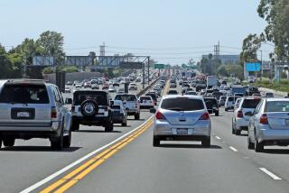
Researchers at the Center for Advanced Transportation Technologies at USC expect intelligent cruise control to practically eliminate the familiar “slinky effect” that occurs when a road disturbance causes pockets of backed-up traffic. In a traffic jam, anxious drivers speed up as much as they can when the car ahead of them starts to move, then are forced to slam on the brakes and come to a quick stop, creating frustrating stop-and-go conditions, said Petros Ioannou, director of the USC center.
With intelligent cruise control, cars would be programmed to synchronize their speed with the vehicles ahead of them, eliminating the herky-jerky pattern of such tie-ups.
A study conducted by Ioannou found that as more drivers install intelligent cruise-control systems, more cars could be on the freeway at once without a corresponding increase in travel time.
In a single hour, a typical freeway lane can handle about 2,000 cars traveling at 60 mph. If half the cars on the road were equipped with intelligent cruise control, the same lane could carry nearly 3,000 cars in the same period. With 80% of cars equipped, the capacity is more than 4,000 cars in an hour, and if all cars had the technology, nearly 5,500 vehicles could use the single freeway lane.
UCLA’s Kanellakopoulos is also working on a computer model to simulate the behavior of big-rig trucks driving in synchronized platoons. He and others believe the trucks could be strung together like train cars using “electronic tow bars”--sensor and actuator systems that could eliminate the need for human drivers in all but the front-running rig. An 18-wheeler near PATH headquarters in Berkeley is being outfitted for automated-driving tests in April.
At UC Riverside, electrical engineering professor Jay Farrell is using data from global positioning system satellites--the core of the system now used to provide the electronic map displays found in many rental cars--to develop a more precise technology that can tell cars exactly where they are.
Farrell says technology he is developing should be able to pinpoint a vehicle’s location to within 1 centimeter (0.4 inch) by keeping track of the number of radio wave cycles in a GPS signal to calculate how far a receiver is from a specific satellite. Once the precise distance is known, a vehicle can use a navigation system of gyroscopes and accelerometers to calculate its changing position as it moves away from the starting point.
*
But Farrell said combining GPS navigation with intelligent cruise control so a car can figure out where to go and then drive there is at least 10 years away. More funding is needed to resolve some “nitty-gritty technical issues,” such as how often the system would have to confirm its location with the GPS system. An even bigger hurdle, he said, is improving obstacle detection so that cars can maneuver around occasional highway nuisances, like a sofa fallen off the back of a truck.
Researchers at the Institute of Transportation Studies at UC Irvine are developing traffic management software to reduce gridlock caused by collisions, stalled cars and other roadway disturbances.
The center uses traffic data supplied over fiber-optic networks in real time from Caltrans to test its computer models, said Baher Abdulhai, a research engineer at the institute. One program under development would divert traffic from highways to surface streets to circumvent accidents and automatically adjust the timing of traffic lights in order to accommodate the additional cars.
It’s not just convenience that might be enhanced by these new systems. A reduction in hydrocarbon emissions could also result if the systems reduce the amount of time vehicles spend on the roads, said Matthew Barth, an electrical engineering professor at UC Riverside.
Moreover, by cutting down on stops and starts, smart driving will improve air quality, because a car’s emissions control system is most effective when the car is being driven at a steady rate, Barth said.
However, if intelligent transportation technologies improve freeway conditions so much that drivers take to the roads in greater numbers, all of these benefits could be wiped out, he acknowledged.
Even with all the technical obstacles, members of the PATH consortium are convinced that solving them is cheaper than the alternative.
“We either have to manage our existing capacity better or build more roads,” Abdulhai said. “But we don’t have money for more roads, and we don’t have space for more roads, and the environment can’t handle new roads.”
*
Karen Kaplan covers technology, telecommunications and aerospace. She can be reached at karen.kaplan@latimes.com
(BEGIN TEXT OF INFOBOX / INFOGRAPHIC)
Traffic Control
“Smart” cars could increase the traffic capacity of today’s freeways without requiring any new road construction. Sensors and actuators would work in tandem to pack more cars in traffic lanes. The devices would help vehicles maintain a safe distance from one another and keep them cruising at a constant speed, eliminating much of the abrupt acceleration and brakingthat causes traffic jams and adds to air pollution.
How It Works
Researchers are designing intelligent cruise-control systems that allow one car to follow another. The high-tech car will automatically slow down if the car ahead slow, or speed up if the lead vehicle accelerates. Tiny sensors attached to the front of a car can measure the distance between it and the vehicle ahead. Engineers at UCLA are using infrared technology to build an inexpensive system that uses lasers like those found in compact disc players.
Capturing Reflections: A laser bounces off reflective patches in the taillights and reflective paint in the license plate. These reflections become data that are recorded and “compared.”
Electronic Snapshots: A microprocessor instructs a charge-coupled device, or CCD, to take an electronic picture (brown arrow) of the car in front. A split second later, a laser fires and the CCD camera takes another picture (pink arrow), this time with the laser illuminating reflective patches on the taillights and the license plate.
Infrared Sensor Attached to the rear-view mirror
Gauging the Distance: The CCD repeats this process over and over, comparing the position of the license plate and taillights, which enables it to determine the relative speed of an distance between the two cars.
Tell Me What to Do: After measuring changes in the relative distance, the microprocessor decides whether the car should speed up or slow down. Commands are then sent to tiny actuators controlling the car’s throttle and brakes.
Better Technology, More Cars
As more drivers adopt “smart” technology, highway capacity grows. Vehicles per hour, per lane:
0%: 2,000
10%: 2,134
20%: 2,293
30%: 2,466
40%: 2,687
50%: 2,927
60%: 3,214
70%: 3,600
80%: 4,045
90%: 4,651
100%: 5,455
Percentage of ‘smart cars’
Sources: Center for Advanced Transportation at USC; UCLA


