Lassoing Country, Beach Vistas in Rodeo Valley
- Share via
Rodeo Valley is the mother of all trail heads for the Marin Headlands, the jumping-off place for explorations of beaches, military history and the bold beauty of the headlands just north of the Golden Gate Bridge.
Sweeping grasslands, pebbly beaches and ridge tops with dramatic vistas beckon the hiker. To learn more about Marin’s military past and its considerable environmental attractions, stop at the Marin Headlands Visitor Center.
The visitor center is housed in what was once the Ft. Barry Chapel, an interdenominational gathering place built in 1941 that held Catholic, Protestant and Jewish services for troops preparing to go to war. The center has displays interpreting the area’s history from the native Coast Miwok era to modern times, as well as a fine little gift shop and bookstore.
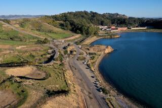
Rodeo Lagoon Trail (1.5 miles round trip) is the easiest introduction to the headlands; in fact, it’s about the only flat trail around. Gaze up at the headlands in back of the visitor center--and you’ll see how hilly they are.
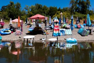
On the way to Rodeo Beach, the trail skirts the mostly freshwater lagoon, home to flotillas of ducks and pelicans, egrets, herons and kingfishers. The pebbly, often windy beach is a favorite of kite fliers and a treat for rockhounds who marvel at the black agates, jasper and other stones strewn about the shore.
The beach cliffs offer a fine vantage point for a look at harbor seals and sea lions swimming in the surf and resting on the rocks. Strong currents and cold water discourage swimmers and all but the boldest surfers.
Just a mile back from the coast, northeast of Rodeo Valley, lies a land that many hikers consider the wildest. Lovely Gerbode Valley, named for Marin Headlands preservationist Martha Gerbode, is the centerpiece of the park’s back country.
In the mid-1960s, developers intended to construct enough houses, stores and roads to support a city of 18,000 on this wild land. Thanks to the efforts of conservationists, the land passed from military to National Park Service administration and stayed out of the hands of private developers.
From the ridge tops above the valley, the hiker gains great views of the bay, from Tiburon to the Golden Gate Bridge towers, as well as to the north of mighty Mt. Tamalpais. The park service intends to restore this compelling area to an even more natural condition by replacing foreign grasses introduced long ago during California’s Spanish days with native species.
By all accounts, Bobcat Trail may be well named; hikers have reported many sightings of the creatures in what is excellent habitat for the animals. Other watchable wildlife includes coyote, deer, rabbits and the occasional fox.
A spider web of trails explores the Gerbode as well as adjacent hills and valleys. For a fine circle tour, take Bobcat Trail on a mellow climb to the ridgeline, then descend via Miwok Trail.
Directions to trail head: From U.S. 101 northbound, just north of the Golden Gate Bridge, exit on Alexander Avenue. Turn left and go under the 101, then briefly backtrack south to Conzelman Road. Bear right and drive a mile to junction McCullough Road. Turn right and proceed 0.8 mile to Bunker Road. Turn left and drive two miles to the parking area for the Marin Headlands Visitor Center. Join signed Lagoon Trail on the west side of the parking lot.
The hike: Those hikers bound for Rodeo Beach will follow Lagoon Trail toward the ocean, while those heading for the hills will take Lagoon Trail on a stairstepping descent north. You briefly parallel Bunker Road, then cross it. Join the wide path (Miwok Trail) to the right (east) of a long warehouse and walk a flat 0.5 mile to a signed junction. Miwok Trail heads north, but you join Bobcat Trail, which at first leads east and then, after junctioning Rodeo Valley Trail, climbs northeast.
Better and better valley views unfold as you climb. As you approach the ridge crest, you’ll hear the eerie sound of the wind vibrating high-tension power lines.
Bobcat Trail turns west atop the ridge crest and offers views of U.S. 101, Sausalito and Richardson Bay. Now you step toward a scene out of an old sci-fi flick: a white space capsule-like metal cone pointed skyward.
Greetings, Vortac. It’s a directional homing device for aircraft, what the Federal Aviation Administration calls, without regard to brevity, a Very High Frequency Omni-Range and Tactical Air Navigation Aid.
About 3.5 miles from the trail head, you’ll say goodbye to Vortac and join signed Miwok Trail as it winds around the fenced-off Vortac’s summit perch. Miwok Trail turns south and descends past junctions with Old Springs and Chaparral trails. It’s an easy descent back to the junction with Bobcat Trail.
Retrace your steps to the trail head or follow the north leg of Rodeo Lagoon Trail to Rodeo Beach.
(BEGIN TEXT OF INFOBOX / INFOGRAPHIC)
Lagoon, Bobcat, Miwok Trails
Where: Golden Gate National Recreation Area.
Distance: To Rodeo Beach is 1.5 miles round trip; keep around Gerbode Valley is 6.4 miles round trip with 500-foot elevation gain.
Terrain: Rugged hills back of Rodeo Beach
Highlights: Rodeo Lagoon, Golden Gate and Sausalito vistas.
Degree of Difficulty: Rodeo Lagoon is easy. Gerbode Valley is moderate.
For More Information: Golden Gate National Recreation Area: tel. (415) 556-0550 or Marin Headlands Visitor Center: tel. (415) 331-1540.
More to Read
Sign up for The Wild
We’ll help you find the best places to hike, bike and run, as well as the perfect silent spots for meditation and yoga.
You may occasionally receive promotional content from the Los Angeles Times.


