El Nino Might Be Returning
- Share via
WASHINGTON — The world may be headed for another bout with El Nino.
The periodic event that can trigger changes in the weather worldwide could return in early spring and affect the United States by late summer, the federal Climate Prediction Center reported Thursday.
The severity of the effects depends on how strong the El Nino is, and it’s too early to predict that, said Vernon Kousky of the climate center, a division of the National Oceanic and Atmospheric Administration.
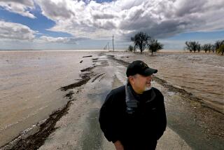
A severe El Nino in 1997-98 caused flooding in California and along the Gulf Coast.
The first signs of an El Nino are an unusual warming of the water in the tropical Pacific Ocean, something that has begun to occur, the agency said. That can result in increases in rising warm air, changes in the air pressure patterns and shifts in the high-level winds that direct the movement of weather.
The climate center said indications of the current warming include increased cloudiness and rainfall over the equatorial central Pacific for the first time since the last El Nino.
“Considering the observed oceanic and atmospheric circulation patterns and their recent evolution, it seems most likely that warm-episode conditions will develop in the tropical Pacific over the next three to six months,” Kousky said.
The first area affected would be the tropical Pacific, he said, with Indonesia likely to get some relief from torrential rains.
If El Nino develops as expected, the Pacific Northwest will experience wetter than normal conditions in the fall. In the winter, Louisiana eastward to Florida, and possibly Southern California, could also experience wetter than normal conditions, and the northern Great Plains could experience warmer than normal conditions, Kousky said.
El Ninos are associated with increased rainfall across the east-central and eastern Pacific and with drier than normal conditions over northern Australia, Indonesia and the Philippines.
During an El Nino, December to February will usually see wetter-than-usual patterns along coastal Ecuador, northwestern Peru, southern Brazil, central Argentina and equatorial eastern Africa.
Drier-than-normal conditions are generally observed over northern South America, Central America and southern Africa during this period.
During June to August of an El Nino, it will be drier than normal over eastern Australia and wetter than usual in the intermountain regions of the United States and over central Chile.
Temperatures during December to February of an El Nino year tend to be abnormally high across Southeast Asia, southeastern Africa, Japan, southern Alaska and western-central Canada, southeastern Brazil and southeastern Australia.
In June to August of an El Nino, it tends to be warmer than normal along the west coast of South America and across southeastern Brazil.
The causes of El Nino are not fully understood, but climate records show the event has been occurring for hundreds of years.
Historically, El Ninos have occurred every two to seven years and can last up to 12 months. Sometimes an unusual cooling of the tropical Pacific, called La Nina, occurs in between.
El Nino means little boy in Spanish. The effect was named by Peruvian fishermen who would notice its effect on their catch around Christmas and called the phenomenon after the baby Jesus.
More to Read
Sign up for Essential California
The most important California stories and recommendations in your inbox every morning.
You may occasionally receive promotional content from the Los Angeles Times.


