Internet Offers Way Out of Freeway Traffic Jams
- Share via
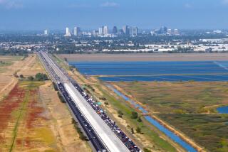
Sometimes, Bob Andosca forgets. Without consulting an online traffic map to see if I-5 is already backed up, he jumps into his car and joins the other commuters deserting downtown Sacramento. The memory lapse can be costly, adding 40 minutes and incalculable irritation to a drive home that takes him an hour and 20 minutes under the best of circumstances.
“Because there are two routes I can take, I use this information almost daily to plan which way to go,” said Andosca, president of the California Alliance for Advanced Transportation Systems. “When I forget, an accident that occurred before I left the office might mean I spend half an hour going three miles.”
If the head of a trade group that promotes high-tech solutions to transportation problems occasionally overlooks the travel data he can find on his computer, perhaps it is not surprising that the idea has failed to catch on with the average motorist. Despite the proliferation of Web sites carrying so-called real-time traffic reports, such information remains an underutilized feature of the Internet, something that appears to have as much relevance in the minds of consumers as a month-old newspaper, according to content providers and market research firms.
“People are so used to getting what they need off the radio. They already know that they are just going to be stuck in traffic or that it usually takes them an hour to get home. So they aren’t as interested in looking up a particular problem because they figure there isn’t anything they can do about it,” said Lisa Osborne, a veteran radio traffic reporter who, two years ago, founded an Internet site called Traffic411.com.
But the public agencies and private companies that are trying to put more useful traffic information into the hands of gridlocked drivers insist that, if expected technological advances come through, cyberspace could become as essential to commuters as cup holders. Among the anticipated breakthroughs are programs that recalculate the amount of time it will take to pass through a freeway segment, basing the conclusions on current road conditions and in-vehicle navigation systems that can direct motorists to alternate routes when they get bogged down.
“Getting the information in the car, a display of a map that will show the approximate speed at the points you requested and recommend a way you should go based on that, is where the industry is heading,” said Clem Driscoll, senior partner of the market research firm Driscoll-Wolfe.
Meanwhile, however, the traffic for Internet sites providing traffic information isn’t exactly bumper-to-bumper. According to a survey of 2,500 adult Internet users conducted over the summer by Jupiter Research, only 4% used the Web as their preferred medium for receiving traffic updates, compared with 24% who favored television broadcasts and 52% who counted on radio reports.
John Cox, CEO of Travel Advisory News Network, a Diamond Bar-based traffic information service launched five years ago with support from the Southern California Assn. of Governments, acknowledged that companies like his “haven’t even scratched the surface yet, in terms of reaching the number of commuters out there.”
Cox estimates that the maps his company produces and then makes available through its Web site and the Web sites of media clients such as The Times are seen by only 100,000 to 150,000 users a month. This in an area where there are 6 million people on the roads every day.
“Every quarter-hour there are 1 million people in drive time listening to a traffic report. We do about 1.8 million page map views a month. That’s nothing compared to what the radio is doing,” he said.
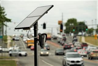
All traffic sites essentially rely on the same set of data, which is obtained from California Highway Patrol reports and cameras and sensors that Caltrans has installed along and under the freeways. On most online maps, real-time freeway speeds appear in a string of color-coded dots -- with green representing smooth sailing, yellow troubled waters and red an SOS. Flashing stars and exclamation points indicate accidents, construction zones and other hot spots.
Some Web sites have additional features designed to make them more user-friendly. At TrafficBee.com, for instance, an estimated 12,000 subscribers have signed up to receive free e-mail alerts about problems on their regular routes. Duke Bristoe, a UCLA economist, is a fan of the maps posted on Traffic411, which he visits whenever he has to drive across town. Surveying the site late one afternoon last week, for example, he could tell from the splashes of green and red that “anyone leaving downtown right now should just take the 101 across, because the 10 is so jammed.”
“I think it’s a terrific service. I don’t know why everybody doesn’t have it on their desktop. It will save you one hour a week, if you routinely drive the freeways of Los Angeles,” he said.
Cox of the travel advisory network said that feedback from the savvy travelers who regularly use his service suggests that the existing sites, though little used, are already prompting some drivers to change their commuting patterns. About 87% of the participants in a focus group and online survey indicated that they had altered their travel plans on the basis of what they had seen on the blinking maps, either delaying their departures or changing their routes.
“The avid user, the traffic junkie, knows more about what those red dots mean on the map than Caltrans does, because they live and die by those in order to make their commute more comfortable for them,” Cox said. The company’s surveys show that the maps are used most often in the afternoon by people in West Los Angeles.
So if the sites are so helpful, why aren’t more people using them?
Both Cox and Andosca think that many people simply don’t know what is available. What the data show “is that the consumer is not aware. The technology is here. It is being applied and deployed. But it’s not being marketed as a vital tool,” Andosca said.
The potential of online traffic information has also been limited because its users have been able to use it only when they are at home or at the office. Since driving conditions can deteriorate in the time it takes to say “jackknifed big rig,” the information quickly becomes obsolete. As more cell phones and hand-held computers start coming equipped with Internet access, interest should jump, according to market analyst Driscoll.
“People are tired of the fact that 90% of the information they get on the radio doesn’t relate to where they are going,” he said.
More to Read
Sign up for Essential California
The most important California stories and recommendations in your inbox every morning.
You may occasionally receive promotional content from the Los Angeles Times.


