Trifecta isn’t uncommon
- Share via
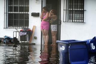
Despite the prospect of three major tropical storms heading toward the Southeastern United States, meteorologists say that the conga-line assault is not particularly unusual in the stormy history of the region.
“We’re in peak season in an active hurricane cycle, and this is one of the results of that,” said Dennis Feltgen, a meteorologist and public affairs officer with the National Hurricane Center in Miami.
“We’ve had incidents where four or five storms have been stacked up.”
The first of the storms, Hanna, was expected to reach the Carolina coast late Friday or early today with sustained winds of 65 mph, according to the National Weather Service.
Hurricane Ike was on a path to reach southern Florida early next week, and Tropical Storm Josephine was on deck between the western coast of Africa and the Caribbean.
With 10 named storms already, the 2008 Atlantic season is certain to top the yearly average of 11.
Forecasters at the National Oceanic and Atmospheric Administration’s Climate Prediction Center recently projected 14 to 18 named storms before the season ends Nov. 30.
Hanna, Ike and Josephine all formed from strong thunderstorms off the western coast of Africa.
As those storms drifted out into the Atlantic, they encountered warm water, moist air and light winds, conditions that allowed them to organize into tropical storms and hurricanes, said Corene J. Matyas, an assistant professor of geography at the University of Florida in Gainesville who studies hurricanes.
Natural forces often prevent multiple hurricanes from forming at the same time.
Josephine wasn’t getting much traction in part because Hanna -- which qualified as a Category 1 hurricane earlier this week -- had a broad cloud shield that kept ocean temperatures relatively cool, Matyas said.
Scientists said global warming could not be blamed for the trio of storms lined up in the Atlantic.
“One cannot attribute an individual storm, month or hurricane season to global warming, since that involves long-term trends in atmospheric and oceanic conditions,” said David Levinson, a scientist with NOAA’s National Climatic Data Center in Asheville, N.C.
Warmer ocean water could provide more fuel for storms, but the effect would not be that great, said Christopher Landsea, science and operations officer for the National Hurricane Center.
Ocean temperatures are forecast to rise 2 to 6 degrees over the next century, and each 1-degree increase boosts hurricane severity by 1%.
In the worst-case scenario, storms could get about 5% stronger, he said.
“Put it in the context of a Category 5 hurricane,” Landsea said. “If before greenhouse gas emissions it would have been 150 mph, then 100 years from now maybe it’ll be 157 mph. That’s a pretty small change.”
--
More to Read
Sign up for Essential California
The most important California stories and recommendations in your inbox every morning.
You may occasionally receive promotional content from the Los Angeles Times.


