Moms in California may need parasols while moms in the East need parkas this weekend

- Share via
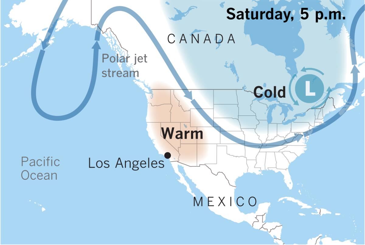
This Mother’s Day weekend, while moms in the West keep parasols handy and bask in summery conditions, moms in parkas will struggle to stay warm in the East.
A blast of frigid Arctic air will turn May chilly and blustery in most of the Eastern U.S., while near-record heat persists out West, the National Weather Service said.
Frost advisories and freeze warnings are up across the Midwest, and snow is possible for the Northeast region and Great Lakes, with heavy snow forecast for northern New England. Accumulations of several inches are possible in the northern and central Appalachians.
Meanwhile, an extensive upper-level ridge will continue to maintain unusually warm conditions in the West through the weekend. Temperatures at some locations in the Pacific Northwest could break records for the date on Saturday.
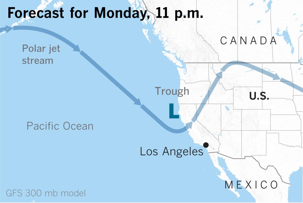
Abnormal warmth will last through Mother’s Day, but an approaching trough will bring cooler readings to California next week.

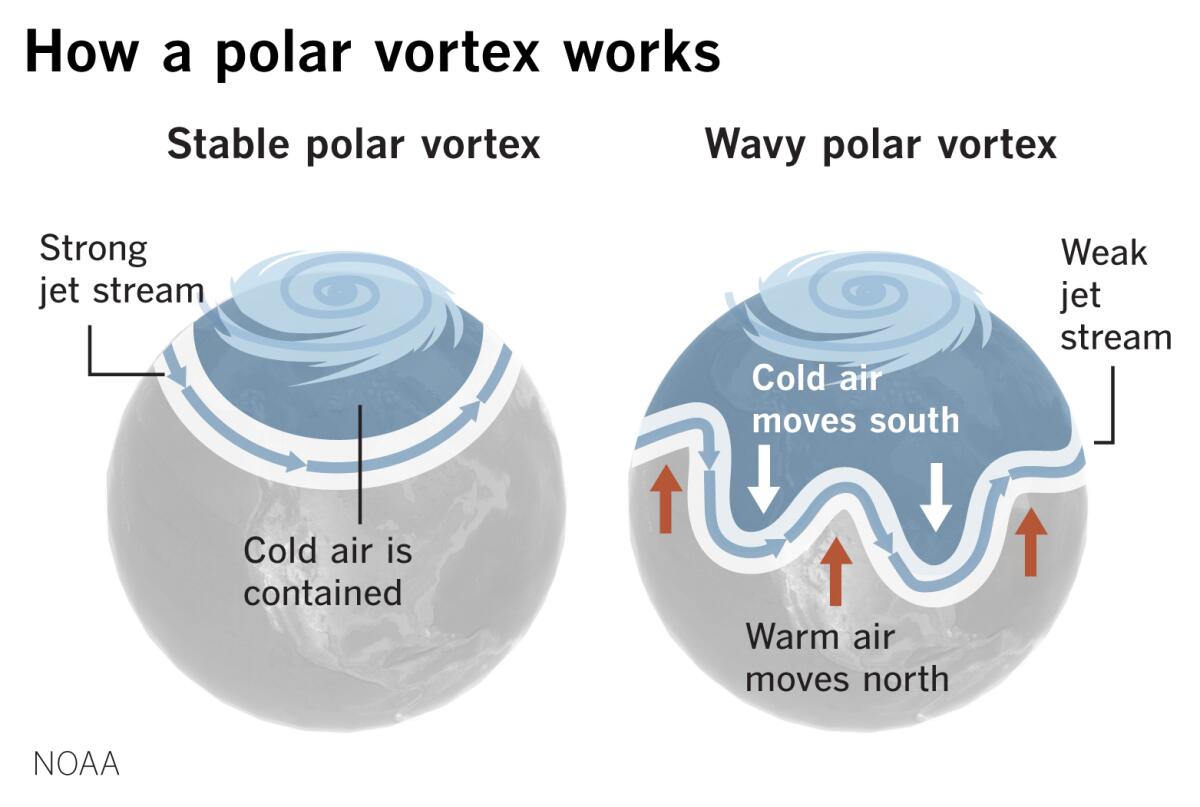
The cold in the Eastern U.S. is the result of an unruly lobe of the polar vortex dipping down from the Arctic. The winter that just ended was the sixth-warmest on record in the contiguous United States, according to the National Oceanic and Atmospheric Administration. One feature of that winter season was a strong zonal, west-to-east-flowing polar vortex. Now the polar vortex is behaving in May as you might expect it to in February or March.
Wintry precipitation could also be widespread across parts of the Great Lakes, Appalachians and Northeast, and severe thunderstorms with damaging winds and large hail are possible on the central Gulf Coast. Temperatures in the Eastern U.S. will remain below normal, but will begin to moderate on Sunday.

On the West Coast, there will be a gradual cooling trend into next week as an upper-level trough approaches from the eastern Pacific. Morning low clouds and fog will return to the Southern California coast Friday night and spread into adjacent valleys next week. There’s a chance of light showers developing Monday night through Tuesday. Rainfall is likely to be light — 0.10 inch or less.
The system is expected to bring light to locally moderate precipitation to the Bay Area on Monday, with showers lingering Tuesday. Rainfall amounts are expected to be highest north of the Golden Gate, with a quarter-inch to an inch possible in the North Bay, and amounts tailing off going southward.
Any precipitation in parched Northern California could, however, help to delay the start of the fire season. And models are supporting the possibility of another stronger storm system arriving in the Bay Area May 17-18, the National Weather Service said.
More to Read
Sign up for Essential California
The most important California stories and recommendations in your inbox every morning.
You may occasionally receive promotional content from the Los Angeles Times.


