Rain likely in Northern California as late-season system arrives from the Pacific

- Share via
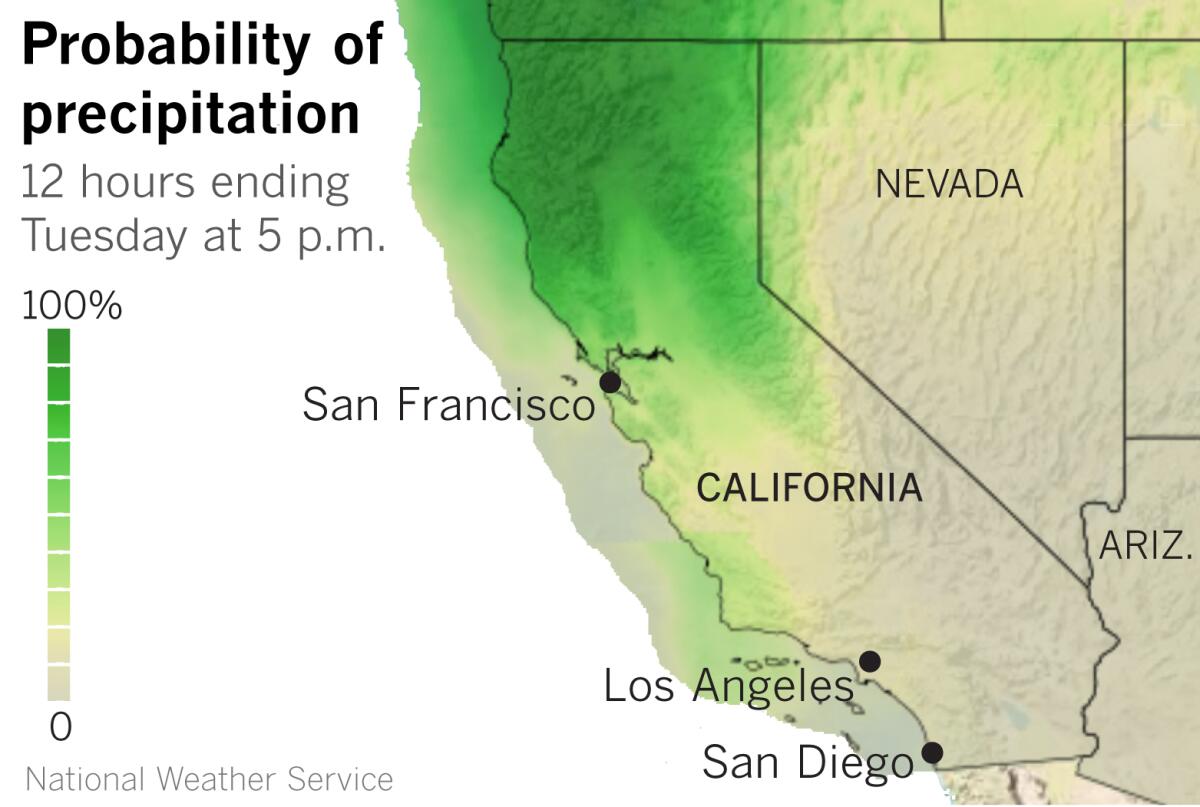
A low-pressure trough pushing into Northern California from the eastern Pacific will bring widespread showers to the part of the state most in need of rain.
The trough is expected to push a cold front into Northern California Monday morning through Monday evening, causing widespread showers and breezy southwest winds gusting 25 to 40 mph in the higher elevations, the National Weather Service said. Showers will continue Monday night and Tuesday as the trough itself pushes through, and weak instability could cause thundershowers. High temperatures will be 5 to 10 degrees below average on Monday, and as much as 20 degrees below average on Tuesday.
To the south, the cold front associated with the trough will bring a deep marine layer and a slight chance of light rain, mainly in San Luis Obispo and Santa Barbara counties, on Monday night and Tuesday morning.
The rainfall in Northern California will not be enough to alleviate the ongoing drought, but it could delay the start of the fire season a little. The National Interagency Fire Center has predicted above-normal potential for large wildfires by midsummer.
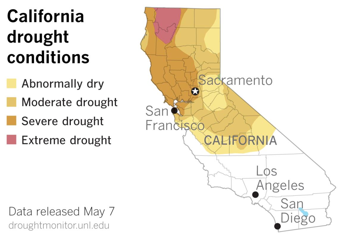
The most recent U.S. Drought Monitor data released Thursday show a slight expansion of the areas of the state considered to be in moderate and severe drought.

The portion of California in moderate drought increased from about 22% to 23.3%, and the portion in severe drought expanded from 14.9% to 15.6%.
The part of the state up by the Oregon border that is in extreme drought declined from 4.7% to 3.9%. May got off to a wet start as 1 to 3 inches or more of rain fell on coastal southwest Oregon and extreme northwest California, the U.S. Drought Monitor reported.
Otherwise, precipitation for the water year to date since Oct. 1 has averaged less than 50% of normal across parts of Oregon, Northern California and the Great Basin.
The portion of the California not considered to be in drought, mainly in the southern and central part of the state, remained at 41.8%. Southern California benefited from some winter-like late-season storms, but has since baked under persistent heat waves as a summer-like ridge of high pressure has camped over California and the Southwest.
This week’s upper-level trough is expected to be slow to move out, so showers could linger in Northern California into Wednesday and Thursday before high pressure and dry, warmer weather return to that part of the state. But long-range trends suggest another trough could bring another late-season rain chance to Northern California around May 17.
More to Read
Sign up for Essential California
The most important California stories and recommendations in your inbox every morning.
You may occasionally receive promotional content from the Los Angeles Times.


