Tropical Storm Barry threatens New Orleans with a long, slow drenching

- Share via
Reporting from New Orleans — Building toward hurricane strength, Tropical Storm Barry began hitting Louisiana with wind and rain Friday as it closed in for what forecasters said will be a long, slow — and epic — drenching that could trigger flooding in and around New Orleans.
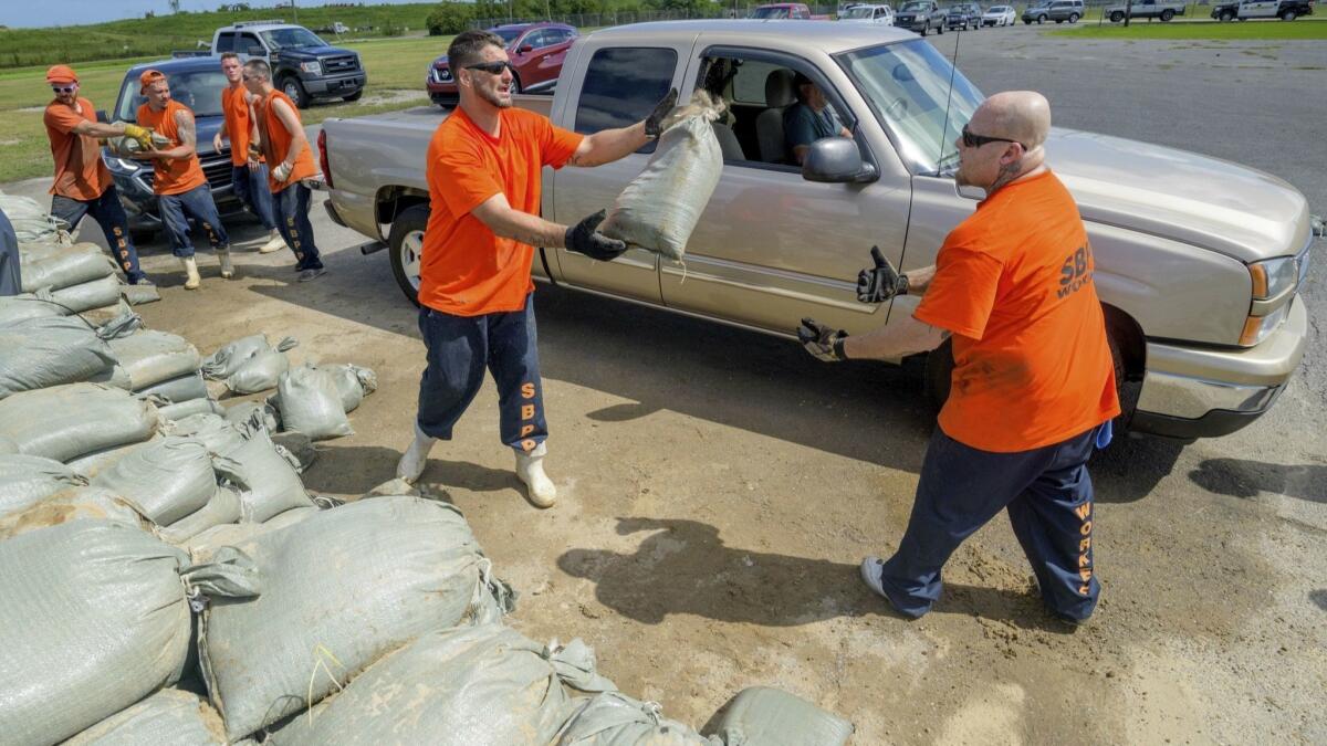
With the storm expected to blow ashore by early Saturday as the first hurricane of the season, National Guard troops and rescue crews were posted around the state with boats, high-water vehicles and helicopters. Drinking water was stockpiled.
Utility repair crews with bucket trucks moved into position in the region. Homeowners sandbagged their property or packed up and left. And tourists crowded New Orleans’ airport in hopes of getting out of town ahead of the storm.
“This is happening. ... Your preparedness window is shrinking,” National Hurricane Center director Ken Graham warned. He added: “It’s powerful. It’s strengthening. And water is going to be a big issue.”
Forecasters said slow-moving Barry could unload 10 to 20 inches of rain through Sunday across a swath of Louisiana that includes New Orleans and Baton Rouge, as well as southwestern Mississippi, with pockets in Louisiana getting 25 inches. Some low-lying roads near the coast were already covered with water Friday morning as the tide rose and the storm pushed water in from the Gulf of Mexico.
Barry was expected to roll in as a weak hurricane, just barely over the 74 mph wind-speed threshold. But authorities warned people not to be fooled by that.
“Nobody should take this storm lightly just because it’s supposed to be a Category 1 when it makes landfall,” Louisiana Gov. John Bel Edwards said. “The real danger in this storm was never about the wind anyway. It’s always been about the rain.”
Barry’s downpours could prove to be a severe test of the improvements made to New Orleans’ flood defenses since the city was devastated by Hurricane Katrina in 2005. The Mississippi River is already running abnormally high because of heavy spring rains and snow melt upstream, and the ground around New Orleans is soggy because of an 8-inch torrent of rain earlier this week.
The Mississippi is expected to crest Saturday at about 19 feet in New Orleans, where the levees protecting the city range from about 20 to 25 feet in height. That could leave only a small margin of safety in some places, particularly if the storm were to change direction or intensity.
New Orleans could get its worst drenching in decades, possibly eclipsing the city’s wettest day on record — 12.24 inches on May 8, 1995 — forecasters said. The storm could also shatter Baton Rouge’s one-day record rainfall of 11.99 inches from April 14, 1967.
Scientists say global warming is responsible for more intense and more frequent storms and floods, but without extensive study they cannot directly link a single weather event to the changing climate.
President Trump declared a federal emergency for Louisiana, authorizing the Department of Homeland Security and the Federal Emergency Management Agency to coordinate relief efforts.
Late Friday morning, Barry was about 100 miles southwest of the mouth of the Mississippi, and its winds had jumped to 65 mph. Tracking forecasts showed the brunt of the storm blowing into the Louisiana delta west of New Orleans on a path that could continue toward Chicago, swelling the Mississippi River basin with water that must eventually flow south again.
With lightning flashing in the distance and some streets already covered with water from heavy rains, shoppers at an Albertsons grocery store in Baton Rouge stripped shelves bare of bread. Half the bottled water was gone.
Kaci Douglas and her 15-year-old son, Juan Causey, were among dozens filling sandbags at a fire station in Baton Rouge. She planned to put the bags around the door of her townhouse. “I told my son it’s better to be safe than sorry,” she said.
In New Orleans, Adam Slocum and his wife got ice, water and extra food, filled their generator with gas and parked their cars on higher ground at a nearby grocery store. Slocum said he wasn’t too concerned about his house, situated near the Mississippi.
“We’re anticipating more water than wind,” he said. “My house is raised, and being this close to the river we typically don’t have too many problems.”
New Orleans Mayor LaToya Cantrell said Thursday that Barry could dump water faster than the city’s drainage pumps can move it. However, the city did not order any evacuations because Barry was so close and was not expected to become a major hurricane.
Hurricane Katrina caused catastrophic flooding in New Orleans 14 years ago and was blamed for more than 1,800 deaths in Louisiana and other states, by some estimates.
In its aftermath, the Army Corps of Engineers began a multibillion-dollar hurricane-protection system that isn’t complete. The work included repairs and improvements to some 350 miles of levees and more than 70 pump stations that are used to remove floodwaters.
Meanwhile, utility crews who may be needed after the storm filled hotel parking lots along Interstate 59 in southern Mississippi.
More to Read
Sign up for Essential California
The most important California stories and recommendations in your inbox every morning.
You may occasionally receive promotional content from the Los Angeles Times.


