
Swimming holes, stargazing and mesmerizing rock towers? This Southwest road trip has it all
- Share via
The genesis of the Grand Circle road trip isn’t totally clear. Some say it was inspired by an itinerary that Utah Parks Company offered in the 1900s, while others consider it a successful national park marketing campaign that brought an influx of tourists to the Colorado Plateau.
Regardless, the route — traditionally centered around Utah’s five national parks and the Grand Canyon — is a time-efficient way to see the Southwest’s most iconic natural wonders. This past summer, after booking tickets to see Big Thief at Red Rocks Amphitheatre, my partner, Reanna, and I decided to configure our own version of the Grand Circle road trip, expanding it to include a few extra parks in Colorado and a stop at Joshua Tree on the way home to L.A. (One cost-saving tip: The America the Beautiful National Park Pass lets you visit 2,000 sites nationally, including all the ones on our route, for $80.)
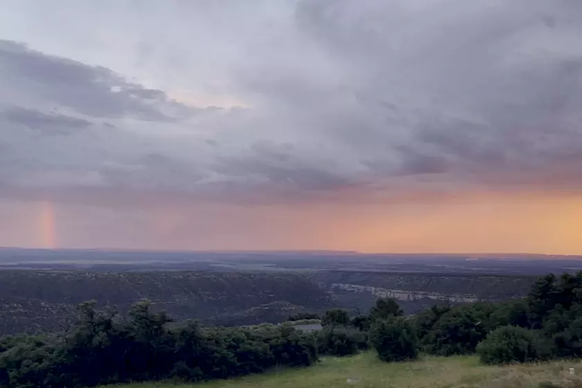
Over the course of 12 days, we were able to visit nearly a dozen parks, drive 3,350 miles, take thousands of photos and devour a shameful amount of roadside hamburgers. We drove alongside running pronghorn in Emery County, Utah, teetered on the edge of Black Canyon in Montrose County, Colo., slept beneath the Milky Way and marveled at rainbows from roadsides and dinner tables. It was, simply, remarkable. I wrote about the whole journey in depth in this story.
Zion, Mesa Verde, Arches, Grand Canyon and Joshua Tree all in one epic journey? We did it. Here’s how it played out.
Here’s a guide to all the national parks on our trip. It includes highlights of each park: notable trails, memorable adventures (swimming holes! sand dunes! so many lookout points!), great places to eat and our favorite accommodations. As with any trip, tailor the route around the weather, your interests and how much time you have.
Zion National Park

Park adventures: Zion is split into six sections, but the most recognizable trails in the park are Angels Landing — which requires a permit and has a 1,488-foot elevation gain that involves 21 steep switchbacks — and the Narrows, a tricky, nearly 10-mile round trip trek through the river (which gets as small as 22 feet wide).
While there’s no easy way to do Angels Landing (and there have been confirmed deaths along the route), plenty of Zion’s other trails are adaptable for people of different levels of hiking ability. I’d recommend the Riverside Walk, a fairly flat, 2.2-mile trail that goes from the ninth shuttle stop, Temple of Sinawava, to the start of the Narrows. The walk winds along the Virgin River and passes plenty of breathtaking views, weeping rocks and swimming opportunities. The Emerald Pools are also an easy and rewarding route, but there’s absolutely no swimming allowed in those. If you’re in the market for something more challenging, one of our shuttle drivers described Observation Point, which can be accessed from East Zion, as “harder but not as sketchy” as Angels Landing.
Shuttle info: From March to late November, Zion doesn’t allow private vehicles on its main canyon scenic drive, meaning that people must park in Springdale (the town just south of the park) or at the visitor center to hop on the park shuttle, which is a beautiful 45-minute ride from start to finish. And though it’s tempting to stay in Zion until sunset, I’d recommend parking at the visitors lot if you plan to do so: the last Zion shuttle doesn’t line up with the last Springdale shuttle, meaning that if you get to the visitors lot after 8 p.m., you’ll need to walk the rest of the way to wherever you parked in town.
Noteworthy eats: The Spotted Dog is a 10-minute walk from the park’s visitor center; it was one of the few restaurants in town that was seating people at 8:30 p.m. It serves filling fare including duck breast in a prickly pear gastrique, lamb shanks and specials like filet mignon (which was served with a remarkable potato croquette that we’re still thinking about weeks later).
Where to stay: Under the Eaves Inn is a sweet little bed-and-breakfast near the fifth stop on the Springdale shuttle, about a mile from the south entrance of the park. A quaint green cottage that looks like something out of a fairy tale, the inn is run by Mark Chambers and Joe Pitti, who have beautifully preserved the historic building, which was previously the Christensen House and a town post office. Each guest is welcome to purchase a $5 breakfast voucher when booking the room, which goes a long way at Oscar’s Cafe just two doors down. Rooms from $119.
Bryce Canyon National Park

Park adventures: If you’re interested in taking a stroll, the Sunset Point to Sunrise Point trail is only an hour with very little elevation gain, and it’s known as the easiest hike in the whole park.
Noteworthy eats: I.D.K. BBQ, a no-frills barbecue joint in Tropic, Utah, has cheap and delicious pulled pork and brisket and three different house-made sauces. Along with standard fixins like cornbread and mac ’n’ cheese, you can wash your meal down with a soda float or a peach cobbler in a cone.
Capitol Reef National Park
Park adventures: You may be perfectly content taking in the sites from the drive, but the park has four easy trails for casual hikers and quite a few more for those willing to put in more time and effort. The park rangers also offer plenty of programs on archaeology, geology and astronomy each summer, making this an especially popular park for families.
Noteworthy eats: Less than 15 minutes from the eastern exit of Capitol Reef, there’s a modest roadside cheese shop called Mesa Market. (It’s right by mile marker 102 on State Route 24 — and I’d recommend trusting the mile markers over whatever your map apps are telling you.) You’ll find a laid-back goat farm where you can buy the most amazing varieties of fresh goat cheese, homemade bread, garden pesto, sun tea and other farm-to-table goods. It’s not a restaurant, and there’s no promise of what they’ll have ready that day, but if you’re lucky, the farm dog, Zig, might come say hi while you’re eating cheese on the porch. Open 10 a.m. to 3 p.m. Thursday through Monday.
Canyonlands National Park

The park is split into three sections: the Island in the Sky (most popular for first-time visitors); the Needles (more attainable for those with four-wheel-drive vehicles); and the Maze (known for being extremely remote and rough). Unlike some of the other parks, where you can drive in one entrance and leave from another, Canyonlands’ sections are divided by the Colorado River and Green River, meaning that you must exit the park the same way you entered. For most travelers, it makes sense to visit Island in the Sky, which has a 34-mile round-trip scenic drive that takes visitors around the entire mesa top to beautiful lookouts like Green River Overlook and Grand View Point.
Park adventures: The Mesa Arch trail — one of the park’s most popular sunrise views — is accessible from Grand View Point Road, and it’s less than a mile on foot to get to the arch and back. Staying in Canyonlands past sundown is also quite rewarding, since the vast canyons make for wonderful stargazing.
Where to stay: Perhaps I played too much “Oregon Trail” as a child, but I was absolutely stoked to stay in the Historic Heritage Homestead’s glamping wagon. The wagons feel larger than they look, and more important, they have Wi-Fi, privacy and detached bathrooms with running water. Wagons from $70.
Arches National Park

Timed entry: Because Arches gets such an influx of visitors, the park requires timed entry reservations that go online three months in advance, though you can also enter at your leisure before 7 a.m. or after 4 p.m. each day. This helps control traffic flow on the main scenic drive, where you can stop at viewpoints for Balanced Rock, Delicate Arch, the Windows and other park highlights. Unfortunately, the park’s popularity also means that Arches has some of the worst bathrooms that we encountered in the entire National Parks System — c’est la vie!
Park adventures: The quintessential hike in Arches is the 3-mile round trip to Delicate Arch. But the 480-foot climb is tougher than people assume — “Rangers frequently rescue people who underestimated the trail’s difficulty,” the park warns — so it’s worth considering whether you’d rather see it from the Delicate Arch Viewpoints. A gentle 1-mile hike is available at the Windows, which leads to views of North Window, South Window and Turret Arch.
Noteworthy eats: Among a sea of Moab tourist traps, Thai Bella had some of the freshest and most satisfying food around. With classics like tom kah soup and pad Thai and specials such as a delectable and hefty sous-vide duck, this is a perfect place to stop for dinner after a long day in the nearby parks.
Where to stay: About an hour and a half from Moab, there’s a small town called Fruita just over the border of Colorado. I’d recommend getting gas before leaving Moab, since there aren’t many rest stops along this stretch of I-70, but this lovely room (booked via Airbnb, rates from $52) was one of our favorite places that we stayed. With a comfy bed and a Jacuzzi tub, Kate and Keith’s home is close to downtown Fruita, which is best known as home to Mike the headless chicken. I’d also recommend stopping at Dinosaur Journey on your way out to see some unbelievable fossils and learn a few fun facts.
Black Canyon of the Gunnison National Park
Park adventures: Though all of the lookout points along the South Rim scenic drive are worth a stop, our favorite was Painted Wall Overlook. Aside from the wall being 2,250 feet tall — taller than the Eiffel Tower, the Empire State Building and Taipei 101 — the overlook has sheer dropoffs that are truly breathtaking. I strongly recommend standing near the fenced edge and holding your arms up to catch the wind, since feeling that air rush through the canyon is absurdly satisfying.
Noteworthy eats: I had exactly one smoked cherry old-fashioned at High Alpine Brewing Company and was absolutely delighted. About an hour and a half from Black Canyon of the Gunnison, the brewery is a perfect casual place to grab dinner after spending a day at the park. My partner and I split a delicious High Alpine pizza and each got our own smaller salads, but as I ate my pizza and watched “Law & Order: SVU” play on one of the TVs, I was pretty bummed that I wouldn’t be able to come back and try the Pig ‘N Fig pizza in the near future.
Where to stay: Though it’s about a 3½-hour drive from Black Canyon of the Gunnison, we decided to stay in Leadville, Colo., to make our trip to Denver the next day short and simple. We booked the Miss Evelyn room at the Colorado Trail House, a 130-year-old Victorian home with ample communal space and an absolutely necessary opportunity to do laundry. LaVerne, who greets everyone as they check in, showed us around, offered us snacks and tea, and even stocked the room with thoughtful touches like bath bombs for us to use in the claw-foot tub. Rooms from $105.
Rocky Mountain National Park

Timed entry: The goal is to reduce traffic snarls on Trail Ridge Road (which crosses the divide) and the scenery-rich Bear Lake Road Corridor, a 10½-mile route that begins near Estes Park and climbs to Bear Lake, 9,475 feet above sea level.
Through Oct. 22, visitors will need a timed-entry reservation (in addition to a basic park entry pass) in order to explore this high country.
At the east end of the park, where most visitors enter, is the gateway city of Estes Park. Rangers warn that there’s a lot of construction in progress near the park’s Fall River entrance.
Park adventures: Estes Park is full of outdoorsy and traveler-friendly businesses along Highway 36. It’s also home to the grand old red-roofed Stanley Hotel, which inspired Stephen King to writing “The Shining” after a night there in 1974. (The film was shot elsewhere, but the the hotel nevertheless offers an hourlong $30 Shining Tour.)
To reach the Continental Divide or the west end of the park, take Trail Ridge Road, which climbs and crosses the divide at 12,183 feet above sea level. The National Park Service calls it the highest continuous paved road in the U.S.; typically it is closed from late October through late May. Before driving it, call (970) 586-1222 for updated road conditions. The park’s off-the-grid Alpine Visitor Center and store, perched amid the alpine tundra at 11,796 feet, are popular stops, well above the treeline.
Beyond the divide, the road descends toward the west side of the park (where fires burned more than 30,000 acres in 2020) and Grand Lake.
Grand Lake, just outside the park’s western boundary, doesn’t get nearly as many visitors as Insta-friendly Bear Lake, but it’s Colorado’s biggest natural body of water, neighbored by a tiny village with the same name. It’s also the answer to a next-level trivia question: Where does the Colorado River begin?
One more note: The park’s slopes and waters are majestic but perilous. At least four climbers and hikers have died in accidents within the park since June.
Where to stay: The Queen Anne Bed and Breakfast has some of the most interesting rooms we found in Denver, including the Aspen Room, which has a beautiful mural of an alpine aspen forest that curves up into the room’s Victorian turret. Located in downtown Denver just an hour and a half from Rocky Mountain National Park and 25 minutes from Red Rocks Park and Amphitheater, it’s a perfect place to rest and have a delicious breakfast in the morning. Our host also gave us a remarkably useful parking map and advised us to park at Red Rocks’ Upper South lot, which got us back to downtown Denver before our friends even made it out of their parking lot. Rooms from $165.
Great Sand Dunes National Park and Preserve
Park adventures: Inside of the park, there’s only one major road that leads from the entrance to the Piñon Flats campground, with a singular fork (to the left of the road) that leads to a parking lot near the sand dunes. From that lot, visitors can walk out to the dunes — including High Dune and Star Dune — to hike, sled or sandboard. Because the sand can reach 150 degrees in the summer, it’s best to go earlier in the morning or after the heat has broken in the evening. Sand Dunes Recreation, which is just 25 minutes from the park, offers sand sled and board rentals for the whole day (or 24 hours from the time of rental) for $19. On the way to the sand dunes, you’ll also pass the UFO Watchtower, which has hundreds of handwritten accounts from visitors and believers who have spotted strange things in the valley.
Noteworthy eats: We ate a lot of hamburgers on this trip but the best ones, by far, were from the Rubi Slipper in Alamosa, Colo. About 30 minutes from the Sand Dunes, this classic diner serves up soda floats that overflow from Coca-Cola glasses, dozens of different burgers and even local specialties like Rocky Mountain oysters, which are … not oysters.
Where to stay: Though Airbnb has countless dome listings that are essentially glorified glamping, the dome that we booked in Crestone, Colo., was the real deal. It’s certainly the most isolated place we stayed on this trip, with a town-wide light pollution mandate and the kind of sheer silence that can be a bit terrifying, but the dome is equipped with all the modern technologies you’d need to comfort yourself from the looming void outside. Crestone, which is often called the “Bermuda Triangle of the West,” is also home to more spiritual centers per square foot than the rest of North America. Rates from $133.
Mesa Verde National Park

Park adventures: Many of the best dwelling viewpoints are around the park’s museum, Mesa Top Loop and Cliff Palace Loop. Cliff Palace was our favorite of the dwellings and is easily seen from the overlook above it, though you can also take the 6-mile Cliff Palace Loop Road past other cliff dwellings. Our favorite stop of the visit was Park Point, which is the highest point in the park at 8,572 feet. Formerly home to the fire lookout, it’s still a vista dappled in sunshine and butterflies that gets sweeping 360-degree views of the 52,000-acre park.
Noteworthy eats: The food at the Metate Room Restaurant is what you might expect in a place where there aren’t any other dining options. It’s a bit overpriced, a bit mediocre and a bit bizarre — who among us wants to order a salmon chile mousse? — but what the restaurant lacks in terms of food is made up for in beautiful views, lovely servers and solid cocktails. There’s usually a wait for seating, since it’s the most popular restaurant in the park with the best hours, but you can wait for your table upstairs at the lounge. The butter pecan-infused rye is made in-house, and I’d argue that a good cocktail paired with a breathtaking tableside sunset is enough to make an OK dinner worthwhile.
Where to stay: The Far View Lodge is a classic national park experience, and by that I mean there will probably not be working Wi-Fi, and you can forget about having a TV in your room. But unplugging is half the fun of being in a national park, and the accommodations and evening programs in Mesa Verde are entertaining enough that you might not even notice. Our room was a short drive from the lodge’s amenities, which include a restaurant, a bar and an entertainment center with arcade games, and we had a modest balcony for stargazing. But the best part of our stay was waking up in the morning, when we spotted several wild horses wandering by our window. Rooms from $176.
Petrified Forest National Park

Park adventures: The best place to see petrified wood in the park is certainly Crystal Forest, which is an easy 0.8-mile loop. There, you’ll get the best views of the colorful crystalized logs that have existed since before dinosaurs walked the earth. And as they remind you at the entrances, it’s illegal to collect petrified wood from the park, and there’s a minimum fine of $325 if they catch visitors removing or damaging it.
Noteworthy eats: After our longest day on the road — traveling nearly 400 miles from Mesa Verde to Four Corners, Petrified Forest and then Flagstaff — we were more than excited to sit down at Tinderbox Kitchen for a late dinner. Though it’s a bit of a splurge, this was undoubtedly the best food we had during our two weeks on the road: Think fresh vegetables, ponzu-brined chicken (which comes with a perfectly umami miso potato puree) and duck served with Brussels sprouts, candied bacon and a sherry gastrique that could lull anyone into a blissful stasis.
Where to stay: I’m willing to take more lodging risks at the beginning of the trip, but as patience wears thinner and sitting-in-the-car aches get worse, I think it’s worth booking places that guarantee comfort. Little America Hotel, in Flagstaff, Ariz., is a beautiful place to rest before embarking on the 90-minute trip to the south rim of the Grand Canyon, and it has all the classic hotel luxuries (huge TVs, great-smelling bathroom products, frigid AC) that you might crave after a long day of driving. Rooms from $125.
Grand Canyon National Park

Park adventures: If it’s your first visit, it’s worth walking along the Rim Trail, which goes for miles along the south rim and intersects with bus stops, meaning that you can walk as far as you please and then return on a shuttle. Though there are certainly more ambitious and dangerous trails to explore, the park’s website reminds visitors that more than 250 people are rescued from the canyon each year, and “the difference between a great adventure in Grand Canyon and a trip to the hospital (or worse) is up to YOU.” Erring on the side of caution, we were perfectly happy walking a mostly paved trail and eating a lovely sandwich with a canyon view.
The best part of our trip started around sunset, when the sky began reflecting new colors into the canyon’s numerous rock layers. We were among the few people who stuck around to watch the entire sunset until darkness sunk in, which made it feel like we had the park all to ourselves. By the time the sky was dark, we could also see an unbelievable amount of stars and even the Milky Way hanging over the pitch-black canyon. And even though it was nearly a full moon that night, we got a phenomenal view of the dark sky for two glorious hours before moonrise.
Noteworthy eats: The food at El Tovar is similar to that at any national park (read: a bit underwhelming and overpriced). But the desserts — which include seasonally flavored crème brûlées, tarts and cheesecakes — are made in-house and were by far the best part of our meal.
Where to stay: El Tovar Hotel is just feet from the rim of the Grand Canyon, making it an unbeatable place to stay if you’re hoping to maximize your time in the park. Built in 1905 as a cross between a Swiss chalet, a Norwegian villa and an Adirondack lodge, it’s a prime example of the rustic beauty of “Parkitecture.” The hotel — which has hosted luminaries including Theodore Roosevelt, Albert Einstein and Oprah Winfrey — has a dining room; several massive taxidermied animal heads; and lots of maps of the canyon and brochures for the many helicopter, Jeep and mule tours that are offered nearby. Though many of the rooms don’t have canyon views, the porch swings that face the canyon make the whole experience feel a bit like summer camp.
Joshua Tree National Park

Park adventures: Climbing rocks is one of the most popular things to do in the park, and many people just pull off to the shoulder to check out rocks that strike their fancy. Many of the larger rocks are easy to ascend safely without any fancy gear, but as with most national parks, it’s always important to know your limits. One of the most wonderful things to do at Joshua Tree is hang around until sunset, since the park’s dark sky has some of the best stargazing in the world. The Cap Rock parking lot stays open overnight for stargazers, so just head there, shut off your car and let your eyes adjust to the darkness for a while for the best gazing.
Noteworthy eats: Just a few minutes from the north entrance of Joshua Tree National Park, there’s a delicious-smelling barbecue joint on 29 Palms Highway. The Rib Co. makes meat that’s worth taking a photo of and sending to your dad, which I’d say is the highest BBQ honor. My partner and I like to get a combo plate — think ribs, brisket, pulled pork or whatever meat you like, with two sides and corn muffins with honey butter.
Where to stay: My favorite place to sleep in the desert is the Pioneertown Motel, the sweetest little place to stay on an old western movie set. Maybe it’s the proximity to Pappy and Harriet’s, or the motel “canteen” where you can make hot cocoa and sign the guest book, but something about the place just puts me at ease. And as an added bonus, you get to use the motel’s lotion and soap, which smell like a blend of desert goods including sage, patchouli and blood orange, among other lovely plants.
Sign up for The Wild
We’ll help you find the best places to hike, bike and run, as well as the perfect silent spots for meditation and yoga.
You may occasionally receive promotional content from the Los Angeles Times.


